![](/images/other/stat-length.png)
![Trail Walking Lambres - Le sentier de la Lacquette - Lambres les Aire - Photo](https://media.geolcdn.com/t/1900/400/ext.pjpeg?maxdim=2&url=https%3A%2F%2Fservices.sitytrail.com%2FGeolivesWS%2FDownloadMedia.ashx%3FTrailID%3D104074%26Media%3D7069_2.jpg)
Le sentier de la Lacquette - Lambres les Aire
tracegps
User
![Length](/images/other/stat-length.png)
Length
11.1 km
![Max alt](https://static1.geolcdn.com/siteimages/upload/files/1508320355ic_sort_altitude_max_24dp.png)
Max alt
79 m
![Uphill gradient](https://static1.geolcdn.com/siteimages/upload/files/1508320355ic_sort_den_pos_24dp.png)
Uphill gradient
98 m
![Km-Effort](/images/other/stat-length.png)
Km-Effort
12.4 km
![Min alt](https://static1.geolcdn.com/siteimages/upload/files/1508320355ic_sort_altitude_min_24dp.png)
Min alt
23 m
![Downhill gradient](https://static1.geolcdn.com/siteimages/upload/files/1508320355ic_sort_den_neg_24dp.png)
Downhill gradient
96 m
![Boucle](https://static1.geolcdn.com/siteimages/upload/files/16400158638029165_repeat_loop_refresh_sync_direction_icon.png)
Boucle
Yes
Creation date :
2014-12-10 00:00:00.0
Updated on :
2014-12-10 00:00:00.0
![Walking](https://static1.geolcdn.com/sitytour/trail-icons/101.png)
2h30
Difficulty : Medium
![Scan this QR Code to open this trail in the SityTrail application](https://capi.geolives.com/qq0zvz2zws4bq2lad0pu/sitytour/trails/104074/qr.png?size=200)
FREE GPS app for hiking
About
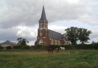
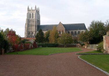
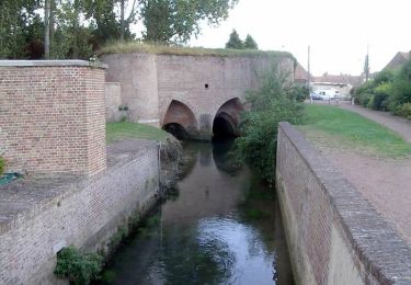
Trail Walking of 11.1 km to be discovered at Hauts-de-France, Pas-de-Calais, Lambres. This trail is proposed by tracegps.
Description
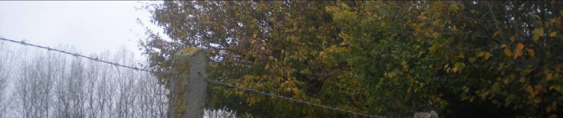
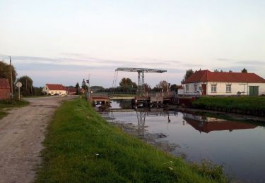
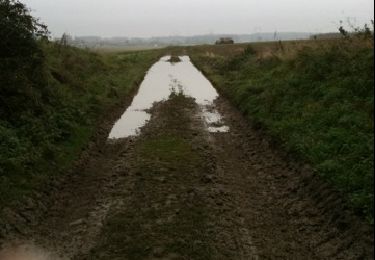
Départ du circuit : église de Lambres lez Aire pour un parcours de 11km 500. Par temps humide prévoir de bonnes chaussures, beaucoup de chemins très peu de bitume.
Positioning
Country:
France
Region :
Hauts-de-France
Department/Province :
Pas-de-Calais
Municipality :
Lambres
Location:
Unknown
Start:(Dec)
Start:(UTM)
457347 ; 5607161 (31U) N.
Comments
Trails nearby
![Trail Walking Aire-sur-la-Lys - Sentier entre Lys et Canal - Aire-sur-la-Lys - Photo](https://media.geolcdn.com/t/375/260/ext.jpg?maxdim=2&url=https%3A%2F%2Fservices.sitytrail.com%2FGeolivesWS%2FDownloadMedia.ashx%3FTrailID%3D317028%26Media%3D16170_4.jpg)
![Walking Walking](https://static1.geolcdn.com/sitytour/trail-icons/101.png)
Sentier entre Lys et Canal - Aire-sur-la-Lys
Walking
Medium
(1)
Aire-sur-la-Lys,
Hauts-de-France,
Pas-de-Calais,
France
![](/images/other/stat-length.png)
10.5 km | 11.2 km-effort
2h 40min
![](https://static1.geolcdn.com/siteimages/upload/files/16400158638029165_repeat_loop_refresh_sync_direction_icon.png)
Yes
![Trail Walking Aire-sur-la-Lys - Sentier du Bruveau - Aire sur la Lys - Photo](https://media.geolcdn.com/t/375/260/ext.jpg?maxdim=2&url=https%3A%2F%2Fservices.sitytrail.com%2FGeolivesWS%2FDownloadMedia.ashx%3FTrailID%3D317009%26Media%3D16148_6.jpg)
![Walking Walking](https://static1.geolcdn.com/sitytour/trail-icons/101.png)
Sentier du Bruveau - Aire sur la Lys
Walking
Medium
Aire-sur-la-Lys,
Hauts-de-France,
Pas-de-Calais,
France
![](/images/other/stat-length.png)
10.8 km | 11.7 km-effort
2h 40min
![](https://static1.geolcdn.com/siteimages/upload/files/16400158638029165_repeat_loop_refresh_sync_direction_icon.png)
Yes
![Trail Walking Liettres - Deux jours de randonnée autour d'Aire sur la Lys - Etape 2 - Photo](https://media.geolcdn.com/t/375/260/ext.jpg?maxdim=2&url=https%3A%2F%2Fservices.sitytrail.com%2FGeolivesWS%2FDownloadMedia.ashx%3FTrailID%3D172776%26Media%3D14199_6.jpg)
![Walking Walking](https://static1.geolcdn.com/sitytour/trail-icons/101.png)
Deux jours de randonnée autour d'Aire sur la Lys - Etape 2
Walking
Difficult
Liettres,
Hauts-de-France,
Pas-de-Calais,
France
![](/images/other/stat-length.png)
23 km | 26 km-effort
6h 0min
![](https://static1.geolcdn.com/siteimages/upload/files/16400158638029165_repeat_loop_refresh_sync_direction_icon.png)
No
![Trail Walking Aire-sur-la-Lys - Le marais - Aire-sur-la-Lys - Photo](https://media.geolcdn.com/t/375/260/ext.jpg?maxdim=2&url=https%3A%2F%2Fservices.sitytrail.com%2FGeolivesWS%2FDownloadMedia.ashx%3FTrailID%3D104307%26Media%3D7535_6.jpg)
![Walking Walking](https://static1.geolcdn.com/sitytour/trail-icons/101.png)
Le marais - Aire-sur-la-Lys
Walking
Medium
Aire-sur-la-Lys,
Hauts-de-France,
Pas-de-Calais,
France
![](/images/other/stat-length.png)
9.4 km | 9.9 km-effort
2h 19min
![](https://static1.geolcdn.com/siteimages/upload/files/16400158638029165_repeat_loop_refresh_sync_direction_icon.png)
Yes
![Trail Walking Aire-sur-la-Lys - Promenade «à livres ouverts» à Aire sur la Lys - Photo](https://media.geolcdn.com/t/375/260/ext.jpg?maxdim=2&url=https%3A%2F%2Fservices.sitytrail.com%2FGeolivesWS%2FDownloadMedia.ashx%3FTrailID%3D172759%26Media%3D14171_6.jpg)
![Walking Walking](https://static1.geolcdn.com/sitytour/trail-icons/101.png)
Promenade «à livres ouverts» à Aire sur la Lys
Walking
Easy
Aire-sur-la-Lys,
Hauts-de-France,
Pas-de-Calais,
France
![](/images/other/stat-length.png)
2.8 km | 3 km-effort
1h 30min
![](https://static1.geolcdn.com/siteimages/upload/files/16400158638029165_repeat_loop_refresh_sync_direction_icon.png)
Yes
![Trail Other activity Isbergues - 2010-11-20 - 10h10m01 - Photo](https://media.geolcdn.com/t/375/260/ext.jpg?maxdim=2&url=https%3A%2F%2Fservices.sitytrail.com%2FGeolivesWS%2FDownloadMedia.ashx%3FTrailID%3D48501%26Media%3Dimage1.jpg)
![Other activity Other activity](https://static1.geolcdn.com/sitytour/trail-icons/900.png)
2010-11-20 - 10h10m01
Other activity
Very easy
Isbergues,
Hauts-de-France,
Pas-de-Calais,
France
![](/images/other/stat-length.png)
23 km | 24 km-effort
Unknown
![](https://static1.geolcdn.com/siteimages/upload/files/16400158638029165_repeat_loop_refresh_sync_direction_icon.png)
No
![Trail Running Ham-en-Artois - course à pied Ham - Photo](https://media.geolcdn.com/t/375/260/ext.jpg?maxdim=2&url=https%3A%2F%2Fstatic1.geolcdn.com%2Fsiteimages%2Fupload%2Ffiles%2F1524743154running.jpg)
![Running Running](https://static1.geolcdn.com/sitytour/trail-icons/103.png)
course à pied Ham
Running
Easy
Ham-en-Artois,
Hauts-de-France,
Pas-de-Calais,
France
![](/images/other/stat-length.png)
11.5 km | 12.5 km-effort
1h 5min
![](https://static1.geolcdn.com/siteimages/upload/files/16400158638029165_repeat_loop_refresh_sync_direction_icon.png)
Yes
![Trail Walking Liettres - liettre - air sur la lys - Photo](https://media.geolcdn.com/t/375/260/ext.jpg?maxdim=2&url=https%3A%2F%2Fstatic1.geolcdn.com%2Fsiteimages%2Fupload%2Ffiles%2F1553511878bg_sport_marche.png)
![Walking Walking](https://static1.geolcdn.com/sitytour/trail-icons/101.png)
liettre - air sur la lys
Walking
Medium
Liettres,
Hauts-de-France,
Pas-de-Calais,
France
![](/images/other/stat-length.png)
7.6 km | 8 km-effort
1h 47min
![](https://static1.geolcdn.com/siteimages/upload/files/16400158638029165_repeat_loop_refresh_sync_direction_icon.png)
No
![Trail Walking Norrent-Fontes - Norrent-Fontes (2) 14Km Dén P 121m - Photo](https://media.geolcdn.com/t/375/260/ext.jpg?maxdim=2&url=https%3A%2F%2Fstatic1.geolcdn.com%2Fsiteimages%2Fupload%2Ffiles%2F1553511878bg_sport_marche.png)
![Walking Walking](https://static1.geolcdn.com/sitytour/trail-icons/101.png)
Norrent-Fontes (2) 14Km Dén P 121m
Walking
Medium
Norrent-Fontes,
Hauts-de-France,
Pas-de-Calais,
France
![](/images/other/stat-length.png)
14.1 km | 15.7 km-effort
2h 51min
![](https://static1.geolcdn.com/siteimages/upload/files/16400158638029165_repeat_loop_refresh_sync_direction_icon.png)
Yes