![](/images/other/stat-length.png)
![Trail Mountain bike Cesson-Sévigné - Rennes - Cesson Sévigné - Tizé - Grand Tertre 15km - Photo](https://media.geolcdn.com/t/1900/400/ext.pjpeg?maxdim=2&url=https%3A%2F%2Fstatic1.geolcdn.com%2Fsiteimages%2Fupload%2Ffiles%2F1524743154velo.jpg)
Rennes - Cesson Sévigné - Tizé - Grand Tertre 15km
tracegps
User
![Length](/images/other/stat-length.png)
![Max alt](https://static1.geolcdn.com/siteimages/upload/files/1508320355ic_sort_altitude_max_24dp.png)
![Uphill gradient](https://static1.geolcdn.com/siteimages/upload/files/1508320355ic_sort_den_pos_24dp.png)
![Km-Effort](/images/other/stat-length.png)
![Min alt](https://static1.geolcdn.com/siteimages/upload/files/1508320355ic_sort_altitude_min_24dp.png)
![Downhill gradient](https://static1.geolcdn.com/siteimages/upload/files/1508320355ic_sort_den_neg_24dp.png)
![Boucle](https://static1.geolcdn.com/siteimages/upload/files/16400158638029165_repeat_loop_refresh_sync_direction_icon.png)
![Mountain bike](https://static1.geolcdn.com/sitytour/trail-icons/202.png)
1h00
Difficulty : Medium
![Scan this QR Code to open this trail in the SityTrail application](https://capi.geolives.com/qq0zvz2zws4bq2lad0pu/sitytour/trails/104001/qr.png?size=200)
FREE GPS app for hiking
About
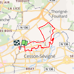
Trail Mountain bike of 14.3 km to be discovered at Brittany, Ille-et-Vilaine, Cesson-Sévigné. This trail is proposed by tracegps.
Description
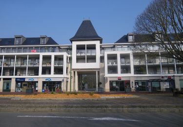
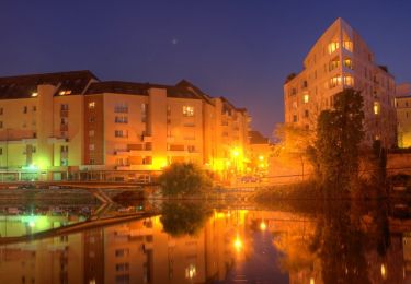
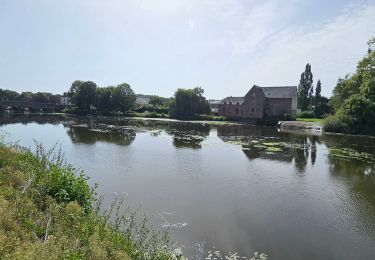
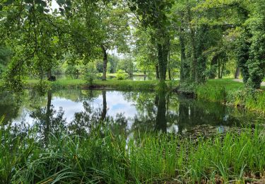
Boucle de 15km au départ de France-Télécom Orange à Cesson. 1ere partie au travers des lotissements de Cesson par les sentiers stabilisés et près des étangs. Balade tranquille 2ème partie au départ du manoir de Tizé en direction du bois de Tizé. Partie technique dans le bois en montée. Lors de l'entrée dans le bois, prendre le chemin à droite vers l'intérieur du bois et suivre les sentiers montants. Ne pas rester sur le sentier en bordure du bois qui ramène au manoir. Il faut monter dans le bois. Technique et super agréable. 3ème partie pour le retour par le chemin du Grand Tertre qui effectue la liaison entre Cesson et Thorigné. Chemin en stabilisé, sans aucune difficulté, un peu lourd par endroit. 4ème partie, retour par la route et chemin secondaire. Peu d’intérêt, mais pas de chemin pour rejoindre le lieu du départ.
Positioning
Comments
Trails nearby
![Trail On foot Saint-Grégoire - Circuit de la Boutière - Photo](https://media.geolcdn.com/t/375/260/be6e7bb0-1772-48a6-9f30-2bc59080eacb.jpeg&format=jpg&maxdim=2)
![On foot On foot](https://static1.geolcdn.com/sitytour/trail-icons/100.png)
On foot
![](/images/other/stat-length.png)
![](https://static1.geolcdn.com/siteimages/upload/files/16400158638029165_repeat_loop_refresh_sync_direction_icon.png)
![Trail On foot Rennes - Circuit des Louvries - Photo](https://media.geolcdn.com/t/375/260/df10b53e-816c-4112-9887-ffbc2c82646e.jpeg&format=jpg&maxdim=2)
![On foot On foot](https://static1.geolcdn.com/sitytour/trail-icons/100.png)
On foot
![](/images/other/stat-length.png)
![](https://static1.geolcdn.com/siteimages/upload/files/16400158638029165_repeat_loop_refresh_sync_direction_icon.png)
![Trail On foot Rennes - La balade à André - Photo](https://media.geolcdn.com/t/375/260/21bf6cca-cebe-47ea-8c50-7b46a79e5fa3.jpeg&format=jpg&maxdim=2)
![On foot On foot](https://static1.geolcdn.com/sitytour/trail-icons/100.png)
On foot
![](/images/other/stat-length.png)
![](https://static1.geolcdn.com/siteimages/upload/files/16400158638029165_repeat_loop_refresh_sync_direction_icon.png)
![Trail On foot Cesson-Sévigné - Parcs et jardins - Photo](https://media.geolcdn.com/t/375/260/037007ff-9a46-424d-a033-bc4b6ff71a6a.jpeg&format=jpg&maxdim=2)
![On foot On foot](https://static1.geolcdn.com/sitytour/trail-icons/100.png)
On foot
![](/images/other/stat-length.png)
![](https://static1.geolcdn.com/siteimages/upload/files/16400158638029165_repeat_loop_refresh_sync_direction_icon.png)
![Trail Walking Cesson-Sévigné - Cesson Sévigné - Photo](https://media.geolcdn.com/t/375/260/ext.jpg?maxdim=2&url=https%3A%2F%2Fstatic1.geolcdn.com%2Fsiteimages%2Fupload%2Ffiles%2F1553511878bg_sport_marche.png)
![Walking Walking](https://static1.geolcdn.com/sitytour/trail-icons/101.png)
Walking
![](/images/other/stat-length.png)
![](https://static1.geolcdn.com/siteimages/upload/files/16400158638029165_repeat_loop_refresh_sync_direction_icon.png)
![Trail Walking Rennes - La promenade Georges Brassens et des Bonnets Rouges - Rennes - Photo](https://media.geolcdn.com/t/375/260/ext.jpg?maxdim=2&url=https%3A%2F%2Fservices.sitytrail.com%2FGeolivesWS%2FDownloadMedia.ashx%3FTrailID%3D191412%26Media%3D14992_6.jpg)
![Walking Walking](https://static1.geolcdn.com/sitytour/trail-icons/101.png)
Walking
![](/images/other/stat-length.png)
![](https://static1.geolcdn.com/siteimages/upload/files/16400158638029165_repeat_loop_refresh_sync_direction_icon.png)
![Trail On foot Rennes - RENNES : street art raccourci le 18/11/2024 - Photo](https://media.geolcdn.com/t/375/260/51742e12-aee2-4c99-96cd-a0fc410ef54f.jpg&format=jpg&maxdim=2)
![On foot On foot](https://static1.geolcdn.com/sitytour/trail-icons/100.png)
On foot
![](/images/other/stat-length.png)
![](https://static1.geolcdn.com/siteimages/upload/files/16400158638029165_repeat_loop_refresh_sync_direction_icon.png)
![Trail Electric bike Rennes - Rennes à Guipry-Messac - Photo](https://media.geolcdn.com/t/375/260/2b36141b-c92e-475f-a12d-aab1f02c06c0.jpg&format=jpg&maxdim=2)
![Electric bike Electric bike](https://static1.geolcdn.com/sitytour/trail-icons/205.png)
Electric bike
![](/images/other/stat-length.png)
![](https://static1.geolcdn.com/siteimages/upload/files/16400158638029165_repeat_loop_refresh_sync_direction_icon.png)
![Trail Walking Cesson-Sévigné - cesson - Photo](https://media.geolcdn.com/t/375/260/031b7295-c682-47d4-9915-29014b9b2945.jpg&format=jpg&maxdim=2)
![Walking Walking](https://static1.geolcdn.com/sitytour/trail-icons/101.png)
Walking
![](/images/other/stat-length.png)
![](https://static1.geolcdn.com/siteimages/upload/files/16400158638029165_repeat_loop_refresh_sync_direction_icon.png)