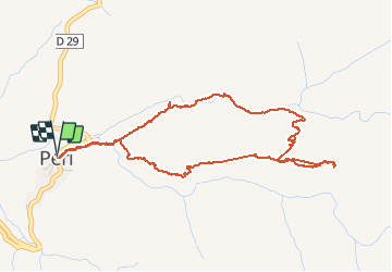
![](/images/other/stat-length.png)
![Trail Other activity Peri - Peri - Photo](https://media.geolcdn.com/t/1900/400/82eb5571-b2eb-428f-a0e7-c62267531ac4.jpg&format=pjpeg&maxdim=2)
Peri
cathymac20
User
![Length](/images/other/stat-length.png)
![Max alt](https://static1.geolcdn.com/siteimages/upload/files/1508320355ic_sort_altitude_max_24dp.png)
![Uphill gradient](https://static1.geolcdn.com/siteimages/upload/files/1508320355ic_sort_den_pos_24dp.png)
![Km-Effort](/images/other/stat-length.png)
![Min alt](https://static1.geolcdn.com/siteimages/upload/files/1508320355ic_sort_altitude_min_24dp.png)
![Downhill gradient](https://static1.geolcdn.com/siteimages/upload/files/1508320355ic_sort_den_neg_24dp.png)
![Boucle](https://static1.geolcdn.com/siteimages/upload/files/16400158638029165_repeat_loop_refresh_sync_direction_icon.png)
![Other activity](https://static1.geolcdn.com/sitytour/trail-icons/900.png)
5h18
Difficulty : Unknown
![Scan this QR Code to open this trail in the SityTrail application](https://capi.geolives.com/qq0zvz2zws4bq2lad0pu/sitytour/trails/1039497/qr.png?size=200)
FREE GPS app for hiking
About
Trail Other activity of 5.7 km to be discovered at Corsica, South Corsica, Peri. This trail is proposed by cathymac20.
Description
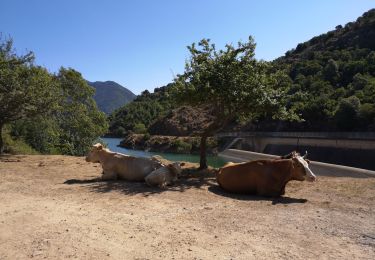
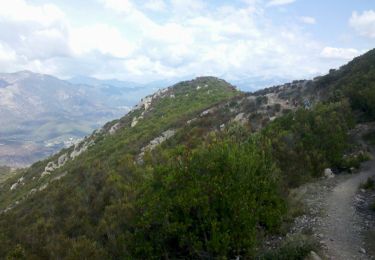
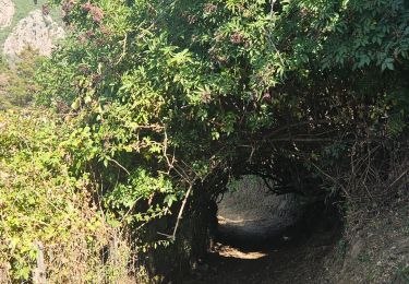
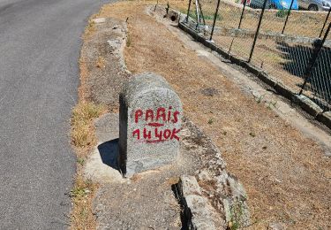
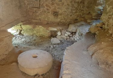
Départ derrière l auberge Usciatellu dans le centre du village vers l église. Le départ et bien marqué, après c est une autre histoire, le plan est de la collectivité est complètement faux... j y ai été à tâtons...j ai trouvé une grotte, maintenant est ce bien la bonne? le retour dans la chataigneraie est hyper mal tracé, les arbres sont tombé et le chemin est très mal entretenu. Dommage car ce st un très bel endroit, une forêt moussue et la rivière a un air tout à fait magique...
Positioning
Comments
Trails nearby
![Trail Walking Cuttoli-Corticchiato - Corse-150926 - MonteAragnascu - Photo](https://media.geolcdn.com/t/375/260/ext.jpg?maxdim=2&url=https%3A%2F%2Fservices.sitytrail.com%2FGeolivesWS%2FDownloadMedia.ashx%3FTrailID%3D475897%26Media%3D39ac4246-e122-4e35-ab4b-fcf09fe6be8f.jpg)
![Walking Walking](https://static1.geolcdn.com/sitytour/trail-icons/101.png)
Walking
![](/images/other/stat-length.png)
![](https://static1.geolcdn.com/siteimages/upload/files/16400158638029165_repeat_loop_refresh_sync_direction_icon.png)
![Trail Walking Cuttoli-Corticchiato - Monté Aragnascu - Photo](https://media.geolcdn.com/t/375/260/ext.jpg?maxdim=2&url=https%3A%2F%2Fservices.sitytrail.com%2FGeolivesWS%2FDownloadMedia.ashx%3FTrailID%3D140221%26Media%3D20120720115107.jpeg)
![Walking Walking](https://static1.geolcdn.com/sitytour/trail-icons/101.png)
Walking
![](/images/other/stat-length.png)
![](https://static1.geolcdn.com/siteimages/upload/files/16400158638029165_repeat_loop_refresh_sync_direction_icon.png)
![Trail Walking Cuttoli-Corticchiato - monte arasgnascu en boucle - Photo](https://media.geolcdn.com/t/375/260/ext.jpg?maxdim=2&url=https%3A%2F%2Fstatic1.geolcdn.com%2Fsiteimages%2Fupload%2Ffiles%2F1553511878bg_sport_marche.png)
![Walking Walking](https://static1.geolcdn.com/sitytour/trail-icons/101.png)
Walking
![](/images/other/stat-length.png)
![](https://static1.geolcdn.com/siteimages/upload/files/16400158638029165_repeat_loop_refresh_sync_direction_icon.png)
![Trail Walking Carbuccia - Punta CACHJONI Carbuccia - Photo](https://media.geolcdn.com/t/375/260/e4dd894a-9054-4b6b-90e0-3c529025da42.jpg&format=jpg&maxdim=2)
![Walking Walking](https://static1.geolcdn.com/sitytour/trail-icons/101.png)
Walking
![](/images/other/stat-length.png)
![](https://static1.geolcdn.com/siteimages/upload/files/16400158638029165_repeat_loop_refresh_sync_direction_icon.png)
![Trail Walking Cuttoli-Corticchiato - A stretta di i mulini - Photo](https://media.geolcdn.com/t/375/260/a5902263-596f-41d2-a740-26e67c6e2062.jpg&format=jpg&maxdim=2)
![Walking Walking](https://static1.geolcdn.com/sitytour/trail-icons/101.png)
Walking
![](/images/other/stat-length.png)
![](https://static1.geolcdn.com/siteimages/upload/files/16400158638029165_repeat_loop_refresh_sync_direction_icon.png)
![Trail Walking Cuttoli-Corticchiato - Mont Aragnascu - Photo](https://media.geolcdn.com/t/375/260/1a46864a-c2c8-4339-b975-89317574f0ba.jpg&format=jpg&maxdim=2)
![Walking Walking](https://static1.geolcdn.com/sitytour/trail-icons/101.png)
Walking
![](/images/other/stat-length.png)
![](https://static1.geolcdn.com/siteimages/upload/files/16400158638029165_repeat_loop_refresh_sync_direction_icon.png)
![Trail Walking Cuttoli-Corticchiato - Moulin deCuttoli - Photo](https://media.geolcdn.com/t/375/260/d5f11e4d-fb2a-4cd7-af5b-518905ed6a2b.jpg&format=jpg&maxdim=2)
![Walking Walking](https://static1.geolcdn.com/sitytour/trail-icons/101.png)
Walking
![](/images/other/stat-length.png)
![](https://static1.geolcdn.com/siteimages/upload/files/16400158638029165_repeat_loop_refresh_sync_direction_icon.png)
![Trail Walking Tavaco - sant'eliseo par Tavaco - Photo](https://media.geolcdn.com/t/375/260/a0575d95-68d7-4fcb-bcba-efbd58969fc3.jpg&format=jpg&maxdim=2)
![Walking Walking](https://static1.geolcdn.com/sitytour/trail-icons/101.png)
Walking
![](/images/other/stat-length.png)
![](https://static1.geolcdn.com/siteimages/upload/files/16400158638029165_repeat_loop_refresh_sync_direction_icon.png)
![Trail Walking Tolla - lac de Tolla - Photo](https://media.geolcdn.com/t/375/260/0098bc4d-cc95-429b-9ad0-6265f106674c.jpg&format=jpg&maxdim=2)
![Walking Walking](https://static1.geolcdn.com/sitytour/trail-icons/101.png)