![](/images/other/stat-length.png)
![Trail Running Cesson-Sévigné - Course à pied la campagne à la ville - Cesson - Sévigné 7km - Photo](https://media.geolcdn.com/t/1900/400/ext.pjpeg?maxdim=2&url=https%3A%2F%2Fstatic1.geolcdn.com%2Fsiteimages%2Fupload%2Ffiles%2F1524743154running.jpg)
Course à pied la campagne à la ville - Cesson - Sévigné 7km
tracegps
User
![Length](/images/other/stat-length.png)
![Max alt](https://static1.geolcdn.com/siteimages/upload/files/1508320355ic_sort_altitude_max_24dp.png)
![Uphill gradient](https://static1.geolcdn.com/siteimages/upload/files/1508320355ic_sort_den_pos_24dp.png)
![Km-Effort](/images/other/stat-length.png)
![Min alt](https://static1.geolcdn.com/siteimages/upload/files/1508320355ic_sort_altitude_min_24dp.png)
![Downhill gradient](https://static1.geolcdn.com/siteimages/upload/files/1508320355ic_sort_den_neg_24dp.png)
![Boucle](https://static1.geolcdn.com/siteimages/upload/files/16400158638029165_repeat_loop_refresh_sync_direction_icon.png)
![Running](https://static1.geolcdn.com/sitytour/trail-icons/103.png)
45m
Difficulty : Medium
![Scan this QR Code to open this trail in the SityTrail application](https://capi.geolives.com/qq0zvz2zws4bq2lad0pu/sitytour/trails/103877/qr.png?size=200)
FREE GPS app for hiking
About
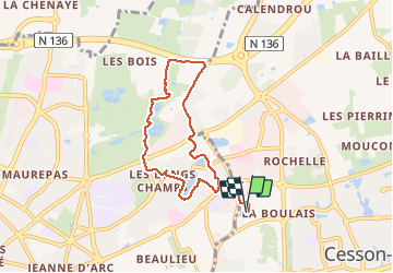
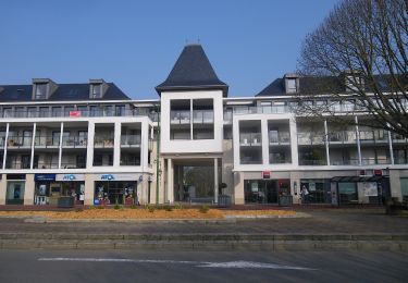
Trail Running of 7.1 km to be discovered at Brittany, Ille-et-Vilaine, Cesson-Sévigné. This trail is proposed by tracegps.
Description
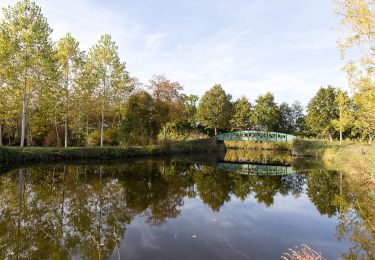
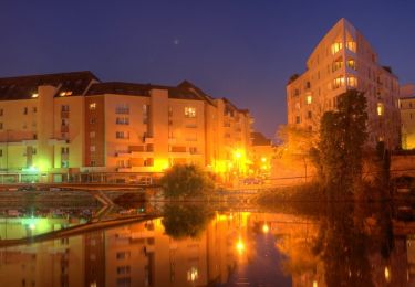
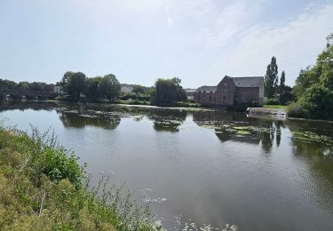
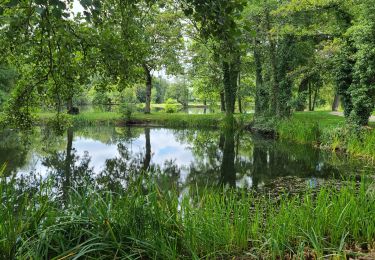
La campagne à la ville. Petite boucle de 7kms au travers du quartier des Longchamps. Accès au petit lac à partir de France-Télécom et via les petits sentiers dans le quartier résidentiel. 3/4 de boucle autour du lac puis direction le parc des Gayeulles. Tour du lac en passant à coté du restaurant. Belle végétation sur le lac : nénuphars en fleurs (rose), très joli. On regretterait presque de ne pas avoir son appareil photo. Puis direction les jardins familiaux. Bien partir vers l'Ouest des jardins , sans quoi, plusieurs cul-de-sac avant de retomber sur le circuit. On rejoint ensuite une petite route longeant la rocade Nord. Puis retour par la route et direction le centre commercial des Longchamps. Prendre le chemin entre le lac et le centre commercial puis tout droit pour retomber sur un chemin , petit sentier qui traverse le quartier résidentiel avant le retour au bercail. 7km sans aucune difficulté.
Positioning
Comments
Trails nearby
![Trail On foot Saint-Grégoire - Circuit de la Boutière - Photo](https://media.geolcdn.com/t/375/260/be6e7bb0-1772-48a6-9f30-2bc59080eacb.jpeg&format=jpg&maxdim=2)
![On foot On foot](https://static1.geolcdn.com/sitytour/trail-icons/100.png)
On foot
![](/images/other/stat-length.png)
![](https://static1.geolcdn.com/siteimages/upload/files/16400158638029165_repeat_loop_refresh_sync_direction_icon.png)
![Trail On foot Rennes - Circuit des Louvries - Photo](https://media.geolcdn.com/t/375/260/df10b53e-816c-4112-9887-ffbc2c82646e.jpeg&format=jpg&maxdim=2)
![On foot On foot](https://static1.geolcdn.com/sitytour/trail-icons/100.png)
On foot
![](/images/other/stat-length.png)
![](https://static1.geolcdn.com/siteimages/upload/files/16400158638029165_repeat_loop_refresh_sync_direction_icon.png)
![Trail On foot Rennes - La balade à André - Photo](https://media.geolcdn.com/t/375/260/21bf6cca-cebe-47ea-8c50-7b46a79e5fa3.jpeg&format=jpg&maxdim=2)
![On foot On foot](https://static1.geolcdn.com/sitytour/trail-icons/100.png)
On foot
![](/images/other/stat-length.png)
![](https://static1.geolcdn.com/siteimages/upload/files/16400158638029165_repeat_loop_refresh_sync_direction_icon.png)
![Trail On foot Cesson-Sévigné - Parcs et jardins - Photo](https://media.geolcdn.com/t/375/260/037007ff-9a46-424d-a033-bc4b6ff71a6a.jpeg&format=jpg&maxdim=2)
![On foot On foot](https://static1.geolcdn.com/sitytour/trail-icons/100.png)
On foot
![](/images/other/stat-length.png)
![](https://static1.geolcdn.com/siteimages/upload/files/16400158638029165_repeat_loop_refresh_sync_direction_icon.png)
![Trail Walking Cesson-Sévigné - Cesson Sévigné - Photo](https://media.geolcdn.com/t/375/260/ext.jpg?maxdim=2&url=https%3A%2F%2Fstatic1.geolcdn.com%2Fsiteimages%2Fupload%2Ffiles%2F1553511878bg_sport_marche.png)
![Walking Walking](https://static1.geolcdn.com/sitytour/trail-icons/101.png)
Walking
![](/images/other/stat-length.png)
![](https://static1.geolcdn.com/siteimages/upload/files/16400158638029165_repeat_loop_refresh_sync_direction_icon.png)
![Trail Walking Rennes - La promenade Georges Brassens et des Bonnets Rouges - Rennes - Photo](https://media.geolcdn.com/t/375/260/ext.jpg?maxdim=2&url=https%3A%2F%2Fservices.sitytrail.com%2FGeolivesWS%2FDownloadMedia.ashx%3FTrailID%3D191412%26Media%3D14992_6.jpg)
![Walking Walking](https://static1.geolcdn.com/sitytour/trail-icons/101.png)
Walking
![](/images/other/stat-length.png)
![](https://static1.geolcdn.com/siteimages/upload/files/16400158638029165_repeat_loop_refresh_sync_direction_icon.png)
![Trail On foot Rennes - RENNES : street art raccourci le 18/11/2024 - Photo](https://media.geolcdn.com/t/375/260/51742e12-aee2-4c99-96cd-a0fc410ef54f.jpg&format=jpg&maxdim=2)
![On foot On foot](https://static1.geolcdn.com/sitytour/trail-icons/100.png)
On foot
![](/images/other/stat-length.png)
![](https://static1.geolcdn.com/siteimages/upload/files/16400158638029165_repeat_loop_refresh_sync_direction_icon.png)
![Trail Electric bike Rennes - Rennes à Guipry-Messac - Photo](https://media.geolcdn.com/t/375/260/2b36141b-c92e-475f-a12d-aab1f02c06c0.jpg&format=jpg&maxdim=2)
![Electric bike Electric bike](https://static1.geolcdn.com/sitytour/trail-icons/205.png)
Electric bike
![](/images/other/stat-length.png)
![](https://static1.geolcdn.com/siteimages/upload/files/16400158638029165_repeat_loop_refresh_sync_direction_icon.png)
![Trail Walking Cesson-Sévigné - cesson - Photo](https://media.geolcdn.com/t/375/260/031b7295-c682-47d4-9915-29014b9b2945.jpg&format=jpg&maxdim=2)
![Walking Walking](https://static1.geolcdn.com/sitytour/trail-icons/101.png)
Walking
![](/images/other/stat-length.png)
![](https://static1.geolcdn.com/siteimages/upload/files/16400158638029165_repeat_loop_refresh_sync_direction_icon.png)