![](/images/other/stat-length.png)
![Trail Walking Cléry-Saint-André - Cléry-Dry - Photo](https://media.geolcdn.com/t/1900/400/ext.pjpeg?maxdim=2&url=https%3A%2F%2Fstatic1.geolcdn.com%2Fsiteimages%2Fupload%2Ffiles%2F1553511878bg_sport_marche.png)
Cléry-Dry
boissay
User
![Length](/images/other/stat-length.png)
Length
13.7 km
![Max alt](https://static1.geolcdn.com/siteimages/upload/files/1508320355ic_sort_altitude_max_24dp.png)
Max alt
103 m
![Uphill gradient](https://static1.geolcdn.com/siteimages/upload/files/1508320355ic_sort_den_pos_24dp.png)
Uphill gradient
57 m
![Km-Effort](/images/other/stat-length.png)
Km-Effort
14.5 km
![Min alt](https://static1.geolcdn.com/siteimages/upload/files/1508320355ic_sort_altitude_min_24dp.png)
Min alt
82 m
![Downhill gradient](https://static1.geolcdn.com/siteimages/upload/files/1508320355ic_sort_den_neg_24dp.png)
Downhill gradient
57 m
![Boucle](https://static1.geolcdn.com/siteimages/upload/files/16400158638029165_repeat_loop_refresh_sync_direction_icon.png)
Boucle
Yes
Creation date :
2019-01-15 16:08:42.255
Updated on :
2019-01-15 16:08:42.255
![Walking](https://static1.geolcdn.com/sitytour/trail-icons/101.png)
3h14
Difficulty : Easy
![Scan this QR Code to open this trail in the SityTrail application](https://capi.geolives.com/qq0zvz2zws4bq2lad0pu/sitytour/trails/1038677/qr.png?size=200)
FREE GPS app for hiking
About
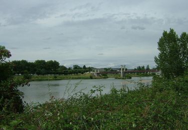
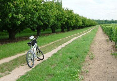
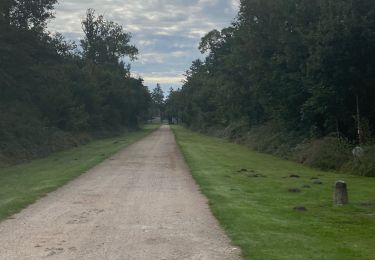
Trail Walking of 13.7 km to be discovered at Centre-Loire Valley, Loiret, Cléry-Saint-André. This trail is proposed by boissay.
Description
Après un petit tour côté Sologne avec passage près du moulin à vent du Mardereau (18ème siècle),on découvre le val d'Ardoux jusqu'à Dry et retour par Mazan et la levée de la Loire. La fin du parcours suit au plus près la rivière Ardoux.
Positioning
Country:
France
Region :
Centre-Loire Valley
Department/Province :
Loiret
Municipality :
Cléry-Saint-André
Location:
Unknown
Start:(Dec)
Start:(UTM)
406672 ; 5296518 (31T) N.
Comments
Trails nearby
![Trail Mountain bike Mézières-lez-Cléry - Les élus Mézière - Photo](https://media.geolcdn.com/t/375/260/ext.jpg?maxdim=2&url=https%3A%2F%2Fservices.sitytrail.com%2FGeolivesWS%2FDownloadMedia.ashx%3FTrailID%3D102853%26Media%3D4026_6.jpg)
![Mountain bike Mountain bike](https://static1.geolcdn.com/sitytour/trail-icons/202.png)
Les élus Mézière
Mountain bike
Medium
Mézières-lez-Cléry,
Centre-Loire Valley,
Loiret,
France
![](/images/other/stat-length.png)
13.1 km | 14.4 km-effort
1h 19min
![](https://static1.geolcdn.com/siteimages/upload/files/16400158638029165_repeat_loop_refresh_sync_direction_icon.png)
Yes
![Trail Walking Mézières-lez-Cléry - Les élus Mézière - Photo](https://media.geolcdn.com/t/375/260/ext.jpg?maxdim=2&url=https%3A%2F%2Fservices.sitytrail.com%2FGeolivesWS%2FDownloadMedia.ashx%3FTrailID%3D102852%26Media%3D4026_6.jpg)
![Walking Walking](https://static1.geolcdn.com/sitytour/trail-icons/101.png)
Les élus Mézière
Walking
Easy
Mézières-lez-Cléry,
Centre-Loire Valley,
Loiret,
France
![](/images/other/stat-length.png)
13.1 km | 14.4 km-effort
3h 30min
![](https://static1.geolcdn.com/siteimages/upload/files/16400158638029165_repeat_loop_refresh_sync_direction_icon.png)
Yes
![Trail Walking Mézières-lez-Cléry - mezieres fevrier 2023 - Photo](https://media.geolcdn.com/t/375/260/8e9bc008-e738-437d-a2d1-3e242f15dba1.jpg&format=jpg&maxdim=2)
![Walking Walking](https://static1.geolcdn.com/sitytour/trail-icons/101.png)
mezieres fevrier 2023
Walking
Medium
Mézières-lez-Cléry,
Centre-Loire Valley,
Loiret,
France
![](/images/other/stat-length.png)
10.6 km | 11.8 km-effort
2h 28min
![](https://static1.geolcdn.com/siteimages/upload/files/16400158638029165_repeat_loop_refresh_sync_direction_icon.png)
Yes
![Trail Walking Mézières-lez-Cléry - Mézières 6 juin 2021 - Photo](https://media.geolcdn.com/t/375/260/4ed21d7b-41f3-437d-bfd5-510784e977d6.jpg&format=jpg&maxdim=2)
![Walking Walking](https://static1.geolcdn.com/sitytour/trail-icons/101.png)
Mézières 6 juin 2021
Walking
Medium
Mézières-lez-Cléry,
Centre-Loire Valley,
Loiret,
France
![](/images/other/stat-length.png)
9.9 km | 10.9 km-effort
3h 7min
![](https://static1.geolcdn.com/siteimages/upload/files/16400158638029165_repeat_loop_refresh_sync_direction_icon.png)
Yes
![Trail Mountain bike Meung-sur-Loire - Les deux ponts - Meung sur Loire - Beaugency - Photo](https://media.geolcdn.com/t/375/260/ext.jpg?maxdim=2&url=https%3A%2F%2Fservices.sitytrail.com%2FGeolivesWS%2FDownloadMedia.ashx%3FTrailID%3D103577%26Media%3D5908_2.jpg)
![Mountain bike Mountain bike](https://static1.geolcdn.com/sitytour/trail-icons/202.png)
Les deux ponts - Meung sur Loire - Beaugency
Mountain bike
Medium
Meung-sur-Loire,
Centre-Loire Valley,
Loiret,
France
![](/images/other/stat-length.png)
17.1 km | 18.4 km-effort
2h 0min
![](https://static1.geolcdn.com/siteimages/upload/files/16400158638029165_repeat_loop_refresh_sync_direction_icon.png)
Yes
![Trail Walking Meung-sur-Loire - Les deux ponts - Meung sur Loire - Beaugency - Photo](https://media.geolcdn.com/t/375/260/ext.jpg?maxdim=2&url=https%3A%2F%2Fservices.sitytrail.com%2FGeolivesWS%2FDownloadMedia.ashx%3FTrailID%3D103576%26Media%3D5908_2.jpg)
![Walking Walking](https://static1.geolcdn.com/sitytour/trail-icons/101.png)
Les deux ponts - Meung sur Loire - Beaugency
Walking
Medium
Meung-sur-Loire,
Centre-Loire Valley,
Loiret,
France
![](/images/other/stat-length.png)
17.1 km | 18.4 km-effort
4h 0min
![](https://static1.geolcdn.com/siteimages/upload/files/16400158638029165_repeat_loop_refresh_sync_direction_icon.png)
Yes
![Trail Cycle Cléry-Saint-André - Cléry Saint André - Photo](https://media.geolcdn.com/t/375/260/ext.jpg?maxdim=2&url=https%3A%2F%2Fservices.sitytrail.com%2FGeolivesWS%2FDownloadMedia.ashx%3FTrailID%3D102657%26Media%3D3666_2.jpg)
![Cycle Cycle](https://static1.geolcdn.com/sitytour/trail-icons/200.png)
Cléry Saint André
Cycle
Easy
Cléry-Saint-André,
Centre-Loire Valley,
Loiret,
France
![](/images/other/stat-length.png)
19.2 km | 20 km-effort
1h 45min
![](https://static1.geolcdn.com/siteimages/upload/files/16400158638029165_repeat_loop_refresh_sync_direction_icon.png)
Yes
![Trail sport Cléry-Saint-André - Sob 7 clery ferte St Cyr - Photo](https://media.geolcdn.com/t/375/260/ce887a6e-1c86-46c1-80c8-24fbf8d76772.jpg&format=jpg&maxdim=2)
Sob 7 clery ferte St Cyr
sport
Very easy
Cléry-Saint-André,
Centre-Loire Valley,
Loiret,
France
![](/images/other/stat-length.png)
24 km | 26 km-effort
Unknown
![](https://static1.geolcdn.com/siteimages/upload/files/16400158638029165_repeat_loop_refresh_sync_direction_icon.png)
No
![Trail Road bike Meung-sur-Loire - Beautency - Photo](https://media.geolcdn.com/t/375/260/ext.jpg?maxdim=2&url=https%3A%2F%2Fstatic1.geolcdn.com%2Fsiteimages%2Fupload%2Ffiles%2F1524743154velo.jpg)
![Road bike Road bike](https://static1.geolcdn.com/sitytour/trail-icons/201.png)
Beautency
Road bike
Meung-sur-Loire,
Centre-Loire Valley,
Loiret,
France
![](/images/other/stat-length.png)
18 km | 19.7 km-effort
1h 12min
![](https://static1.geolcdn.com/siteimages/upload/files/16400158638029165_repeat_loop_refresh_sync_direction_icon.png)
Yes