


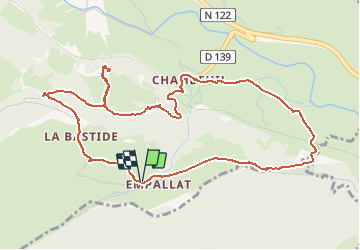


9.6 km | 14.1 km-effort


User


FREE GPS app for hiking
 SityTrail
IGN / Geographical institutes
SityTrail World
The world is yours!
Trail Walking of 6 km to be discovered at Auvergne-Rhône-Alpes, Cantal, Laveissière. This trail is proposed by tracegps.
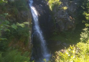
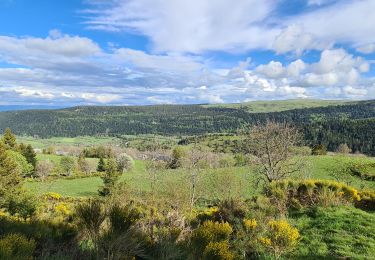
Un circuit à emprunter par tous. On descend vers la voie ferrée que l'on franchit sur un vieux pont de pierres. L'itinéraire continue au fond de la vallée de l'Allagnon pour rejoindre le village de Chambeuil. Passage ensuite sous un viaduc et marche en sous bois en direction du lieu dit "Combrelle", où se dressait autrefois un château siège d'une seigneurie du même nom. Au retour, la vue sur la vallée sera une bonne occasion pour reprendre son souffle.

Walking

Walking

Walking

Road bike

Road bike

Road bike
Trail

Walking
Walking