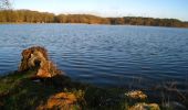

Autour de Sillé le Guillaume

tracegps
User

Length
43 km

Max alt
281 m

Uphill gradient
598 m

Km-Effort
51 km

Min alt
149 m

Downhill gradient
596 m
Boucle
Yes
Creation date :
2014-12-10 00:00:00.0
Updated on :
2014-12-10 00:00:00.0
4h00
Difficulty : Difficult

FREE GPS app for hiking
About
Trail Mountain bike of 43 km to be discovered at Pays de la Loire, Sarthe, Sillé-le-Guillaume. This trail is proposed by tracegps.
Description
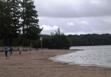
Très joli cadre autour du lac de Sillé le Guillaume avec des portions très difficiles parfois. L'ensemble du circuit est réservé au VTTiste avertis. Le circuit se fait généralement dans une forêt de pins, avec quelques dénivelés importants.
Positioning
Country:
France
Region :
Pays de la Loire
Department/Province :
Sarthe
Municipality :
Sillé-le-Guillaume
Location:
Unknown
Start:(Dec)
Start:(UTM)
713147 ; 5344000 (30U) N.
Comments
Trails nearby
Tour du Grand Étang


On foot
Easy
Sillé-le-Guillaume,
Pays de la Loire,
Sarthe,
France

3.8 km | 4.4 km-effort
1h 0min
Yes

adal_stesuzanne 20160530 m


Walking
Medium
(1)
Sillé-le-Guillaume,
Pays de la Loire,
Sarthe,
France

14.1 km | 17.1 km-effort
3h 42min
Yes
2 = Sillé le Guillaume - Fresnay sur Sarthe


Walking
Easy
Sillé-le-Guillaume,
Pays de la Loire,
Sarthe,
France

28 km | 34 km-effort
5h 50min
No
1= Mont St Jean ~ Sillé le Guillaume


Walking
Very easy
Mont-Saint-Jean,
Pays de la Loire,
Sarthe,
France

9.1 km | 11.7 km-effort
1h 52min
No

Sentier de Bel Air (b)


On foot
Easy
Saint-Germain-de-Coulamer,
Pays de la Loire,
Mayenne,
France

4.9 km | 6.3 km-effort
1h 25min
Yes
Autour du lac de Sillé le Guillaume


Mountain bike
Difficult
Sillé-le-Guillaume,
Pays de la Loire,
Sarthe,
France

33 km | 41 km-effort
3h 0min
Yes

Tour des Alpes Mancelles en 4 jours


Walking
Easy
Mont-Saint-Jean,
Pays de la Loire,
Sarthe,
France

87 km | 108 km-effort
17h 0min
Yes

Fr Coco plage. RS 16-01-2023 8,8 km


Nordic walking
Very easy
Sillé-le-Guillaume,
Pays de la Loire,
Sarthe,
France

8.8 km | 10.4 km-effort
2h 1min
Yes

tour en forêt de Sillé.


Mountain bike
Medium
Sillé-le-Guillaume,
Pays de la Loire,
Sarthe,
France

22 km | 26 km-effort
1h 58min
Yes


 SityTrail


