Trail Mountain bike Saint-Macaire - Saint Macaire - la Pena B - Photo

Saint Macaire - la Pena B

 tracegps
tracegps

User

© OpenStreetMap contributors
Length
Length
34 km
Max alt
Max alt
118 m
Uphill gradient
Uphill gradient
489 m
Km-Effort
Km-Effort  
40 km
Min alt
Min alt
7 m
Downhill gradient
Downhill gradient
491 m
Boucle
Boucle
Yes
Creation date :
2014-12-10 00:00:00.0
Updated on :
2014-12-10 00:00:00.0

(0 Reviews)

Mountain bike
Mountain bike
2h19
Difficulty : Difficult

Scan this QR Code to open this trail in the SityTrail application

FREE GPS app for hiking

Logo SityTrail SityTrail

IGN / Geographical institutes

Download SityTrail from the App Store Download SityTrail from Google Play

Logo SityTrail SityTrail World

The world is yours!

Download SityTrail from the App Store Download SityTrail from Google Play Download SityTrail on Huawei AppGallery

About

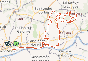
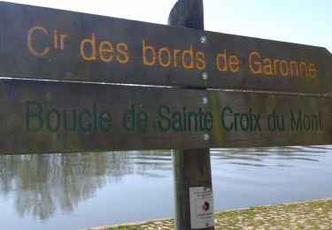
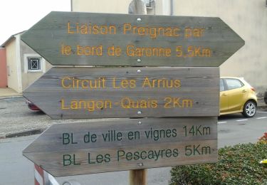
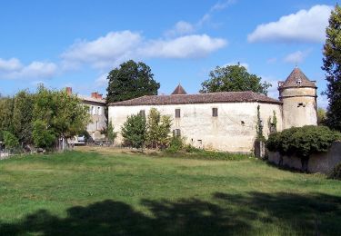
Trail Mountain bike of 34 km to be discovered at New Aquitaine, Gironde, Saint-Macaire. This trail is proposed by tracegps.

Description

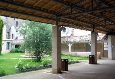
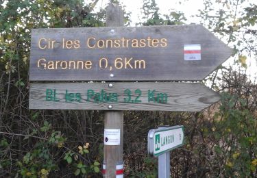
Point de vue agréable des coteaux sur la vallée de la Garonne. Bébert! je t'attends en haut!

Elevation profile

Photos

Positioning

Country:
France
Region :
New Aquitaine
Department/Province :
Gironde
Municipality :
Saint-Macaire
Location:
Unknown
Start:(UTM)
720177 ; 4938406 (30T) N.

Trails nearby

Trail Walking Verdelais - Verdelais boucle n1 1h30 7km - Photo
Walking
respicair

Walking

Very easy
(1)
Verdelais, New Aquitaine, Gironde, France
7.1 km | 8.8 km-effort
Unknown
Yes
Trail Walking Verdelais - Verdelais - Photo
Walking
plavengut

Walking

Medium
Verdelais, New Aquitaine, Gironde, France
10 km | 12 km-effort
3h 6min
No
Trail On foot Langon - Les Gabares : circuit départemental - Photo
On foot
GUIDE+

On foot

Medium
Langon, New Aquitaine, Gironde, France
21 km | 23 km-effort
5h 15min
No
Trail On foot Verdelais - Boucle locale de Verdelais - Photo
On foot
GUIDE+

On foot

Easy
Verdelais, New Aquitaine, Gironde, France
3.4 km | 4.6 km-effort
1h 2min
Yes
Trail On foot Saint-Maixant - Saint-Maixant : boucle locale - Photo
On foot
GUIDE+

On foot

Easy
Saint-Maixant, New Aquitaine, Gironde, France
8.2 km | 10 km-effort
2h 16min
Yes
Trail On foot Toulenne - Les Pescayres : boucle locale - Photo
On foot
GUIDE+

On foot

Easy
Toulenne, New Aquitaine, Gironde, France
3.5 km | 3.9 km-effort
52min
No
Trail On foot Saint-Pardon-de-Conques - Les Jauberthes - Photo
On foot
GUIDE+

On foot

Easy
Saint-Pardon-de-Conques, New Aquitaine, Gironde, France
4.5 km | 5 km-effort
1h 8min
Yes
Trail On foot Langon - Les Contrastes : circuit départemental - Photo
On foot
GUIDE+

On foot

Easy
Langon, New Aquitaine, Gironde, France
9.6 km | 10.5 km-effort
2h 23min
No
Trail On foot Saint-Pierre-de-Mons - Les Palus : boucle locale - Photo
On foot
GUIDE+

On foot

Easy
Saint-Pierre-de-Mons, New Aquitaine, Gironde, France
3.1 km | 3.5 km-effort
47min
Yes


Close
My subscriptions