![](/images/other/stat-length.png)
![Trail Walking Chamonix-Mont-Blanc - Circuit de la Mer de Glace - Chamonix Mont Blanc - Photo](https://media.geolcdn.com/t/1900/400/ext.pjpeg?maxdim=2&url=https%3A%2F%2Fservices.sitytrail.com%2FGeolivesWS%2FDownloadMedia.ashx%3FTrailID%3D103700%26Media%3D6192_6.jpg)
Circuit de la Mer de Glace - Chamonix Mont Blanc
tracegps
User
![Length](/images/other/stat-length.png)
![Max alt](https://static1.geolcdn.com/siteimages/upload/files/1508320355ic_sort_altitude_max_24dp.png)
![Uphill gradient](https://static1.geolcdn.com/siteimages/upload/files/1508320355ic_sort_den_pos_24dp.png)
![Km-Effort](/images/other/stat-length.png)
![Min alt](https://static1.geolcdn.com/siteimages/upload/files/1508320355ic_sort_altitude_min_24dp.png)
![Downhill gradient](https://static1.geolcdn.com/siteimages/upload/files/1508320355ic_sort_den_neg_24dp.png)
![Boucle](https://static1.geolcdn.com/siteimages/upload/files/16400158638029165_repeat_loop_refresh_sync_direction_icon.png)
![Walking](https://static1.geolcdn.com/sitytour/trail-icons/101.png)
5h30
Difficulty : Difficult
![Scan this QR Code to open this trail in the SityTrail application](https://capi.geolives.com/qq0zvz2zws4bq2lad0pu/sitytour/trails/103700/qr.png?size=200)
FREE GPS app for hiking
About
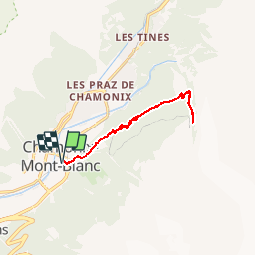
Trail Walking of 13.3 km to be discovered at Auvergne-Rhône-Alpes, Upper Savoy, Chamonix-Mont-Blanc. This trail is proposed by tracegps.
Description
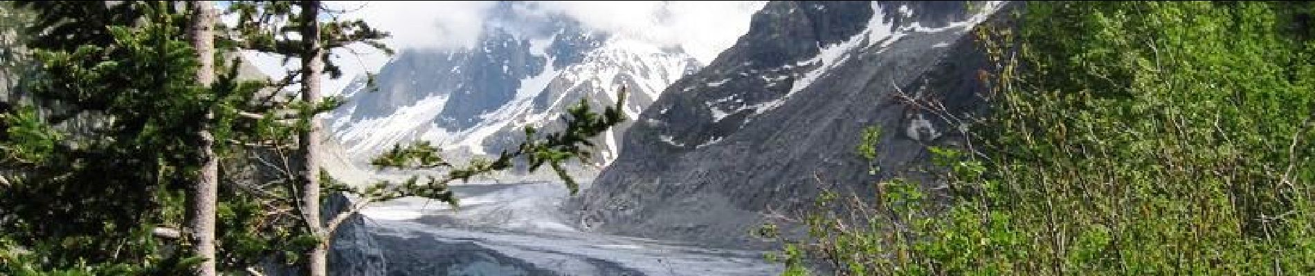
Circuit de la Mer de Glace - Chamonix Mont Blanc Circuit assez difficile aller retour 5h30; dernier 1/3 difficile beaucoup de roches et passages avec neige selon saison. Il y en avait encore fin mai 2009. Départ depuis la gare du train Montenvers à Chamonix. Suivre la trace gps, sinon il y a quelques pancartes indicatrices. Montée permanente sur 900m de dénivelé. Les premiers 600m de dénivelé s'effectuent sur de bons sentiers après mieux vaut être bien équipé. Vues splendides sur la vallée sur les 2/3, puis on longe la Mer de Glace sans la voir. Et évidemment la cerise sur le gâteau: enfin la vue sur la Mer de Glace. On peut continuer jusqu'en haut encore 100m de dénivelé et redescendre par un autre chemin mais je n'avais pas le temps de le chercher donc je suis redescendu par le même. Des bâtons de randonneurs pour s'appuyer dans la descente sont les bienvenus.
Positioning
Comments
Trails nearby
![Trail Walking Chamonix-Mont-Blanc - J8 - Cascade du Dard - Photo](https://media.geolcdn.com/t/375/260/c145d485-4f6a-4304-96f9-70fb8a7d1c29.jpg&format=jpg&maxdim=2)
![Walking Walking](https://static1.geolcdn.com/sitytour/trail-icons/101.png)
Walking
![](/images/other/stat-length.png)
![](https://static1.geolcdn.com/siteimages/upload/files/16400158638029165_repeat_loop_refresh_sync_direction_icon.png)
![Trail Running Chamonix-Mont-Blanc - The North Face© Ultra Trail du Mont-Blanc© UTMB 2008 - Photo](https://media.geolcdn.com/t/375/260/ext.jpg?maxdim=2&url=https%3A%2F%2Fservices.sitytrail.com%2FGeolivesWS%2FDownloadMedia.ashx%3FTrailID%3D109134%26Media%3D3174_5.jpg)
![Running Running](https://static1.geolcdn.com/sitytour/trail-icons/103.png)
Running
![](/images/other/stat-length.png)
![](https://static1.geolcdn.com/siteimages/upload/files/16400158638029165_repeat_loop_refresh_sync_direction_icon.png)
![Trail Walking Chamonix-Mont-Blanc - Glacier des Bossons Les Houches Chamonix - Photo](https://media.geolcdn.com/t/375/260/ext.jpg?maxdim=2&url=https%3A%2F%2Fservices.sitytrail.com%2FGeolivesWS%2FDownloadMedia.ashx%3FTrailID%3D118854%26Media%3D13070_2.jpg)
![Walking Walking](https://static1.geolcdn.com/sitytour/trail-icons/101.png)
Walking
![](/images/other/stat-length.png)
![](https://static1.geolcdn.com/siteimages/upload/files/16400158638029165_repeat_loop_refresh_sync_direction_icon.png)
![Trail Walking Chamonix-Mont-Blanc - Chalet des Pyramides 1895m 11.7.22 - Photo](https://media.geolcdn.com/t/375/260/ef1bf2d0-a858-40af-bcf2-b4e7d382c27f.jpg&format=jpg&maxdim=2)
![Walking Walking](https://static1.geolcdn.com/sitytour/trail-icons/101.png)
Walking
![](/images/other/stat-length.png)
![](https://static1.geolcdn.com/siteimages/upload/files/16400158638029165_repeat_loop_refresh_sync_direction_icon.png)
![Trail Running Chamonix-Mont-Blanc - Hôtel Arveyron au Chalet de la Floria - Photo](https://media.geolcdn.com/t/375/260/ext.jpg?maxdim=2&url=https%3A%2F%2Fstatic1.geolcdn.com%2Fsiteimages%2Fupload%2Ffiles%2F1524743154running.jpg)
![Running Running](https://static1.geolcdn.com/sitytour/trail-icons/103.png)
Running
![](/images/other/stat-length.png)
![](https://static1.geolcdn.com/siteimages/upload/files/16400158638029165_repeat_loop_refresh_sync_direction_icon.png)
![Trail Walking Chamonix-Mont-Blanc - La cascade du dard - Photo](https://media.geolcdn.com/t/375/260/ext.jpg?maxdim=2&url=https%3A%2F%2Fservices.sitytrail.com%2FGeolivesWS%2FDownloadMedia.ashx%3FTrailID%3D626685%26Media%3D433ceacd-297f-461a-afa3-69d034da6405.jpg)
![Walking Walking](https://static1.geolcdn.com/sitytour/trail-icons/101.png)
Walking
![](/images/other/stat-length.png)
![](https://static1.geolcdn.com/siteimages/upload/files/16400158638029165_repeat_loop_refresh_sync_direction_icon.png)
![Trail Walking Chamonix-Mont-Blanc - Le lac bleus - Photo](https://media.geolcdn.com/t/375/260/ext.jpg?maxdim=2&url=https%3A%2F%2Fservices.sitytrail.com%2FGeolivesWS%2FDownloadMedia.ashx%3FTrailID%3D467938%26Media%3D0e0140a2-6104-42dc-addc-29be79b70aa4.jpg)
![Walking Walking](https://static1.geolcdn.com/sitytour/trail-icons/101.png)
Walking
![](/images/other/stat-length.png)
![](https://static1.geolcdn.com/siteimages/upload/files/16400158638029165_repeat_loop_refresh_sync_direction_icon.png)
![Trail Mountain bike Chamonix-Mont-Blanc - vtt à Chamonix - Photo](https://media.geolcdn.com/t/375/260/ext.jpg?maxdim=2&url=https%3A%2F%2Fservices.sitytrail.com%2FGeolivesWS%2FDownloadMedia.ashx%3FTrailID%3D467115%26Media%3D7ce48f5e-712a-47f0-8147-acaa94237d97.jpg)
![Mountain bike Mountain bike](https://static1.geolcdn.com/sitytour/trail-icons/202.png)
Mountain bike
![](/images/other/stat-length.png)
![](https://static1.geolcdn.com/siteimages/upload/files/16400158638029165_repeat_loop_refresh_sync_direction_icon.png)
![Trail Other activity Chamonix-Mont-Blanc - vallée blanche - Photo](https://media.geolcdn.com/t/375/260/ext.jpg?maxdim=2&url=https%3A%2F%2Fstatic1.geolcdn.com%2Fsiteimages%2Fupload%2Ffiles%2F1545311037marcheuse_200dpi.jpg)
![Other activity Other activity](https://static1.geolcdn.com/sitytour/trail-icons/900.png)
Other activity
![](/images/other/stat-length.png)
![](https://static1.geolcdn.com/siteimages/upload/files/16400158638029165_repeat_loop_refresh_sync_direction_icon.png)
Très bonne balade mais effectivement, mieux vaut être équipés!