
Boucle entre les lacs de Sewen et d'Alfeld

tracegps
User

Length
8.1 km

Max alt
722 m

Uphill gradient
321 m

Km-Effort
12.3 km

Min alt
494 m

Downhill gradient
320 m
Boucle
Yes
Creation date :
2014-12-10 00:00:00.0
Updated on :
2014-12-10 00:00:00.0
2h30
Difficulty : Medium

FREE GPS app for hiking
About
Trail Walking of 8.1 km to be discovered at Grand Est, Haut-Rhin, Sewen. This trail is proposed by tracegps.
Description
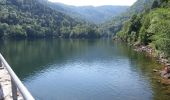
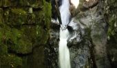
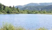
Au fond de la vallée de la Doller, dans le périmètre classé du Ballon d'Alsace, un petit circuit facile et très plaisant autour des lacs de Sewen et d'Alfeld. A voir : les lacs, la tourbière lacustre de Sewen, la flore et avec un peu de chance, les castors.
Positioning
Country:
France
Region :
Grand Est
Department/Province :
Haut-Rhin
Municipality :
Sewen
Location:
Unknown
Start:(Dec)
Start:(UTM)
343112 ; 5297108 (32T) N.
Comments
Trails nearby
Haute Bers


Walking
Medium
(1)
Rimbach-près-Masevaux,
Grand Est,
Haut-Rhin,
France

12 km | 20 km-effort
3h 25min
Yes
Tour du Ballon d'Alsace


Walking
Difficult
(1)
Saint-Maurice-sur-Moselle,
Grand Est,
Vosges,
France

10.5 km | 17.7 km-effort
5h 25min
Yes
lac d'Alfeld


Walking
Very difficult
(1)
Sewen,
Grand Est,
Haut-Rhin,
France

17.1 km | 28 km-effort
8h 7min
Yes
2025-01-03 Rando Polaire Dolleren Ballon Alsace Etape 2


Walking
Very difficult
Dolleren,
Grand Est,
Haut-Rhin,
France

17.3 km | 26 km-effort
6h 0min
No
suuntoapp-Hiking-2025-01-02T19-20-24Z


Walking
Medium
Dolleren,
Grand Est,
Haut-Rhin,
France

4.3 km | 8.1 km-effort
1h 50min
No
2022-07-16 Marche Auberge Gazon Vert Chapelle des Ves


Walking
Very difficult
Storckensohn,
Grand Est,
Haut-Rhin,
France

21 km | 37 km-effort
6h 11min
No
2022-07-15 Marche Refuge Baerenkopf Auberge Gazon Vert


Walking
Very difficult
Kirchberg,
Grand Est,
Haut-Rhin,
France

23 km | 38 km-effort
8h 21min
No
Les deux lacs


Walking
Difficult
Rimbach-près-Masevaux,
Grand Est,
Haut-Rhin,
France

15.5 km | 25 km-effort
5h 47min
Yes
FucksfelsenBelacker


Walking
Medium
Wegscheid,
Grand Est,
Haut-Rhin,
France

14.4 km | 24 km-effort
4h 9min
Yes


 SityTrail


