![](/images/other/stat-length.png)
![Trail Walking Trégunc - St Philibert - Kersidan - Don - Trez Coa - Photo](https://media.geolcdn.com/t/1900/400/ext.pjpeg?maxdim=2&url=https%3A%2F%2Fstatic1.geolcdn.com%2Fsiteimages%2Fupload%2Ffiles%2F1553511878bg_sport_marche.png)
St Philibert - Kersidan - Don - Trez Coa
toporient
User
![Length](/images/other/stat-length.png)
Length
4.1 km
![Max alt](https://static1.geolcdn.com/siteimages/upload/files/1508320355ic_sort_altitude_max_24dp.png)
Max alt
23 m
![Uphill gradient](https://static1.geolcdn.com/siteimages/upload/files/1508320355ic_sort_den_pos_24dp.png)
Uphill gradient
27 m
![Km-Effort](/images/other/stat-length.png)
Km-Effort
4.5 km
![Min alt](https://static1.geolcdn.com/siteimages/upload/files/1508320355ic_sort_altitude_min_24dp.png)
Min alt
1 m
![Downhill gradient](https://static1.geolcdn.com/siteimages/upload/files/1508320355ic_sort_den_neg_24dp.png)
Downhill gradient
29 m
![Boucle](https://static1.geolcdn.com/siteimages/upload/files/16400158638029165_repeat_loop_refresh_sync_direction_icon.png)
Boucle
Yes
Creation date :
2019-01-15 15:56:04.811
Updated on :
2019-01-15 15:56:04.811
![Walking](https://static1.geolcdn.com/sitytour/trail-icons/101.png)
59m
Difficulty : Easy
![Scan this QR Code to open this trail in the SityTrail application](https://capi.geolives.com/qq0zvz2zws4bq2lad0pu/sitytour/trails/1036313/qr.png?size=200)
FREE GPS app for hiking
About
Trail Walking of 4.1 km to be discovered at Brittany, Finistère, Trégunc. This trail is proposed by toporient.
Description
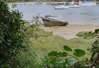
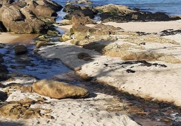
Circuit en boucle de l'église de st Philibert (dont 1,5 km en bord de mer) passant par les plages de Kersidan, du Don, de Trez Cao pour revenir par le chemin du parcours sportif.
Positioning
Country:
France
Region :
Brittany
Department/Province :
Finistère
Municipality :
Trégunc
Location:
Unknown
Start:(Dec)
Start:(UTM)
437661 ; 5295041 (30T) N.
Comments
Trails nearby
![Trail Running Trégunc - GR34 - 31 - Photo](https://media.geolcdn.com/t/375/260/ext.jpg?maxdim=2&url=https%3A%2F%2Fstatic1.geolcdn.com%2Fsiteimages%2Fupload%2Ffiles%2F1524743154running.jpg)
![Running Running](https://static1.geolcdn.com/sitytour/trail-icons/103.png)
![Trail Walking Névez - Samedi 4 novembre 2012 - Photo](https://media.geolcdn.com/t/375/260/ext.jpg?maxdim=2&url=https%3A%2F%2Fstatic1.geolcdn.com%2Fsiteimages%2Fupload%2Ffiles%2F1553511878bg_sport_marche.png)
![Walking Walking](https://static1.geolcdn.com/sitytour/trail-icons/101.png)
Samedi 4 novembre 2012
Walking
Very easy
(1)
Névez,
Brittany,
Finistère,
France
![](/images/other/stat-length.png)
6.6 km | 7.2 km-effort
1h 16min
![](https://static1.geolcdn.com/siteimages/upload/files/16400158638029165_repeat_loop_refresh_sync_direction_icon.png)
Yes
![Trail Walking Trégunc - Randonnee de Trévignon - Trégunc - Photo](https://media.geolcdn.com/t/375/260/ext.jpg?maxdim=2&url=https%3A%2F%2Fstatic1.geolcdn.com%2Fsiteimages%2Fupload%2Ffiles%2F1553511878bg_sport_marche.png)
![Walking Walking](https://static1.geolcdn.com/sitytour/trail-icons/101.png)
Randonnee de Trévignon - Trégunc
Walking
Easy
(2)
Trégunc,
Brittany,
Finistère,
France
![](/images/other/stat-length.png)
6.7 km | 7.3 km-effort
1h 45min
![](https://static1.geolcdn.com/siteimages/upload/files/16400158638029165_repeat_loop_refresh_sync_direction_icon.png)
Yes
![Trail Walking Trégunc - Yregunc re ar wenodenn - Photo](https://media.geolcdn.com/t/375/260/920b2546-d768-4de0-82fe-cbd6fddcfc28.jpg&format=jpg&maxdim=2)
![Walking Walking](https://static1.geolcdn.com/sitytour/trail-icons/101.png)
Yregunc re ar wenodenn
Walking
Easy
Trégunc,
Brittany,
Finistère,
France
![](/images/other/stat-length.png)
5.8 km | 6.2 km-effort
1h 33min
![](https://static1.geolcdn.com/siteimages/upload/files/16400158638029165_repeat_loop_refresh_sync_direction_icon.png)
Yes
![Trail Walking Trégunc - Saint Philibert-Trévignon plage - Photo](https://media.geolcdn.com/t/375/260/cebc81cb-da8e-476d-ba58-36b6f4cdb247.jpg&format=jpg&maxdim=2)
![Walking Walking](https://static1.geolcdn.com/sitytour/trail-icons/101.png)
Saint Philibert-Trévignon plage
Walking
Medium
Trégunc,
Brittany,
Finistère,
France
![](/images/other/stat-length.png)
7.1 km | 7.7 km-effort
1h 55min
![](https://static1.geolcdn.com/siteimages/upload/files/16400158638029165_repeat_loop_refresh_sync_direction_icon.png)
Yes
![Trail Walking Trégunc - TREGUNC - Photo](https://media.geolcdn.com/t/375/260/04a90680-2ce4-46fa-965d-80bc63343dd4.jpg&format=jpg&maxdim=2)
![Walking Walking](https://static1.geolcdn.com/sitytour/trail-icons/101.png)
![Trail Walking Trégunc - Tregunc - Photo](https://media.geolcdn.com/t/375/260/0294ed77-693d-4112-8e2e-97085a77d8cd.jpg&format=jpg&maxdim=2)
![Walking Walking](https://static1.geolcdn.com/sitytour/trail-icons/101.png)
![Trail Walking Névez - Kerascoët- Plage de Tahiti-Raguenez - Photo](https://media.geolcdn.com/t/375/260/eb9238df-9db1-4408-903e-0787f78f91db.jpg&format=jpg&maxdim=2)
![Walking Walking](https://static1.geolcdn.com/sitytour/trail-icons/101.png)
Kerascoët- Plage de Tahiti-Raguenez
Walking
Very easy
Névez,
Brittany,
Finistère,
France
![](/images/other/stat-length.png)
3.8 km | 4.3 km-effort
2h 34min
![](https://static1.geolcdn.com/siteimages/upload/files/16400158638029165_repeat_loop_refresh_sync_direction_icon.png)
Yes
![Trail Walking Névez - Rospico, Trémorvézen, Kercvaillet, Plage Tahiti et retour par bord de mer - Photo](https://media.geolcdn.com/t/375/260/ext.jpg?maxdim=2&url=https%3A%2F%2Fstatic1.geolcdn.com%2Fsiteimages%2Fupload%2Ffiles%2F1553511878bg_sport_marche.png)
![Walking Walking](https://static1.geolcdn.com/sitytour/trail-icons/101.png)
Rospico, Trémorvézen, Kercvaillet, Plage Tahiti et retour par bord de mer
Walking
Very easy
(1)
Névez,
Brittany,
Finistère,
France
![](/images/other/stat-length.png)
7 km | 7.8 km-effort
2h 0min
![](https://static1.geolcdn.com/siteimages/upload/files/16400158638029165_repeat_loop_refresh_sync_direction_icon.png)
Yes