


6.9 km | 9.3 km-effort

User


FREE GPS app for hiking
 SityTrail
IGN / Geographical institutes
SityTrail World
The world is yours!
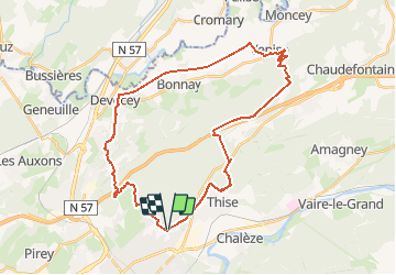
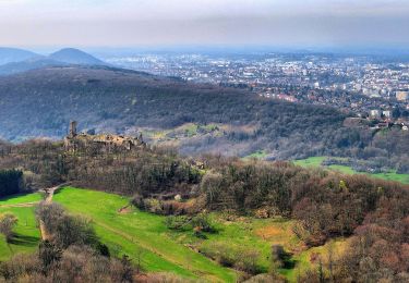
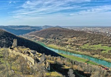
Trail Mountain bike of 34 km to be discovered at Bourgogne-Franche-Comté, Doubs, Besançon. This trail is proposed by tracegps.
Ce parcours est de niveau difficile. Le début est tranquille, on alterne dans les bois chemin larges et sentiers étroits, jusqu'au village de Chatillon. On prend alors une super descente jusqu'a Devecey. D'ici, on longe l'ancienne voie ferrée pendant 8 km (un peu longuet). Nous voila arrivé au village "Venise" et là commence la grande montée. 200m de dénivelé pour arriver tout en haut de la forêt de Chailluz. Le début de la côte est très raide (ça patine un peu sur sol mouillé) mais ça devient ensuite plus régulier. Le retour est parsemé de chemins et de bois.


Walking
Walking
On foot
On foot
On foot
On foot
On foot
On foot
On foot