Trail Running Montplonne - Les châteaux et la vallée de la Saulx (circuit 2) - Photo

Les châteaux et la vallée de la Saulx (circuit 2)

 tracegps
tracegps

User

© OpenStreetMap contributors
Length
Length
25 km
Max alt
Max alt
298 m
Uphill gradient
Uphill gradient
332 m
Km-Effort
Km-Effort  
29 km
Min alt
Min alt
169 m
Downhill gradient
Downhill gradient
332 m
Boucle
Boucle
Yes
Creation date :
2014-12-10 00:00:00.0
Updated on :
2014-12-10 00:00:00.0

(0 Reviews)

Running
Running
2h00
Difficulty : Very difficult

Scan this QR Code to open this trail in the SityTrail application

FREE GPS app for hiking

Logo SityTrail SityTrail

IGN / Geographical institutes

Download SityTrail from the App Store Download SityTrail from Google Play

Logo SityTrail SityTrail World

The world is yours!

Download SityTrail from the App Store Download SityTrail from Google Play Download SityTrail on Huawei AppGallery

About

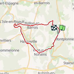
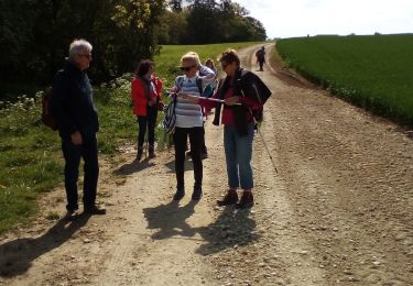
Trail Running of 25 km to be discovered at Grand Est, Meuse, Montplonne. This trail is proposed by tracegps.

Description

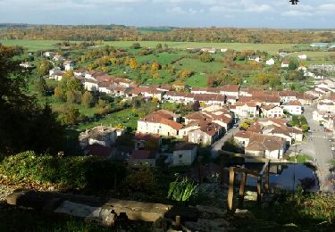
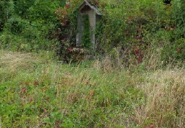
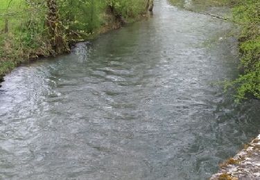
Parcours traversant la campagne meusienne et longeant la rivière "la saulx" qui s'écoule dans une très belle vallée appelée vallée des Ducs. En traversant les villages vous y verrez châteaux (à Bazincourt, Saudrupt, Haironville, Ville sur Saulx, Brillon en Barrois), fermes fortifiées, lavoirs , fontaines et ponts (du XVII à Bazincourt, 12 arches à Haironville)...

Elevation profile

Positioning

Country:
France
Region :
Grand Est
Department/Province :
Meuse
Municipality :
Montplonne
Location:
Unknown
Start:(UTM)
658685 ; 5396106 (31U) N.

Trails nearby

Trail Walking Bazincourt-sur-Saulx - bazincourt n18 18a - Photo
Walking
cath310

Walking

Difficult
(1)
Bazincourt-sur-Saulx, Grand Est, Meuse, France
22 km | 29 km-effort
5h 30min
Yes
Trail Walking Longeville-en-Barrois - beauregard - Photo
Walking
ghislaine61

Walking

Medium
Longeville-en-Barrois, Grand Est, Meuse, France
12.9 km | 16.6 km-effort
2h 52min
Yes
Trail Walking Stainville - n° 21 boucle des Nants - Photo
Walking
cath310

Walking

Easy
Stainville, Grand Est, Meuse, France
14.5 km | 18.3 km-effort
3h 49min
Yes
Trail Walking Bazincourt-sur-Saulx - 18 vallée de l'ornain et de la saulx  - Photo
Walking
cath310

Walking

Difficult
Bazincourt-sur-Saulx, Grand Est, Meuse, France
23 km | 30 km-effort
4h 57min
Yes
Trail Walking Brillon-en-Barrois - Randowen 2023 Brillon en Barrois - Photo
Walking
Nono55

Walking

Very easy
Brillon-en-Barrois, Grand Est, Meuse, France
11.8 km | 13.5 km-effort
2h 19min
Yes
Trail Mountain bike Montplonne - Les châteaux et la vallée de la Saulx (circuit 2) - Photo
Mountain bike
tracegps

Mountain bike

Difficult
Montplonne, Grand Est, Meuse, France
25 km | 29 km-effort
1h 30min
Yes
Trail Walking Montplonne - Les châteaux et la vallée de la Saulx (circuit 2) - Photo
Walking
tracegps

Walking

Very difficult
Montplonne, Grand Est, Meuse, France
25 km | 29 km-effort
5h 0min
Yes
Trail Running Bazincourt-sur-Saulx - Les châteaux et la vallée de la Saulx (circuit 1) - Photo
Running
tracegps

Running

Very difficult
Bazincourt-sur-Saulx, Grand Est, Meuse, France
23 km | 29 km-effort
2h 0min
Yes
Trail Mountain bike Bazincourt-sur-Saulx - Les châteaux et la vallée de la Saulx (circuit 1) - Photo
Mountain bike
tracegps

Mountain bike

Difficult
Bazincourt-sur-Saulx, Grand Est, Meuse, France
23 km | 29 km-effort
1h 30min
Yes


Close
My subscriptions