Trail Walking Bessuéjouls - Jour 2 Espalion - Colinhac - Photo

Jour 2 Espalion - Colinhac

 matb
matb

User

© OpenStreetMap contributors
Length
Length
19.6 km
Max alt
Max alt
668 m
Uphill gradient
Uphill gradient
617 m
Km-Effort
Km-Effort  
27 km
Min alt
Min alt
316 m
Downhill gradient
Downhill gradient
457 m
Boucle
Boucle
No
Creation date :
2019-01-15 15:43:04.221
Updated on :
2019-04-19 11:47:52.274

(0 Reviews)

Walking
Walking
7h02
Difficulty : Medium

Scan this QR Code to open this trail in the SityTrail application

FREE GPS app for hiking

Logo SityTrail SityTrail

IGN / Geographical institutes

Download SityTrail from the App Store Download SityTrail from Google Play

Logo SityTrail SityTrail World

The world is yours!

Download SityTrail from the App Store Download SityTrail from Google Play Download SityTrail on Huawei AppGallery

About

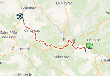
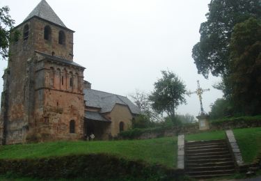
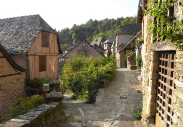
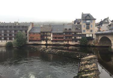
Trail Walking of 19.6 km to be discovered at Occitania, Aveyron, Bessuéjouls. This trail is proposed by matb.

Description

Départ : Le Briffoul
44°31'58.1"N 2°42'34.2"E
44.532804, 2.709505

Arrivée : Le Barthas

Elevation profile

Points of interest

Point of interest Saint-Chély-d'Aubrac - Aubrac - Photo
matb
SAINT-CHÉLY-D'AUBRAC 
Point of interest Saint-Chély-d'Aubrac - Saint-Chély d'Aubrac - Photo
matb
SAINT-CHÉLY-D'AUBRAC 
Point of interest Saint-Côme-d'Olt - Saint Côme d'olt - Photo
matb
SAINT-CÔME-D'OLT 
Point of interest Espalion - Espalion - Photo
matb
ESPALION 
Point of interest Bessuéjouls - Bessuéjouls - Photo
matb
BESSUÉJOULS 
Point of interest Sébrazac - Estaing - Photo
matb
SÉBRAZAC 
Point of interest Golinhac - Golinhac - Photo
matb
GOLINHAC 
Point of interest Espeyrac - Espeyrac - Photo
matb
ESPEYRAC 
Point of interest Sénergues - Sénergues - Photo
matb
SÉNERGUES 
Point of interest Conques-en-Rouergue - Conques - Photo
matb
CONQUES-EN-ROUERGUE 

Positioning

Country:
France
Region :
Occitania
Department/Province :
Aveyron
Municipality :
Bessuéjouls
Location:
Unknown
Start:(UTM)
476931 ; 4931097 (31T) N.

Trails nearby

Trail Walking Espalion - Compostelle 08 - Espalion -> Estaing - Photo
Walking
uru2010

Walking

Easy
(1)
Espalion, Occitania, Aveyron, France
13.8 km | 17.9 km-effort
3h 53min
No
Trail Walking Estaing - Estaing - Espeyrac - Chemin de St-Jacques de Compostelle - Photo
Walking
tracegps

Walking

Difficult
(1)
Estaing, Occitania, Aveyron, France
23 km | 32 km-effort
4h 15min
No
Trail Walking Espalion - Espalion Massip Avril 2018 - Photo
Walking
GUIDE
Kargil

Walking

Difficult
Espalion, Occitania, Aveyron, France
25 km | 35 km-effort
7h 13min
No
Trail Equestrian Estaing - Rallye Estaing 2013 - 15km - Photo
Equestrian
zbozzo

Equestrian

Medium
(1)
Estaing, Occitania, Aveyron, France
17.4 km | 24 km-effort
2h 59min
Yes
Trail Walking Sébrazac - St Jacques Etape 9 par GR6 - Photo
Walking
Jean-MarieFaux

Walking

Very difficult
Sébrazac, Occitania, Aveyron, France
23 km | 31 km-effort
6h 57min
No
Trail On foot Espalion - La Voie du Rail - Photo
On foot
GUIDE+

On foot

Easy
Espalion, Occitania, Aveyron, France
10.2 km | 14.7 km-effort
3h 20min
No
Trail Walking Espalion - CC_Velay_BD_08_Espalion_Golinhac_20070823 - Photo
Walking
patrickdanilo

Walking

Difficult
Espalion, Occitania, Aveyron, France
28 km | 39 km-effort
7h 30min
No
Trail Walking Espalion - Mon Compostelle, quatrième étape - Photo
Walking
Ardeiserois

Walking

Very difficult
Espalion, Occitania, Aveyron, France
47 km | 65 km-effort
10h 0min
No
Trail Walking Espalion - espalion - golinhac - Photo
Walking
jib971

Walking

Difficult
Espalion, Occitania, Aveyron, France
29 km | 39 km-effort
8h 42min
No


Close
My subscriptions