


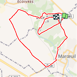


14.3 km | 16.7 km-effort


User


FREE GPS app for hiking
 SityTrail
IGN / Geographical institutes
SityTrail World
The world is yours!
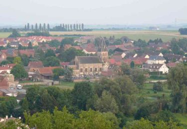
Trail Walking of 10.6 km to be discovered at Hauts-de-France, Pas-de-Calais, Marœuil. This trail is proposed by tracegps.
Après un tour à l'intérieur du bois le circuit vous fait faire un grand tour à l'extérieur. Randonnée du Club Arras Inter Générations.
Walking

Walking

Nordic walking
Walking

Walking
Other activity
Walking

Walking
Walking