Séméac - Sarrouilles - Oléac-Debat
tracegps
User
Length
29 km
Max alt
436 m
Uphill gradient
408 m
Km-Effort
35 km
Min alt
277 m
Downhill gradient
410 m
Boucle
No
Creation date :
2014-12-10 00:00:00.0
Updated on :
2014-12-10 00:00:00.0
3h00
Difficulty : Difficult
FREE GPS app for hiking
About
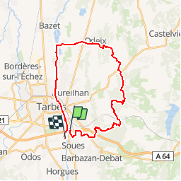
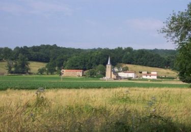
Trail Mountain bike of 29 km to be discovered at Occitania, Hautespyrenees, Soues. This trail is proposed by tracegps.
Description
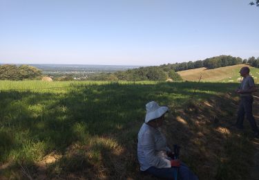
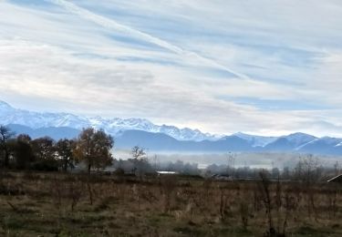
Sortie sympa sur les coteaux de TARBES, avec beau point de vue sur TARBES et ses alentours, et jolis panoramas sur nos superbes Pyrénées. Plus de détails sur le site VTT en 65, le sentier-web du VTT en Hautes Pyrénées. Trace faite par "lours65".
Positioning
Country:
France
Region :
Occitania
Department/Province :
Hautespyrenees
Municipality :
Soues
Location:
Unknown
Start:(Dec)
Start:(UTM)
264225 ; 4789065 (31T) N.
Comments
Trails nearby
Le Chemin Vert
On foot
Medium
Tarbes,
Occitania,
Hautespyrenees,
France
18.6 km | 22 km-effort
4h 54min
No
Le Bois de Rebisclou
On foot
Easy
Barbazan-Debat,
Occitania,
Hautespyrenees,
France
9.6 km | 12.7 km-effort
2h 53min
Yes
bagneres tarbes
Cycle
Easy
(1)
Tarbes,
Occitania,
Hautespyrenees,
France
42 km | 46 km-effort
1h 52min
Yes
la barthe circuit rouge
Walking
Very easy
Séméac,
Occitania,
Hautespyrenees,
France
3.4 km | 4.7 km-effort
59min
Yes
caminadour velo
Road bike
Easy
Tarbes,
Occitania,
Hautespyrenees,
France
14.2 km | 15.2 km-effort
5h 5min
No
vélo ecole de Ger 2022 caminadour du collège au nord du lac de Bours
Cycle
Very easy
Tarbes,
Occitania,
Hautespyrenees,
France
15.1 km | 16.3 km-effort
Unknown
Yes
pietat barbazan M1.5
Walking
Very easy
Barbazan-Debat,
Occitania,
Hautespyrenees,
France
10.1 km | 12.8 km-effort
2h 37min
Yes
Horgues Odos
Nordic walking
Easy
Horgues,
Occitania,
Hautespyrenees,
France
9.1 km | 9.8 km-effort
2h 3min
Yes
Angos - Bordes - Bois de Peyraube
Mountain bike
Difficult
Angos,
Occitania,
Hautespyrenees,
France
35 km | 46 km-effort
2h 30min
Yes