Trail Mountain bike La Robine-sur-Galabre - Espace VTT FFC Digne les Bains - N° 04 La Robine - Photo

Espace VTT FFC Digne les Bains - N° 04 La Robine

 tracegps
tracegps

User

© OpenStreetMap contributors
Length
Length
26 km
Max alt
Max alt
1530 m
Uphill gradient
Uphill gradient
1027 m
Km-Effort
Km-Effort  
40 km
Min alt
Min alt
627 m
Downhill gradient
Downhill gradient
1021 m
Boucle
Boucle
Yes
Creation date :
2014-12-10 00:00:00.0
Updated on :
2014-12-10 00:00:00.0

(0 Reviews)

Mountain bike
Mountain bike
2h30
Difficulty : Difficult

Scan this QR Code to open this trail in the SityTrail application

FREE GPS app for hiking

Logo SityTrail SityTrail

IGN / Geographical institutes

Download SityTrail from the App Store Download SityTrail from Google Play

Logo SityTrail SityTrail World

The world is yours!

Download SityTrail from the App Store Download SityTrail from Google Play Download SityTrail on Huawei AppGallery

About

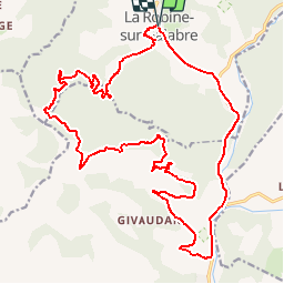
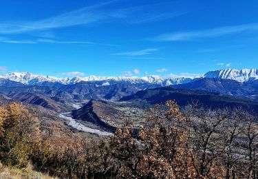
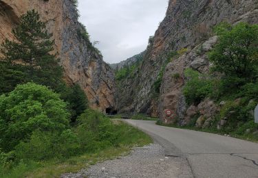
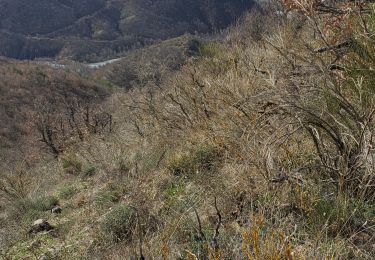
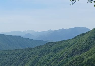
Trail Mountain bike of 26 km to be discovered at Provence-Alpes-Côte d'Azur, Alpes-de-Haute-Provence, La Robine-sur-Galabre. This trail is proposed by tracegps.

Description

Espace VTT FFC de Digne les Bains et le Pays Dignois Circuit labellisé par la Fédération Française de Cyclisme. Espace VTT FFC Digne les Bains - N° 04 La Robine Au départ du village de la Robine, ce parcours sportif vous conduira, après avoir rejoint la Dalle à ammonites à la sortie de Digne les Bains, dans le vallon du Gévaudan. Après un passage un peu raide (petit portage), vous cheminerez sur les pistes forestières du bois de Siron. Si la montée est parfois raide, les points de vue vous feront vite oublier ces quelques efforts. Le Club VTT Rando 04, organisateur de randonnées, sorties et manifestations.

Elevation profile

Photos

Positioning

Country:
France
Region :
Provence-Alpes-Côte d'Azur
Department/Province :
Alpes-de-Haute-Provence
Municipality :
La Robine-sur-Galabre
Location:
Unknown
Start:(UTM)
277545 ; 4894570 (32T) N.

Trails nearby

Trail Walking Hautes-Duyes - geruen sentier des chamois  - Photo
Walking
GUIDE
Danielba

Walking

Very difficult
(1)
Hautes-Duyes, Provence-Alpes-Côte d'Azur, Alpes-de-Haute-Provence, France
11 km | 22 km-effort
7h 15min
Yes
Trail Walking Thoard - la Bigue par Thoard - Photo
Walking
FPOL04

Walking

Medium
(1)
Thoard, Provence-Alpes-Côte d'Azur, Alpes-de-Haute-Provence, France
17.5 km | 30 km-effort
7h 43min
No
Trail Walking Hautes-Duyes - Crête de Géruën descente sud Est - Photo
Walking
GUIDE
nadd73

Walking

Difficult
Hautes-Duyes, Provence-Alpes-Côte d'Azur, Alpes-de-Haute-Provence, France
11.6 km | 22 km-effort
5h 18min
Yes
Trail Walking Hautes-Duyes - sommet Geruen et son pas - Photo
Walking
GUIDE
nadd73

Walking

Difficult
Hautes-Duyes, Provence-Alpes-Côte d'Azur, Alpes-de-Haute-Provence, France
14 km | 28 km-effort
7h 6min
Yes
Trail Walking La Robine-sur-Galabre - LAMBERT mourre du barri - Photo
Walking
RobinMicheline

Walking

Very easy
(1)
La Robine-sur-Galabre, Provence-Alpes-Côte d'Azur, Alpes-de-Haute-Provence, France
12.6 km | 21 km-effort
4h 18min
Yes
Trail Walking La Javie - vélodrome esclangon 17kms 1049m - Photo
Walking
GUIDE
Danielba

Walking

Difficult
La Javie, Provence-Alpes-Côte d'Azur, Alpes-de-Haute-Provence, France
15.5 km | 29 km-effort
7h 28min
Yes
Trail Walking Marcoux - Marcoux crete de liman 950m 15kms  - Photo
Walking
GUIDE
Danielba

Walking

Medium
Marcoux, Provence-Alpes-Côte d'Azur, Alpes-de-Haute-Provence, France
14.7 km | 25 km-effort
7h 31min
No
Trail Walking La Robine-sur-Galabre - LA ROBINE . Les Pharaons Au fil de l eau o m s - Photo
Walking
RobinMicheline

Walking

Easy
(1)
La Robine-sur-Galabre, Provence-Alpes-Côte d'Azur, Alpes-de-Haute-Provence, France
8.4 km | 14.3 km-effort
3h 7min
Yes
Trail On foot Marcoux - La Crête de Liman - Photo
On foot
GUIDE+

On foot

Easy
Marcoux, Provence-Alpes-Côte d'Azur, Alpes-de-Haute-Provence, France
10 km | 18.5 km-effort
4h 12min
No


Close
My subscriptions