Trail Walking Courchevel - Brêche de la Portetta - Photo

Brêche de la Portetta

 tracegps
tracegps

User

© OpenStreetMap contributors
Length
Length
12.7 km
Max alt
Max alt
2703 m
Uphill gradient
Uphill gradient
1073 m
Km-Effort
Km-Effort  
27 km
Min alt
Min alt
1738 m
Downhill gradient
Downhill gradient
1074 m
Boucle
Boucle
Yes
Creation date :
2014-12-11 00:00:00.0
Updated on :
2014-12-11 00:00:00.0

(1 Reviews)

Walking
Walking
5h00
Difficulty : Very difficult

Scan this QR Code to open this trail in the SityTrail application

FREE GPS app for hiking

Logo SityTrail SityTrail

IGN / Geographical institutes

Download SityTrail from the App Store Download SityTrail from Google Play

Logo SityTrail SityTrail World

The world is yours!

Download SityTrail from the App Store Download SityTrail from Google Play Download SityTrail on Huawei AppGallery

About

Trail Walking of 12.7 km to be discovered at Auvergne-Rhône-Alpes, Savoy, Courchevel. This trail is proposed by tracegps.

Description

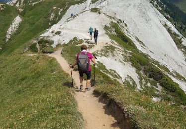
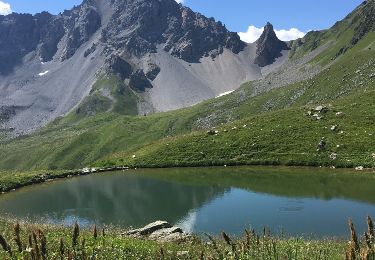
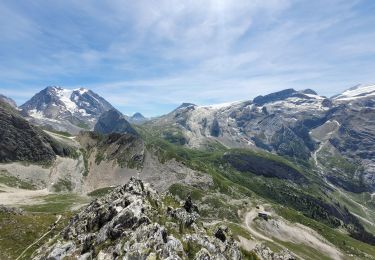
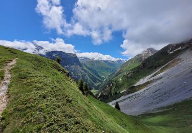
La randonnée commence simplement en empruntant une piste forestière au fond du Vallon des Avals. Au niveau du Chalet du Biol, ca commence à se compliquer où il faut emprunter un petit sentier bien tracé et balisé. Ensuite, il faut monter dans une pente raide et caillouteuse jusqu'au niveaux des brêches (car il y en a plusieurs en réalité). Une fois arrivé, vous vous sentirez tout petits, car entourés par des falaises verticales assez hautes. Attention aux enfants car la faute de pas ne pardonne pas ! Attention aussi aux cailloux qui pourraient débarouler à cause des personnes à l'amont de vous dans le pierrier

Elevation profile

Points of interest

Point of interest Pralognan-la-Vanoise - Brêche de Portetta - Photo
tracegps
PRALOGNAN-LA-VANOISE 

Positioning

Country:
France
Region :
Auvergne-Rhône-Alpes
Department/Province :
Savoy
Municipality :
Courchevel
Location:
Saint-Bon-Tarentaise
Start:(UTM)
317152 ; 5030678 (32T) N.

Comments

Please log in to post a review or rate the element


Trails nearby

Trail Walking Pralognan-la-Vanoise - Pralognan - la crête du mont Charvet - Photo
Walking
countryjack

Walking

Medium
(1)
Pralognan-la-Vanoise, Auvergne-Rhône-Alpes, Savoy, France
11.4 km | 24 km-effort
5h 1min
No
Trail Walking Courchevel - lac des creux au départ de l'altiport  - Photo
Walking
Klhn

Walking

Easy
(1)
Courchevel, Auvergne-Rhône-Alpes, Savoy, France
6.8 km | 11.1 km-effort
2h 40min
Yes
Trail Walking Pralognan-la-Vanoise - pointe de Leschaux - Photo
Walking
GUIDE
amiral13

Walking

Difficult
Pralognan-la-Vanoise, Auvergne-Rhône-Alpes, Savoy, France
12 km | 28 km-effort
5h 43min
Yes
Trail Walking Planay - la cascade de la Vuzelle - Photo
Walking
GUIDE
amiral13

Walking

Medium
Planay, Auvergne-Rhône-Alpes, Savoy, France
4.3 km | 10.4 km-effort
2h 21min
Yes
Trail Walking Pralognan-la-Vanoise - col de napremont - Photo
Walking
GUIDE
amiral13

Walking

Easy
Pralognan-la-Vanoise, Auvergne-Rhône-Alpes, Savoy, France
9.4 km | 19.4 km-effort
4h 24min
Yes
Trail Mountain bike Bozel - activity_9181659290 (1) - Photo
Mountain bike
GUIDE
pascalou73

Mountain bike

Easy
Bozel, Auvergne-Rhône-Alpes, Savoy, France
9.4 km | 13.8 km-effort
57min
Yes
Trail Walking Planay - le refuge du Grand Bec (boucle) - Photo
Walking
GUIDE
amiral13

Walking

Medium
Planay, Auvergne-Rhône-Alpes, Savoy, France
8.8 km | 19.3 km-effort
4h 22min
Yes
Trail Walking Pralognan-la-Vanoise - Pralognan - Petit Mont Blanc 2677m 08/07/2019 - Photo
Walking
GUIDE
fredetpascale

Walking

Medium
(2)
Pralognan-la-Vanoise, Auvergne-Rhône-Alpes, Savoy, France
11 km | 25 km-effort
5h 0min
Yes
Trail Walking Courchevel - Petit Mont Blanc par Courchevel - Photo
Walking
Brusa

Walking

Easy
(1)
Courchevel, Auvergne-Rhône-Alpes, Savoy, France
19.8 km | 34 km-effort
6h 59min
Yes


Close
My subscriptions