


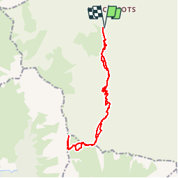


8.2 km | 13.3 km-effort


User


FREE GPS app for hiking
 SityTrail
IGN / Geographical institutes
SityTrail World
The world is yours!
Trail Walking of 15.8 km to be discovered at Auvergne-Rhône-Alpes, Savoy, Les Belleville. This trail is proposed by tracegps.
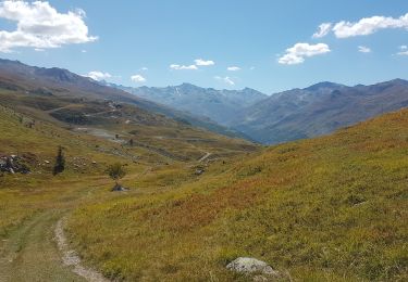
Randonnée de belle envergure mais où vous aurez très probablement comme récompense de pouvoir apercevoir (et c'est peu de le dire) des bouquetins, très nombreux dans ce massif.

Walking

Walking

Walking
Walking
Walking
Walking

Electric bike
Mountain bike

Touring skiing