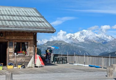
Trail Mountain bike Ugine - Piste cyclable Ugine-Annecy - Photo

Piste cyclable Ugine-Annecy

 tracegps
tracegps

User

© OpenStreetMap contributors
Length
Length
142 km
Max alt
Max alt
524 m
Uphill gradient
Uphill gradient
1221 m
Km-Effort
Km-Effort  
158 km
Min alt
Min alt
407 m
Downhill gradient
Downhill gradient
1220 m
Boucle
Boucle
Yes
Creation date :
2014-12-10 00:00:00.0
Updated on :
2014-12-10 00:00:00.0

(0 Reviews)

Mountain bike
Mountain bike
4h00
Difficulty : Medium

Scan this QR Code to open this trail in the SityTrail application

FREE GPS app for hiking

Logo SityTrail SityTrail

IGN / Geographical institutes

Download SityTrail from the App Store Download SityTrail from Google Play

Logo SityTrail SityTrail World

The world is yours!

Download SityTrail from the App Store Download SityTrail from Google Play Download SityTrail on Huawei AppGallery

About

Trail Mountain bike of 142 km to be discovered at Auvergne-Rhône-Alpes, Savoy, Ugine. This trail is proposed by tracegps.

Description

Parcours tranquille à cheval sur 2 départements, la Savoie et la haute-Savoie. Pour cela, on utilise une piste cyclable réhabilitant une ancienne voie ferrée. Il n'y a donc pas (sauf au tout départ d'Ugine) de dénivelé. Au niveau de Duingt, un tunnel est emprunté. Au bord du lac, de nombreuses plages vous permettront de "piquer une petite tête".

Elevation profile

Points of interest

Point of interest Muggia - 000 - Photo
tracegps
MUGGIA 
Point of interest Hrpelje-Kozina - 001 - Photo
tracegps
HRPELJE-KOZINA 
Point of interest Divača - 002 - Photo
tracegps
DIVAČA 
Point of interest Postojna - 003 - Photo
tracegps
POSTOJNA 
Point of interest Ajdovščina - 004 - Photo
tracegps
AJDOVŠČINA 
Point of interest Idrija - 005 - Photo
tracegps
IDRIJA 
Point of interest Idrija - 006 - Photo
tracegps
IDRIJA 
Point of interest Cerkno - 007 - Photo
tracegps
CERKNO 
Point of interest Tolmin - 008 - Photo
tracegps
TOLMIN 
Point of interest Bohinj - 009 - Photo
tracegps
BOHINJ 
Point of interest Bohinj - 010 - Photo
tracegps
BOHINJ 
Point of interest Bohinj - 011 - Photo
tracegps
BOHINJ 
Point of interest Bovec - 012 - Photo
tracegps
BOVEC 
Point of interest Bovec - 013 - Photo
tracegps
BOVEC 
Point of interest Tarvisio - 014 - Photo
tracegps
TARVISIO 
Point of interest Hohenthurn - 015 - Photo
tracegps
HOHENTHURN 
Point of interest Sankt Stefan im Gailtal - 016 - Photo
tracegps
SANKT STEFAN IM GAILTAL 
Point of interest Hermagor-Pressegger See - 017 - Photo
tracegps
HERMAGOR-PRESSEGGER SEE 
Point of interest Paularo - 018 - Photo
tracegps
PAULARO 
Point of interest Kötschach-Mauthen - 019 - Photo
tracegps
KÖTSCHACH-MAUTHEN 
Point of interest Lesachtal - 020 - Photo
tracegps
LESACHTAL 
Point of interest Forni Avoltri - 021 - Photo
tracegps
FORNI AVOLTRI 
Point of interest Santo Stefano di Cadore - 022 - Photo
tracegps
SANTO STEFANO DI CADORE 
Point of interest Gemeinde Kartitsch - 023 - Photo
tracegps
GEMEINDE KARTITSCH 
Point of interest Gemeinde Kartitsch - 024 - Photo
tracegps
GEMEINDE KARTITSCH 
Point of interest Sexten - Sesto - 025 - Photo
tracegps
SEXTEN - SESTO 
Point of interest Toblach - Dobbiaco - 026 - Photo
tracegps
TOBLACH - DOBBIACO 
Point of interest Prags - Braies - 027 - Photo
tracegps
PRAGS - BRAIES 
Point of interest Prags - Braies - 028 - Photo
tracegps
PRAGS - BRAIES 
Point of interest Rasen-Antholz - Rasun-Anterselva - 029 - Photo
tracegps
RASEN-ANTHOLZ - RASUN-ANTERSELVA 
Point of interest Rasen-Antholz - Rasun-Anterselva - 030 - Photo
tracegps
RASEN-ANTHOLZ - RASUN-ANTERSELVA 
Point of interest Sand in Taufers - Campo Tures - 031 - Photo
tracegps
SAND IN TAUFERS - CAMPO TURES 
Point of interest Ahrntal - Valle Aurina - 032 - Photo
tracegps
AHRNTAL - VALLE AURINA 
Point of interest Mühlwald - Selva dei Molini - 033 - Photo
tracegps
MÜHLWALD - SELVA DEI MOLINI 
Point of interest Pfitsch - Val di Vizze - 034 - Photo
tracegps
PFITSCH - VAL DI VIZZE 
Point of interest Gemeinde Finkenberg - 035 - Photo
tracegps
GEMEINDE FINKENBERG 
Point of interest Gemeinde Finkenberg - 036 - Photo
tracegps
GEMEINDE FINKENBERG 
Point of interest Gemeinde Hippach - 037 - Photo
tracegps
GEMEINDE HIPPACH 
Point of interest Gemeinde Fügenberg - 038 - Photo
tracegps
GEMEINDE FÜGENBERG 
Point of interest Gemeinde Pill - 039 - Photo
tracegps
GEMEINDE PILL 
Point of interest Marktgemeinde Vomp - 040 - Photo
tracegps
MARKTGEMEINDE VOMP 
Point of interest Marktgemeinde Vomp - 041 - Photo
tracegps
MARKTGEMEINDE VOMP 
Point of interest Gemeinde Scharnitz - 042 - Photo
tracegps
GEMEINDE SCHARNITZ 
Point of interest Gemeinde Leutasch - 043 - Photo
tracegps
GEMEINDE LEUTASCH 
Point of interest Garmisch-Partenkirchen - 044 - Photo
tracegps
GARMISCH-PARTENKIRCHEN 
Point of interest Gemeinde Ehrwald - 045 - Photo
tracegps
GEMEINDE EHRWALD 
Point of interest Gemeinde Biberwier - 046 - Photo
tracegps
GEMEINDE BIBERWIER 
Point of interest Gemeinde Berwang - 047 - Photo
tracegps
GEMEINDE BERWANG 
Point of interest Gemeinde Weißenbach am Lech - 048 - Photo
tracegps
GEMEINDE WEISSENBACH AM LECH 
Point of interest Oberstdorf - 049 - Photo
tracegps
OBERSTDORF 
Point of interest Oberstdorf - 050 - Photo
tracegps
OBERSTDORF 
Point of interest Gemeinde Warth - 051 - Photo
tracegps
GEMEINDE WARTH 
Point of interest Gemeinde Sonntag - 052 - Photo
tracegps
GEMEINDE SONNTAG 
Point of interest Gemeinde Sonntag - 053 - Photo
tracegps
GEMEINDE SONNTAG 
Point of interest Gemeinde Röns - 054 - Photo
tracegps
GEMEINDE RÖNS 
Point of interest Stadt Feldkirch - 055 - Photo
tracegps
STADT FELDKIRCH 
Point of interest Balzers - 056 - Photo
tracegps
BALZERS 
Point of interest Triesen - 057 - Photo
tracegps
TRIESEN 
Point of interest Seewis im Prättigau - 058 - Photo
tracegps
SEEWIS IM PRÄTTIGAU 
Point of interest Schiers - 059 - Photo
tracegps
SCHIERS 
Point of interest Luzein - 060 - Photo
tracegps
LUZEIN 
Point of interest Luzein - 061 - Photo
tracegps
LUZEIN 
Point of interest Gemeinde Sankt Gallenkirch - 062 - Photo
tracegps
GEMEINDE SANKT GALLENKIRCH 
Point of interest Gemeinde Gaschurn - 063 - Photo
tracegps
GEMEINDE GASCHURN 
Point of interest Gemeinde Galtür - 064 - Photo
tracegps
GEMEINDE GALTÜR 
Point of interest Scuol - 065 - Photo
tracegps
SCUOL 
Point of interest Scuol - 066 - Photo
tracegps
SCUOL 
Point of interest Taufers im Münstertal - Tubre - 067 - Photo
tracegps
TAUFERS IM MÜNSTERTAL - TUBRE 
Point of interest Stilfs - Stelvio - 068 - Photo
tracegps
STILFS - STELVIO 
Point of interest Stilfs - Stelvio - 069 - Photo
tracegps
STILFS - STELVIO 
Point of interest Valdidentro - 070 - Photo
tracegps
VALDIDENTRO 
Point of interest Valdidentro - 071 - Photo
tracegps
VALDIDENTRO 
Point of interest Grosio - 072 - Photo
tracegps
GROSIO 
Point of interest Grosotto - 073 - Photo
tracegps
GROSOTTO 
Point of interest Sernio - 074 - Photo
tracegps
SERNIO 
Point of interest Brusio - 075 - Photo
tracegps
BRUSIO 
Point of interest Lanzada - 076 - Photo
tracegps
LANZADA 
Point of interest Chiesa in Valmalenco - 077 - Photo
tracegps
CHIESA IN VALMALENCO 
Point of interest Bregaglia - 078 - Photo
tracegps
BREGAGLIA 
Point of interest Surses - 079 - Photo
tracegps
SURSES 
Point of interest Avers - 080 - Photo
tracegps
AVERS 
Point of interest Madesimo - 081 - Photo
tracegps
MADESIMO 
Point of interest Madesimo - 082 - Photo
tracegps
MADESIMO 
Point of interest Soazza - 083 - Photo
tracegps
SOAZZA 
Point of interest Calanca - 084 - Photo
tracegps
CALANCA 
Point of interest Biasca - 085 - Photo
tracegps
BIASCA 
Point of interest Personico - 086 - Photo
tracegps
PERSONICO 
Point of interest Verzasca - 087 - Photo
tracegps
VERZASCA 
Point of interest Lavizzara - 088 - Photo
tracegps
LAVIZZARA 
Point of interest Lavizzara - 089 - Photo
tracegps
LAVIZZARA 
Point of interest Cevio - 090 - Photo
tracegps
CEVIO 
Point of interest Cevio - 091 - Photo
tracegps
CEVIO 
Point of interest Obergoms - 092 - Photo
tracegps
OBERGOMS 
Point of interest Goms - 093 - Photo
tracegps
GOMS 
Point of interest Bettmeralp - 094 - Photo
tracegps
BETTMERALP 
Point of interest Naters - 095 - Photo
tracegps
NATERS 
Point of interest Ausserberg - 096 - Photo
tracegps
AUSSERBERG 
Point of interest Guttet-Feschel - 097 - Photo
tracegps
GUTTET-FESCHEL 
Point of interest Leukerbad - 098 - Photo
tracegps
LEUKERBAD 
Point of interest Adelboden - 099 - Photo
tracegps
ADELBODEN 
Point of interest Adelboden - 100 - Photo
tracegps
ADELBODEN 
Point of interest Saanen - 101 - Photo
tracegps
SAANEN 
Point of interest Gsteig - 102 - Photo
tracegps
GSTEIG 
Point of interest Savièse - 103 - Photo
tracegps
SAVIÈSE 
Point of interest Conthey - 104 - Photo
tracegps
CONTHEY 
Point of interest Bex - 105 - Photo
tracegps
BEX 
Point of interest Dorénaz - 106 - Photo
tracegps
DORÉNAZ 
Point of interest Evionnaz - 107 - Photo
tracegps
EVIONNAZ 
Point of interest Champéry - 108 - Photo
tracegps
CHAMPÉRY 
Point of interest Samoëns - 109 - Photo
tracegps
SAMOËNS 
Point of interest Sixt-Fer-à-Cheval - 110 - Photo
tracegps
SIXT-FER-À-CHEVAL 
Point of interest Chamonix-Mont-Blanc - 111 - Photo
tracegps
CHAMONIX-MONT-BLANC 
Point of interest Chamonix-Mont-Blanc - 112 - Photo
tracegps
CHAMONIX-MONT-BLANC 
Point of interest Bovernier - 113 - Photo
tracegps
BOVERNIER 
Point of interest Liddes - 114 - Photo
tracegps
LIDDES 
Point of interest Bourg-Saint-Pierre - 115 - Photo
tracegps
BOURG-SAINT-PIERRE 
Point of interest Saint-Rhémy-en-Bosses - 116 - Photo
tracegps
SAINT-RHÉMY-EN-BOSSES 
Point of interest Arvier - 117 - Photo
tracegps
ARVIER 
Point of interest Valgrisenche - 118 - Photo
tracegps
VALGRISENCHE 
Point of interest Sainte-Foy-Tarentaise - 119 - Photo
tracegps
SAINTE-FOY-TARENTAISE 
Point of interest Tignes - 120 - Photo
tracegps
TIGNES 
Point of interest Tignes - 121 - Photo
tracegps
TIGNES 
Point of interest Val-Cenis - 122 - Photo
tracegps
VAL-CENIS 
Point of interest Aussois - 123 - Photo
tracegps
AUSSOIS 
Point of interest Modane - 124 - Photo
tracegps
MODANE 
Point of interest Névache - 125 - Photo
tracegps
NÉVACHE 
Point of interest Névache - 126 - Photo
tracegps
NÉVACHE 
Point of interest Vallouise-Pelvoux - 127 - Photo
tracegps
VALLOUISE-PELVOUX 
Point of interest L'Argentière-la-Bessée - 128 - Photo
tracegps
L'ARGENTIÈRE-LA-BESSÉE 
Point of interest Champcella - 129 - Photo
tracegps
CHAMPCELLA 
Point of interest Saint-Crépin - 130 - Photo
tracegps
SAINT-CRÉPIN 
Point of interest Guillestre - 131 - Photo
tracegps
GUILLESTRE 
Point of interest Ceillac - 132 - Photo
tracegps
CEILLAC 
Point of interest Acceglio - 133 - Photo
tracegps
ACCEGLIO 
Point of interest Acceglio - 134 - Photo
tracegps
ACCEGLIO 
Point of interest Canosio - 135 - Photo
tracegps
CANOSIO 
Point of interest Pietraporzio - 136 - Photo
tracegps
PIETRAPORZIO 
Point of interest Vinadio - 137 - Photo
tracegps
VINADIO 
Point of interest Vinadio - 138 - Photo
tracegps
VINADIO 
Point of interest Vinadio - 139 - Photo
tracegps
VINADIO 
Point of interest Valdieri - 140 - Photo
tracegps
VALDIERI 
Point of interest Valdieri - 141 - Photo
tracegps
VALDIERI 
Point of interest Entracque - 142 - Photo
tracegps
ENTRACQUE 
Point of interest Saint-Martin-Vésubie - 143 - Photo
tracegps
SAINT-MARTIN-VÉSUBIE 
Point of interest Saint-Martin-Vésubie - 144 - Photo
tracegps
SAINT-MARTIN-VÉSUBIE 
Point of interest Belvédère - 145 - Photo
tracegps
BELVÉDÈRE 
Point of interest Tende - 146 - Photo
tracegps
TENDE 
Point of interest Tende - 147 - Photo
tracegps
TENDE 
Point of interest Limone Piemonte - 148 - Photo
tracegps
LIMONE PIEMONTE 
Point of interest Briga Alta - 149 - Photo
tracegps
BRIGA ALTA 
Point of interest Ormea - 150 - Photo
tracegps
ORMEA 
Point of interest Ormea - 151 - Photo
tracegps
ORMEA 
Point of interest Garessio - 152 - Photo
tracegps
GARESSIO 
Point of interest Armo - 153 - Photo
tracegps
ARMO 
Point of interest Cosio di Arroscia - 154 - Photo
tracegps
COSIO DI ARROSCIA 
Point of interest Triora - 155 - Photo
tracegps
TRIORA 
Point of interest Saorge - 156 - Photo
tracegps
SAORGE 
Point of interest Breil-sur-Roya - 157 - Photo
tracegps
BREIL-SUR-ROYA 
Point of interest Sospel - 158 - Photo
tracegps
SOSPEL 
Point of interest Peille - 159 - Photo
tracegps
PEILLE 
Point of interest La Turbie - 160 - Photo
tracegps
LA TURBIE 
Point of interest Toblach - Dobbiaco - 161 - Photo
tracegps
TOBLACH - DOBBIACO 
Point of interest Prags - Braies - 162 - Photo
tracegps
PRAGS - BRAIES 
Point of interest Prags - Braies - 163 - Photo
tracegps
PRAGS - BRAIES 
Point of interest Prags - Braies - 164 - Photo
tracegps
PRAGS - BRAIES 
Point of interest Cortina d'Ampezzo - 165 - Photo
tracegps
CORTINA D'AMPEZZO 
Point of interest Rasen-Antholz - Rasun-Anterselva - 166 - Photo
tracegps
RASEN-ANTHOLZ - RASUN-ANTERSELVA 
Point of interest Rasen-Antholz - Rasun-Anterselva - 168 - Photo
tracegps
RASEN-ANTHOLZ - RASUN-ANTERSELVA 
Point of interest Rasen-Antholz - Rasun-Anterselva - 169 - Photo
tracegps
RASEN-ANTHOLZ - RASUN-ANTERSELVA 
Point of interest Rasen-Antholz - Rasun-Anterselva - 170 - Photo
tracegps
RASEN-ANTHOLZ - RASUN-ANTERSELVA 
Point of interest Rasen-Antholz - Rasun-Anterselva - 171 - Photo
tracegps
RASEN-ANTHOLZ - RASUN-ANTERSELVA 
Point of interest Sand in Taufers - Campo Tures - 172 - Photo
tracegps
SAND IN TAUFERS - CAMPO TURES 
Point of interest Sand in Taufers - Campo Tures - 173 - Photo
tracegps
SAND IN TAUFERS - CAMPO TURES 
Point of interest Mühlwald - Selva dei Molini - 174 - Photo
tracegps
MÜHLWALD - SELVA DEI MOLINI 
Point of interest Ahrntal - Valle Aurina - 175 - Photo
tracegps
AHRNTAL - VALLE AURINA 
Point of interest Mühlwald - Selva dei Molini - 176 - Photo
tracegps
MÜHLWALD - SELVA DEI MOLINI 
Point of interest Ahrntal - Valle Aurina - 177 - Photo
tracegps
AHRNTAL - VALLE AURINA 
Point of interest Mühlwald - Selva dei Molini - 178 - Photo
tracegps
MÜHLWALD - SELVA DEI MOLINI 
Point of interest Mühlwald - Selva dei Molini - 179 - Photo
tracegps
MÜHLWALD - SELVA DEI MOLINI 
Point of interest Mühlwald - Selva dei Molini - 180 - Photo
tracegps
MÜHLWALD - SELVA DEI MOLINI 
Point of interest Mühlwald - Selva dei Molini - 181 - Photo
tracegps
MÜHLWALD - SELVA DEI MOLINI 
Point of interest Mühlwald - Selva dei Molini - 182 - Photo
tracegps
MÜHLWALD - SELVA DEI MOLINI 
Point of interest Mühlwald - Selva dei Molini - 183 - Photo
tracegps
MÜHLWALD - SELVA DEI MOLINI 
Point of interest Vintl - Vandoies - 184 - Photo
tracegps
VINTL - VANDOIES 
Point of interest Vintl - Vandoies - 185 - Photo
tracegps
VINTL - VANDOIES 
Point of interest Pfitsch - Val di Vizze - 186 - Photo
tracegps
PFITSCH - VAL DI VIZZE 
Point of interest Pfitsch - Val di Vizze - 187 - Photo
tracegps
PFITSCH - VAL DI VIZZE 
Point of interest Pfitsch - Val di Vizze - 188 - Photo
tracegps
PFITSCH - VAL DI VIZZE 
Point of interest Pfitsch - Val di Vizze - 189 - Photo
tracegps
PFITSCH - VAL DI VIZZE 
Point of interest Pfitsch - Val di Vizze - 190 - Photo
tracegps
PFITSCH - VAL DI VIZZE 
Point of interest Pfitsch - Val di Vizze - 191 - Photo
tracegps
PFITSCH - VAL DI VIZZE 
Point of interest Pfitsch - Val di Vizze - 192 - Photo
tracegps
PFITSCH - VAL DI VIZZE 
Point of interest Pfitsch - Val di Vizze - 193 - Photo
tracegps
PFITSCH - VAL DI VIZZE 
Point of interest Pfitsch - Val di Vizze - 194 - Photo
tracegps
PFITSCH - VAL DI VIZZE 
Point of interest Pfitsch - Val di Vizze - 195 - Photo
tracegps
PFITSCH - VAL DI VIZZE 
Point of interest Gemeinde Finkenberg - 196 - Photo
tracegps
GEMEINDE FINKENBERG 
Point of interest Gemeinde Finkenberg - 197 - Photo
tracegps
GEMEINDE FINKENBERG 
Point of interest Gemeinde Finkenberg - 198 - Photo
tracegps
GEMEINDE FINKENBERG 
Point of interest Gemeinde Finkenberg - 199 - Photo
tracegps
GEMEINDE FINKENBERG 
Point of interest Gemeinde Finkenberg - 200 - Photo
tracegps
GEMEINDE FINKENBERG 
Point of interest Gemeinde Finkenberg - 201 - Photo
tracegps
GEMEINDE FINKENBERG 
Point of interest Gemeinde Finkenberg - 202 - Photo
tracegps
GEMEINDE FINKENBERG 
Point of interest Gemeinde Finkenberg - 203 - Photo
tracegps
GEMEINDE FINKENBERG 
Point of interest Gemeinde Finkenberg - 204 - Photo
tracegps
GEMEINDE FINKENBERG 
Point of interest Gemeinde Finkenberg - 205 - Photo
tracegps
GEMEINDE FINKENBERG 
Point of interest Gemeinde Hippach - 206 - Photo
tracegps
GEMEINDE HIPPACH 
Point of interest Gemeinde Hippach - 207 - Photo
tracegps
GEMEINDE HIPPACH 
Point of interest Gemeinde Pill - 208 - Photo
tracegps
GEMEINDE PILL 
Point of interest Gemeinde Pill - 209 - Photo
tracegps
GEMEINDE PILL 
Point of interest Gemeinde Pill - 210 - Photo
tracegps
GEMEINDE PILL 
Point of interest Stadt Schwaz - 211 - Photo
tracegps
STADT SCHWAZ 
Point of interest Stadt Schwaz - 212 - Photo
tracegps
STADT SCHWAZ 
Point of interest Toblach - Dobbiaco - 3 Cime - Photo
tracegps
TOBLACH - DOBBIACO 
Point of interest Marktgemeinde Mayrhofen - 660 M - Photo
tracegps
MARKTGEMEINDE MAYRHOFEN 
Point of interest Rasen-Antholz - Rasun-Anterselva - Anterselva di - Photo
tracegps
RASEN-ANTHOLZ - RASUN-ANTERSELVA 
Point of interest Cortina d'Ampezzo - Biella - Photo
tracegps
CORTINA D'AMPEZZO 
Point of interest Prags - Braies - Brais - Photo
tracegps
PRAGS - BRAIES 
Point of interest Marktgemeinde Mayrhofen - Breitlahner - Photo
tracegps
MARKTGEMEINDE MAYRHOFEN 
Point of interest Sand in Taufers - Campo Tures - Costa di Tures - Photo
tracegps
SAND IN TAUFERS - CAMPO TURES 
Point of interest Rasen-Antholz - Rasun-Anterselva - Dorfl - Photo
tracegps
RASEN-ANTHOLZ - RASUN-ANTERSELVA 
Point of interest Gemeinde Finkenberg - Dornauberg - Photo
tracegps
GEMEINDE FINKENBERG 
Point of interest Gemeinde Finkenberg - Finkenberg - Photo
tracegps
GEMEINDE FINKENBERG 
Point of interest Mühlwald - Selva dei Molini - G Porro - Photo
tracegps
MÜHLWALD - SELVA DEI MOLINI 
Point of interest Stadt Schwaz - Gare Swach - Photo
tracegps
STADT SCHWAZ 
Point of interest Marktgemeinde Mayrhofen - Ginzling - Photo
tracegps
MARKTGEMEINDE MAYRHOFEN 
Point of interest Paluzza - GMH  One for T - Photo
tracegps
PALUZZA 
Point of interest Gemeinde Kartitsch - Großer KINIGAT - Photo
tracegps
GEMEINDE KARTITSCH 
Point of interest Rasen-Antholz - Rasun-Anterselva - Grublscharte - Photo
tracegps
RASEN-ANTHOLZ - RASUN-ANTERSELVA 
Point of interest Pfitsch - Val di Vizze - Hochfeilerhutt - Photo
tracegps
PFITSCH - VAL DI VIZZE 
Point of interest Gemeinde Fügenberg - Hochfugen - Photo
tracegps
GEMEINDE FÜGENBERG 
Point of interest Gemeinde Finkenberg - Innerberg - Photo
tracegps
GEMEINDE FINKENBERG 
Point of interest Ahrntal - Valle Aurina - Innerhoffer - Photo
tracegps
AHRNTAL - VALLE AURINA 
Point of interest Sexten - Sesto - Karnische Alpe - Photo
tracegps
SEXTEN - SESTO 
Point of interest Stadt Schwaz - Keller Joch - Photo
tracegps
STADT SCHWAZ 
Point of interest Stadt Schwaz - Kellerjoch - Photo
tracegps
STADT SCHWAZ 
Point of interest Sexten - Sesto - Kreuzbergpass - Photo
tracegps
SEXTEN - SESTO 
Point of interest Gemeinde Hippach - Lac - Photo
tracegps
GEMEINDE HIPPACH 
Point of interest Mühlwald - Selva dei Molini - Lac de Cesa - Photo
tracegps
MÜHLWALD - SELVA DEI MOLINI 
Point of interest Prags - Braies - Lago di Brais - Photo
tracegps
PRAGS - BRAIES 
Point of interest Gemeinde Fügenberg - Lanmarkalm - Photo
tracegps
GEMEINDE FÜGENBERG 
Point of interest Ahrntal - Valle Aurina - Lappacher Joch - Photo
tracegps
AHRNTAL - VALLE AURINA 
Point of interest Sexten - Sesto - Locatelli - Photo
tracegps
SEXTEN - SESTO 
Point of interest Gemeinde Schwendau - Mayerhofen - Photo
tracegps
GEMEINDE SCHWENDAU 
Point of interest Welsberg-Taisten - Monguelfo-Tesido - Monguelfo - Photo
tracegps
WELSBERG-TAISTEN - MONGUELFO-TESIDO 
Point of interest Gemeinde Finkenberg - Olperer - Photo
tracegps
GEMEINDE FINKENBERG 
Point of interest Pfitsch - Val di Vizze - Passo Di Vizze - Photo
tracegps
PFITSCH - VAL DI VIZZE 
Point of interest Gemeinde Schwendau - Penken See - Photo
tracegps
GEMEINDE SCHWENDAU 
Point of interest Vintl - Vandoies - Ponte Ghiacco - Photo
tracegps
VINTL - VANDOIES 
Point of interest Prags - Braies - Ponticello - Photo
tracegps
PRAGS - BRAIES 
Point of interest Prags - Braies - Prato-Piazza - Photo
tracegps
PRAGS - BRAIES 
Point of interest Gemeinde Kartitsch - Prinz Heinrich - Photo
tracegps
GEMEINDE KARTITSCH 
Point of interest Pfitsch - Val di Vizze - Quinzo - Photo
tracegps
PFITSCH - VAL DI VIZZE 
Point of interest Gemeinde Fügenberg - Rastkogel - Photo
tracegps
GEMEINDE FÜGENBERG 
Point of interest Gemeinde Hippach - Rastkogel 2762 - Photo
tracegps
GEMEINDE HIPPACH 
Point of interest Sand in Taufers - Campo Tures - RIVA'S RIVER, - Photo
tracegps
SAND IN TAUFERS - CAMPO TURES 
Point of interest Pfitsch - Val di Vizze - San Giacomo - Photo
tracegps
PFITSCH - VAL DI VIZZE 
Point of interest Gsies - Valle di Casies - San Martino - Photo
tracegps
GSIES - VALLE DI CASIES 
Point of interest Stadt Schwaz - Schwaz - Photo
tracegps
STADT SCHWAZ 
Point of interest Prags - Braies - Segheria - Photo
tracegps
PRAGS - BRAIES 
Point of interest Sexten - Sesto - Sesto - Photo
tracegps
SEXTEN - SESTO 
Point of interest Eggstätt - SIGHT N GO - Photo
tracegps
EGGSTÄTT 
Point of interest Pfitsch - Val di Vizze - Stein - Photo
tracegps
PFITSCH - VAL DI VIZZE 
Point of interest Prags - Braies - Strudelkopf - - Photo
tracegps
PRAGS - BRAIES 
Point of interest Welsberg-Taisten - Monguelfo-Tesido - Tesido - Photo
tracegps
WELSBERG-TAISTEN - MONGUELFO-TESIDO 
Point of interest Sand in Taufers - Campo Tures - TOR (1.5/1.5) - Photo
tracegps
SAND IN TAUFERS - CAMPO TURES 
Point of interest Stadt Schwaz - Uber den Däche - Photo
tracegps
STADT SCHWAZ 
Point of interest Prags - Braies - Vallandro - Photo
tracegps
PRAGS - BRAIES 
Point of interest Prags - Braies - Vallone - Photo
tracegps
PRAGS - BRAIES 
Point of interest Sand in Taufers - Campo Tures - Vedrette Ries - Photo
tracegps
SAND IN TAUFERS - CAMPO TURES 
Point of interest Sand in Taufers - Campo Tures - Vigo Michelle - Photo
tracegps
SAND IN TAUFERS - CAMPO TURES 
Point of interest Sand in Taufers - Campo Tures - Wasserfalle - Photo
tracegps
SAND IN TAUFERS - CAMPO TURES 
Point of interest Gemeinde Finkenberg - Zamser Grund ( - Photo
tracegps
GEMEINDE FINKENBERG 
Point of interest Pfitsch - Val di Vizze - Zillertal's Hi - Photo
tracegps
PFITSCH - VAL DI VIZZE 

Positioning

Country:
France
Region :
Auvergne-Rhône-Alpes
Department/Province :
Savoy
Municipality :
Ugine
Location:
Unknown
Start:(UTM)
299382 ; 5068871 (32T) N.

Trails nearby

Trail Walking Queige - suuntoapp-Hiking-2024-09-06T06-04-43Z - Photo
Walking
GUIDE
holtzv

Walking

Very difficult
Queige, Auvergne-Rhône-Alpes, Savoy, France
15.1 km | 32 km-effort
7h 22min
No
Trail Walking Marthod - Dent de Cons en boucle depuis Raffort - Photo
Walking
GUIDE
nadd73

Walking

Medium
Marthod, Auvergne-Rhône-Alpes, Savoy, France
8.5 km | 23 km-effort
4h 21min
No
Trail Snowshoes Ugine - Hery - Belieuvre - Photo
Snowshoes
GUIDE
GEGERANDO17

Snowshoes

Medium
Ugine, Auvergne-Rhône-Alpes, Savoy, France
10.4 km | 18.9 km-effort
4h 49min
Yes
Trail Walking Marthod - Santier botanique - Photo
Walking
biollay

Walking

Difficult
Marthod, Auvergne-Rhône-Alpes, Savoy, France
7.3 km | 12 km-effort
2h 49min
Yes
Trail Walking Ugine - Praz Véchin - Photo
Walking
cron

Walking

Medium
(1)
Ugine, Auvergne-Rhône-Alpes, Savoy, France
8.5 km | 16.2 km-effort
3h 22min
Yes
Trail Walking Marthod - Le fort de la batterie - Photo
Walking
ochamley

Walking

Very easy
Marthod, Auvergne-Rhône-Alpes, Savoy, France
3.2 km | 6.9 km-effort
1h 2min
Yes
Trail Snowshoes Queige - Le Haut du Pré depuis le parking des Croix - Photo
Snowshoes
ilur56

Snowshoes

Medium
Queige, Auvergne-Rhône-Alpes, Savoy, France
7.1 km | 14.5 km-effort
2h 42min
Yes
Trail Walking Ugine - PRAZ VECHIN depuis La Penne - Photo
Walking
Jean-Paulchoux

Walking

Medium
Ugine, Auvergne-Rhône-Alpes, Savoy, France
9.3 km | 17.5 km-effort
5h 21min
Yes
Trail Walking Ugine - chateau - Photo
Walking
Bugeat

Walking

Medium
Ugine, Auvergne-Rhône-Alpes, Savoy, France
15.8 km | 29 km-effort
4h 11min
Yes


Close
My subscriptions