![](/images/other/stat-length.png)
![Trail Mountain bike Lantignié - 20eme Rando des Primeurs - Photo](https://media.geolcdn.com/t/1900/400/ext.pjpeg?maxdim=2&url=https%3A%2F%2Fservices.sitytrail.com%2FGeolivesWS%2FDownloadMedia.ashx%3FTrailID%3D102952%26Media%3D4270_2.jpg)
20eme Rando des Primeurs
tracegps
User
![Length](/images/other/stat-length.png)
Length
25 km
![Max alt](https://static1.geolcdn.com/siteimages/upload/files/1508320355ic_sort_altitude_max_24dp.png)
Max alt
772 m
![Uphill gradient](https://static1.geolcdn.com/siteimages/upload/files/1508320355ic_sort_den_pos_24dp.png)
Uphill gradient
806 m
![Km-Effort](/images/other/stat-length.png)
Km-Effort
36 km
![Min alt](https://static1.geolcdn.com/siteimages/upload/files/1508320355ic_sort_altitude_min_24dp.png)
Min alt
260 m
![Downhill gradient](https://static1.geolcdn.com/siteimages/upload/files/1508320355ic_sort_den_neg_24dp.png)
Downhill gradient
805 m
![Boucle](https://static1.geolcdn.com/siteimages/upload/files/16400158638029165_repeat_loop_refresh_sync_direction_icon.png)
Boucle
Yes
Creation date :
2014-12-10 00:00:00.0
Updated on :
2014-12-10 00:00:00.0
![Mountain bike](https://static1.geolcdn.com/sitytour/trail-icons/202.png)
2h40
Difficulty : Difficult
![Scan this QR Code to open this trail in the SityTrail application](https://capi.geolives.com/qq0zvz2zws4bq2lad0pu/sitytour/trails/102952/qr.png?size=200)
FREE GPS app for hiking
About
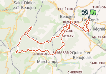
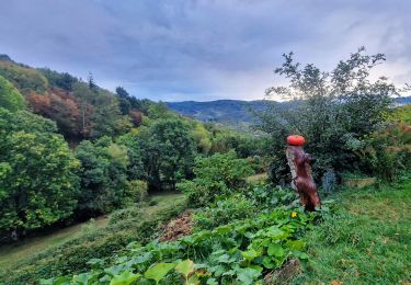
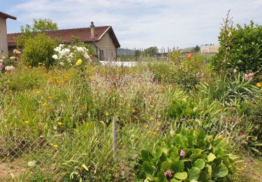
Trail Mountain bike of 25 km to be discovered at Auvergne-Rhône-Alpes, Rhône, Lantignié. This trail is proposed by tracegps.
Description
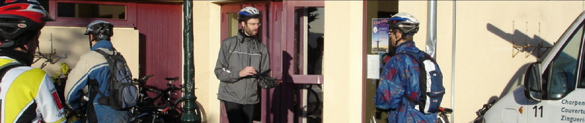
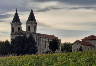
20eme édition de cette randonnée incontournable dans les vignes du beaujolais avec un peu de neige cette année. Très bonne ambiance et bouteille de primeur offerte à l'arrivée!!
Positioning
Country:
France
Region :
Auvergne-Rhône-Alpes
Department/Province :
Rhône
Municipality :
Lantignié
Location:
Unknown
Start:(Dec)
Start:(UTM)
625243 ; 5111604 (31T) N.
Comments
Trails nearby
![Trail Mountain bike Lantignié - 19e Rando des Primeurs - Photo](https://media.geolcdn.com/t/375/260/ext.jpg?maxdim=2&url=https%3A%2F%2Fservices.sitytrail.com%2FGeolivesWS%2FDownloadMedia.ashx%3FTrailID%3D101810%26Media%3D2084_2.jpg)
![Mountain bike Mountain bike](https://static1.geolcdn.com/sitytour/trail-icons/202.png)
19e Rando des Primeurs
Mountain bike
Difficult
(1)
Lantignié,
Auvergne-Rhône-Alpes,
Rhône,
France
![](/images/other/stat-length.png)
30 km | 45 km-effort
3h 0min
![](https://static1.geolcdn.com/siteimages/upload/files/16400158638029165_repeat_loop_refresh_sync_direction_icon.png)
Yes
![Trail Walking Chiroubles - Itinérant Beaujolais rouge étape 5 Chiroubles- Foretal - Photo](https://media.geolcdn.com/t/375/260/bf6c4c39-6cf0-41e3-8fc7-ac4d114e4ee5.jpg&format=jpg&maxdim=2)
![Walking Walking](https://static1.geolcdn.com/sitytour/trail-icons/101.png)
Itinérant Beaujolais rouge étape 5 Chiroubles- Foretal
Walking
Medium
Chiroubles,
Auvergne-Rhône-Alpes,
Rhône,
France
![](/images/other/stat-length.png)
23 km | 32 km-effort
5h 44min
![](https://static1.geolcdn.com/siteimages/upload/files/16400158638029165_repeat_loop_refresh_sync_direction_icon.png)
No
![Trail Walking Beaujeu - Itinérant Beaujolais rouge étape 4 . Malval - Chiroubles - Photo](https://media.geolcdn.com/t/375/260/7e353f10-ae9e-4e5c-a303-dba8e616c8c7.jpg&format=jpg&maxdim=2)
![Walking Walking](https://static1.geolcdn.com/sitytour/trail-icons/101.png)
Itinérant Beaujolais rouge étape 4 . Malval - Chiroubles
Walking
Medium
Beaujeu,
Auvergne-Rhône-Alpes,
Rhône,
France
![](/images/other/stat-length.png)
26 km | 34 km-effort
5h 40min
![](https://static1.geolcdn.com/siteimages/upload/files/16400158638029165_repeat_loop_refresh_sync_direction_icon.png)
No
![Trail Horseback riding Quincié-en-Beaujolais - Quincié CxRozier Court - Photo](https://media.geolcdn.com/t/375/260/ext.jpg?maxdim=2&url=https%3A%2F%2Fstatic1.geolcdn.com%2Fsiteimages%2Fupload%2Ffiles%2F1524743154cheval.jpg)
![Horseback riding Horseback riding](https://static1.geolcdn.com/sitytour/trail-icons/301.png)
Quincié CxRozier Court
Horseback riding
Very difficult
(1)
Quincié-en-Beaujolais,
Auvergne-Rhône-Alpes,
Rhône,
France
![](/images/other/stat-length.png)
28 km | 42 km-effort
5h 33min
![](https://static1.geolcdn.com/siteimages/upload/files/16400158638029165_repeat_loop_refresh_sync_direction_icon.png)
Yes
![Trail Horseback riding Quincié-en-Beaujolais - Quincié Croix ROZEIR - Photo](https://media.geolcdn.com/t/375/260/ext.jpg?maxdim=2&url=https%3A%2F%2Fstatic1.geolcdn.com%2Fsiteimages%2Fupload%2Ffiles%2F1524743154cheval.jpg)
![Horseback riding Horseback riding](https://static1.geolcdn.com/sitytour/trail-icons/301.png)
Quincié Croix ROZEIR
Horseback riding
Very difficult
(1)
Quincié-en-Beaujolais,
Auvergne-Rhône-Alpes,
Rhône,
France
![](/images/other/stat-length.png)
31 km | 46 km-effort
6h 3min
![](https://static1.geolcdn.com/siteimages/upload/files/16400158638029165_repeat_loop_refresh_sync_direction_icon.png)
Yes
![Trail Walking Villié-Morgon - sentier Victor Villié morgon - Photo](https://media.geolcdn.com/t/375/260/b8bcac3e-3fe0-47b1-9d02-47fe9d1beb00.jpg&format=jpg&maxdim=2)
![Walking Walking](https://static1.geolcdn.com/sitytour/trail-icons/101.png)
sentier Victor Villié morgon
Walking
Difficult
Villié-Morgon,
Auvergne-Rhône-Alpes,
Rhône,
France
![](/images/other/stat-length.png)
15.9 km | 21 km-effort
3h 35min
![](https://static1.geolcdn.com/siteimages/upload/files/16400158638029165_repeat_loop_refresh_sync_direction_icon.png)
Yes
![Trail Walking Chiroubles - 2023-05-26_00h30m21_28127-15675317-2 (2) - Photo](https://media.geolcdn.com/t/375/260/ext.jpg?maxdim=2&url=https%3A%2F%2Fstatic1.geolcdn.com%2Fsiteimages%2Fupload%2Ffiles%2F1553511878bg_sport_marche.png)
![Walking Walking](https://static1.geolcdn.com/sitytour/trail-icons/101.png)
2023-05-26_00h30m21_28127-15675317-2 (2)
Walking
Very difficult
(1)
Chiroubles,
Auvergne-Rhône-Alpes,
Rhône,
France
![](/images/other/stat-length.png)
16.9 km | 26 km-effort
5h 49min
![](https://static1.geolcdn.com/siteimages/upload/files/16400158638029165_repeat_loop_refresh_sync_direction_icon.png)
Yes
![Trail Horseback riding Quincié-en-Beaujolais - Quincié Croix - Photo](https://media.geolcdn.com/t/375/260/ext.jpg?maxdim=2&url=https%3A%2F%2Fstatic1.geolcdn.com%2Fsiteimages%2Fupload%2Ffiles%2F1524743154cheval.jpg)
![Horseback riding Horseback riding](https://static1.geolcdn.com/sitytour/trail-icons/301.png)
Quincié Croix
Horseback riding
Difficult
(1)
Quincié-en-Beaujolais,
Auvergne-Rhône-Alpes,
Rhône,
France
![](/images/other/stat-length.png)
26 km | 40 km-effort
5h 14min
![](https://static1.geolcdn.com/siteimages/upload/files/16400158638029165_repeat_loop_refresh_sync_direction_icon.png)
Yes
![Trail On foot Régnié-Durette - 2022-09-01_17h24m13_e3IWHtaTFWwfACzh8d3-Xw - Photo](https://media.geolcdn.com/t/375/260/3d2e7483-074f-47cf-a21e-968074b112a3.jpg&format=jpg&maxdim=2)
![On foot On foot](https://static1.geolcdn.com/sitytour/trail-icons/100.png)
2022-09-01_17h24m13_e3IWHtaTFWwfACzh8d3-Xw
On foot
Medium
Régnié-Durette,
Auvergne-Rhône-Alpes,
Rhône,
France
![](/images/other/stat-length.png)
18.1 km | 25 km-effort
5h 40min
![](https://static1.geolcdn.com/siteimages/upload/files/16400158638029165_repeat_loop_refresh_sync_direction_icon.png)
Yes