![](/images/other/stat-length.png)
![Trail Mountain bike Saint-Quentin-Fallavier - La St Quentinoise 2008 - Photo](https://media.geolcdn.com/t/1900/400/ext.pjpeg?maxdim=2&url=https%3A%2F%2Fservices.sitytrail.com%2FGeolivesWS%2FDownloadMedia.ashx%3FTrailID%3D102873%26Media%3D4080_1.jpg)
La St Quentinoise 2008
tracegps
User
![Length](/images/other/stat-length.png)
Length
47 km
![Max alt](https://static1.geolcdn.com/siteimages/upload/files/1508320355ic_sort_altitude_max_24dp.png)
Max alt
506 m
![Uphill gradient](https://static1.geolcdn.com/siteimages/upload/files/1508320355ic_sort_den_pos_24dp.png)
Uphill gradient
972 m
![Km-Effort](/images/other/stat-length.png)
Km-Effort
60 km
![Min alt](https://static1.geolcdn.com/siteimages/upload/files/1508320355ic_sort_altitude_min_24dp.png)
Min alt
235 m
![Downhill gradient](https://static1.geolcdn.com/siteimages/upload/files/1508320355ic_sort_den_neg_24dp.png)
Downhill gradient
970 m
![Boucle](https://static1.geolcdn.com/siteimages/upload/files/16400158638029165_repeat_loop_refresh_sync_direction_icon.png)
Boucle
Yes
Creation date :
2014-12-10 00:00:00.0
Updated on :
2014-12-10 00:00:00.0
![Mountain bike](https://static1.geolcdn.com/sitytour/trail-icons/202.png)
4h00
Difficulty : Difficult
![Scan this QR Code to open this trail in the SityTrail application](https://capi.geolives.com/qq0zvz2zws4bq2lad0pu/sitytour/trails/102873/qr.png?size=200)
FREE GPS app for hiking
About
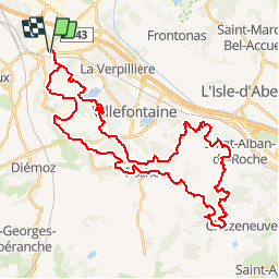
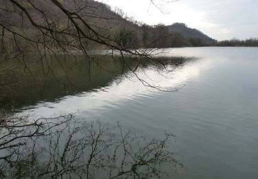
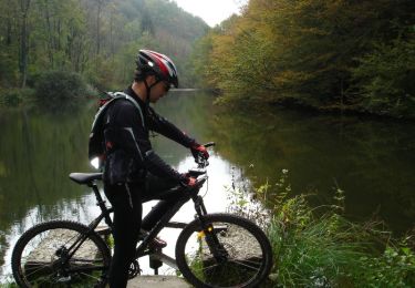
Trail Mountain bike of 47 km to be discovered at Auvergne-Rhône-Alpes, Isère, Saint-Quentin-Fallavier. This trail is proposed by tracegps.
Description
Parcours de la randonnée VTT La 5eme St Quentinoise (Isère). Ce parcours est très physique et propose des passages techniques et quelques beaux paysages aux alentours de St Quentin Fallavier, L'isle d'Abeau et Villefontaine.
Positioning
Country:
France
Region :
Auvergne-Rhône-Alpes
Department/Province :
Isère
Municipality :
Saint-Quentin-Fallavier
Location:
Unknown
Start:(Dec)
Start:(UTM)
664101 ; 5056132 (31T) N.
Comments
Trails nearby
![Trail Walking Bonnefamille - Bonne Famille - Photo](https://media.geolcdn.com/t/375/260/ext.jpg?maxdim=2&url=https%3A%2F%2Fstatic1.geolcdn.com%2Fsiteimages%2Fupload%2Ffiles%2F1553511878bg_sport_marche.png)
![Walking Walking](https://static1.geolcdn.com/sitytour/trail-icons/101.png)
Bonne Famille
Walking
Very easy
(1)
Bonnefamille,
Auvergne-Rhône-Alpes,
Isère,
France
![](/images/other/stat-length.png)
8.4 km | 10.6 km-effort
2h 23min
![](https://static1.geolcdn.com/siteimages/upload/files/16400158638029165_repeat_loop_refresh_sync_direction_icon.png)
Yes
![Mountain bike Mountain bike](https://static1.geolcdn.com/sitytour/trail-icons/202.png)
Les étangs et le golf
Mountain bike
Vaulx-Milieu,
Auvergne-Rhône-Alpes,
Isère,
France
![](/images/other/stat-length.png)
13.1 km | 16.1 km-effort
1h 18min
![](https://static1.geolcdn.com/siteimages/upload/files/16400158638029165_repeat_loop_refresh_sync_direction_icon.png)
No
![Trail Mountain bike Chamagnieu - Rando des Etangs - Chamagnieu - Photo](https://media.geolcdn.com/t/375/260/ext.jpg?maxdim=2&url=https%3A%2F%2Fservices.sitytrail.com%2FGeolivesWS%2FDownloadMedia.ashx%3FTrailID%3D317165%26Media%3D16320_6.jpg)
![Mountain bike Mountain bike](https://static1.geolcdn.com/sitytour/trail-icons/202.png)
Rando des Etangs - Chamagnieu
Mountain bike
Medium
Chamagnieu,
Auvergne-Rhône-Alpes,
Isère,
France
![](/images/other/stat-length.png)
26 km | 35 km-effort
2h 30min
![](https://static1.geolcdn.com/siteimages/upload/files/16400158638029165_repeat_loop_refresh_sync_direction_icon.png)
Yes
![Trail Mountain bike Chamagnieu - Autour de Chamagnieu - Photo](https://media.geolcdn.com/t/375/260/ext.jpg?maxdim=2&url=https%3A%2F%2Fservices.sitytrail.com%2FGeolivesWS%2FDownloadMedia.ashx%3FTrailID%3D173122%26Media%3D14673_5.jpg)
![Mountain bike Mountain bike](https://static1.geolcdn.com/sitytour/trail-icons/202.png)
Autour de Chamagnieu
Mountain bike
Difficult
Chamagnieu,
Auvergne-Rhône-Alpes,
Isère,
France
![](/images/other/stat-length.png)
29 km | 36 km-effort
2h 30min
![](https://static1.geolcdn.com/siteimages/upload/files/16400158638029165_repeat_loop_refresh_sync_direction_icon.png)
Yes
![Trail Walking Chamagnieu - Autour de Chamagnieu - Photo](https://media.geolcdn.com/t/375/260/ext.jpg?maxdim=2&url=https%3A%2F%2Fservices.sitytrail.com%2FGeolivesWS%2FDownloadMedia.ashx%3FTrailID%3D173121%26Media%3D14673_5.jpg)
![Walking Walking](https://static1.geolcdn.com/sitytour/trail-icons/101.png)
Autour de Chamagnieu
Walking
Difficult
Chamagnieu,
Auvergne-Rhône-Alpes,
Isère,
France
![](/images/other/stat-length.png)
29 km | 36 km-effort
5h 30min
![](https://static1.geolcdn.com/siteimages/upload/files/16400158638029165_repeat_loop_refresh_sync_direction_icon.png)
Yes
![Trail Walking Villefontaine - LAETITIA - Photo](https://media.geolcdn.com/t/375/260/756ccec6-e022-4cb5-ade1-8bf07d670600.jpg&format=jpg&maxdim=2)
![Walking Walking](https://static1.geolcdn.com/sitytour/trail-icons/101.png)
LAETITIA
Walking
Very easy
Villefontaine,
Auvergne-Rhône-Alpes,
Isère,
France
![](/images/other/stat-length.png)
3.2 km | 3.9 km-effort
1h 3min
![](https://static1.geolcdn.com/siteimages/upload/files/16400158638029165_repeat_loop_refresh_sync_direction_icon.png)
Yes
![Trail Walking Saint-Quentin-Fallavier - Saint Quantin Falavier - Photo](https://media.geolcdn.com/t/375/260/3f5cd956-d678-4c6a-aed9-961da9dce621.jpg&format=jpg&maxdim=2)
![Walking Walking](https://static1.geolcdn.com/sitytour/trail-icons/101.png)
Saint Quantin Falavier
Walking
Medium
Saint-Quentin-Fallavier,
Auvergne-Rhône-Alpes,
Isère,
France
![](/images/other/stat-length.png)
10.8 km | 13.4 km-effort
3h 8min
![](https://static1.geolcdn.com/siteimages/upload/files/16400158638029165_repeat_loop_refresh_sync_direction_icon.png)
Yes
![Trail Cycle Villefontaine - Villages et Châteaux - Photo](https://media.geolcdn.com/t/375/260/ext.jpg?maxdim=2&url=https%3A%2F%2Fservices.sitytrail.com%2FGeolivesWS%2FDownloadMedia.ashx%3FTrailID%3D401336%26Media%3Dfix__20150327133622.jpg)
![Cycle Cycle](https://static1.geolcdn.com/sitytour/trail-icons/200.png)
Villages et Châteaux
Cycle
Medium
Villefontaine,
Auvergne-Rhône-Alpes,
Isère,
France
![](/images/other/stat-length.png)
49 km | 57 km-effort
3h 18min
![](https://static1.geolcdn.com/siteimages/upload/files/16400158638029165_repeat_loop_refresh_sync_direction_icon.png)
Yes
![Trail Mountain bike Villefontaine - Boucle autour de Villefontaine - Photo](https://media.geolcdn.com/t/375/260/ext.jpg?maxdim=2&url=https%3A%2F%2Fservices.sitytrail.com%2FGeolivesWS%2FDownloadMedia.ashx%3FTrailID%3D101638%26Media%3D1832_2.jpg)
![Mountain bike Mountain bike](https://static1.geolcdn.com/sitytour/trail-icons/202.png)
Boucle autour de Villefontaine
Mountain bike
Difficult
Villefontaine,
Auvergne-Rhône-Alpes,
Isère,
France
![](/images/other/stat-length.png)
39 km | 49 km-effort
3h 0min
![](https://static1.geolcdn.com/siteimages/upload/files/16400158638029165_repeat_loop_refresh_sync_direction_icon.png)
Yes