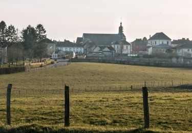
Trail Equestrian Moulins-la-Marche - De Moulins la Marche à la Forêt du Perche et de la Trappe - Photo

De Moulins la Marche à la Forêt du Perche et de la Trappe

 tracegps
tracegps

User

© OpenStreetMap contributors
Length
Length
34 km
Max alt
Max alt
307 m
Uphill gradient
Uphill gradient
492 m
Km-Effort
Km-Effort  
40 km
Min alt
Min alt
207 m
Downhill gradient
Downhill gradient
489 m
Boucle
Boucle
Yes
Creation date :
2014-12-10 00:00:00.0
Updated on :
2014-12-10 00:00:00.0

(0 Reviews)

Equestrian
Equestrian
2h30
Difficulty : Medium

Scan this QR Code to open this trail in the SityTrail application

FREE GPS app for hiking

Logo SityTrail SityTrail

IGN / Geographical institutes

Download SityTrail from the App Store Download SityTrail from Google Play

Logo SityTrail SityTrail World

The world is yours!

Download SityTrail from the App Store Download SityTrail from Google Play Download SityTrail on Huawei AppGallery

About

Trail Equestrian of 34 km to be discovered at Normandy, Orne, Moulins-la-Marche. This trail is proposed by tracegps.

Description

Chef-lieu de Canton et siège de la Communauté de Communes du Pays de la Marche, Moulins la Marche évoque d'une part les nombreux moulins alimentés par les ruisseaux qui ne tarissent jamais, mais également la frontière de la Normandie et du Perche, sur laquelle le château était situé, perché sur sa Motte Féodale. Au XIIème siècle, les ducs de Normandie ajouteront à ces forteresses un immense rempart linéaire en terre, dont les vestiges, encore visibles entre Verneuil-sur-Avre et Sainte-Scolasse-sur-Sarthe sont appelés "Les Fossés-le-Roy".

Elevation profile

Positioning

Country:
France
Region :
Normandy
Department/Province :
Orne
Municipality :
Moulins-la-Marche
Location:
Unknown
Start:(UTM)
313876 ; 5392242 (31U) N.

Trails nearby

Trail Walking Soligny-la-Trappe - Soligny-la-Trappe - Tourouvre - voie Nord 14 km - Photo
Walking

Walking

Easy
Soligny-la-Trappe, Normandy, Orne, France
13.8 km | 16.6 km-effort
3h 40min
No
Trail Walking Soligny-la-Trappe - Soligny-la-Trappe - Tourouvre - voie Sud 11 Km - Photo
Walking

Walking

Easy
Soligny-la-Trappe, Normandy, Orne, France
11.1 km | 13.5 km-effort
20min
No
Trail Car La Ferrière-au-Doyen - 2024-11-23 Moulins Bonsmoulins VduP - Photo
Car
patrick2m

Car

La Ferrière-au-Doyen, Normandy, Orne, France
56 km | 65 km-effort
3h 11min
No
Trail Walking Bonsmoulins - Bonsmoulins 7.7 Km - Photo
Walking
ODDAD78

Walking

Easy
Bonsmoulins, Normandy, Orne, France
7.7 km | 9.1 km-effort
2h 0min
Yes
Trail Walking Soligny-la-Trappe - Soligny la Trappe 9.6 Km - Photo
Walking
ODDAD78

Walking

Easy
Soligny-la-Trappe, Normandy, Orne, France
9.6 km | 11.6 km-effort
2h 31min
Yes
Trail Walking Moulins-la-Marche - moulin la marche - Photo
Walking
jlesacher

Walking

Very easy
Moulins-la-Marche, Normandy, Orne, France
34 km | 40 km-effort
8h 42min
Yes
Trail Mountain bike Moulins-la-Marche - De Moulins la Marche à la Forêt du Perche et de la Trappe - Photo
Mountain bike
tracegps

Mountain bike

Medium
Moulins-la-Marche, Normandy, Orne, France
34 km | 40 km-effort
2h 30min
Yes
Trail Walking La Ferrière-au-Doyen - Forêt de Moulins  - Photo
Walking
DranoelNiala

Walking

Medium
La Ferrière-au-Doyen, Normandy, Orne, France
8 km | 9.2 km-effort
2h 5min
Yes
Trail Walking Bonsmoulins - Bonsmoulins - Saint Aquilin de Corbion  - Photo
Walking
DranoelNiala

Walking

Difficult
Bonsmoulins, Normandy, Orne, France
11.2 km | 13.4 km-effort
3h 2min
Yes


Close
My subscriptions