![](/images/other/stat-length.png)
![Trail Mountain bike Chambost-Allières - Espace VTT FFC Pays Beaujolais - Haute Vallée d'Azergues - Circuit n° 02 - Chambost Allières - Photo](https://media.geolcdn.com/t/1900/400/ext.pjpeg?maxdim=2&url=https%3A%2F%2Fservices.sitytrail.com%2FGeolivesWS%2FDownloadMedia.ashx%3FTrailID%3D102487%26Media%3D3257_1.jpg)
Espace VTT FFC Pays Beaujolais - Haute Vallée d'Azergues - Circuit n° 02 - Chambost Allières
tracegps
User
![Length](/images/other/stat-length.png)
![Max alt](https://static1.geolcdn.com/siteimages/upload/files/1508320355ic_sort_altitude_max_24dp.png)
![Uphill gradient](https://static1.geolcdn.com/siteimages/upload/files/1508320355ic_sort_den_pos_24dp.png)
![Km-Effort](/images/other/stat-length.png)
![Min alt](https://static1.geolcdn.com/siteimages/upload/files/1508320355ic_sort_altitude_min_24dp.png)
![Downhill gradient](https://static1.geolcdn.com/siteimages/upload/files/1508320355ic_sort_den_neg_24dp.png)
![Boucle](https://static1.geolcdn.com/siteimages/upload/files/16400158638029165_repeat_loop_refresh_sync_direction_icon.png)
![Mountain bike](https://static1.geolcdn.com/sitytour/trail-icons/202.png)
2h00
Difficulty : Medium
![Scan this QR Code to open this trail in the SityTrail application](https://capi.geolives.com/qq0zvz2zws4bq2lad0pu/sitytour/trails/102487/qr.png?size=200)
FREE GPS app for hiking
About
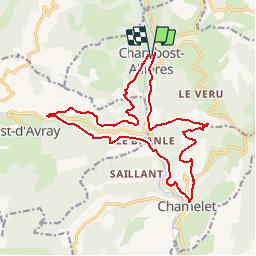
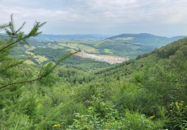
Trail Mountain bike of 18.4 km to be discovered at Auvergne-Rhône-Alpes, Rhône, Chambost-Allières. This trail is proposed by tracegps.
Description
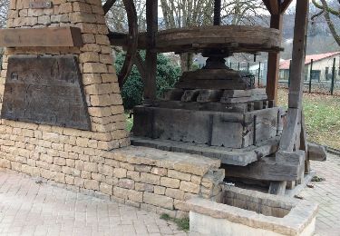
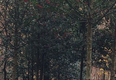
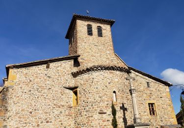
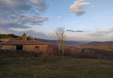
Espace VTT FFC Pays Beaujolais , Haute Vallée d’Azergues. Circuit officiel labellisé par la Fédération Française de Cyclisme. En venant du sud, après avoir traversé la partie basse des « Pierres dorées », vous changez de décor près d’Allières où les arbres résineux pour la plupart, transforment les paysages en panorama jurassien ou vosgien. Blotti au fond de la vallée où coule l’Azergues, c’est un important centre d’activités industrielles : mécanique de précision, plasturgie…Un village, deux églises. Ne manquez pas de visiter l’église de Chambost du XIe siècle alliant les styles roman et gothique.
Positioning
Comments
Trails nearby
![Trail Walking Saint-Just-d'Avray - Des mollets d'aciers - Saint Just d'Avray - Photo](https://media.geolcdn.com/t/375/260/ext.jpg?maxdim=2&url=https%3A%2F%2Fservices.sitytrail.com%2FGeolivesWS%2FDownloadMedia.ashx%3FTrailID%3D105228%26Media%3D8877_2.jpg)
![Walking Walking](https://static1.geolcdn.com/sitytour/trail-icons/101.png)
Walking
![](/images/other/stat-length.png)
![](https://static1.geolcdn.com/siteimages/upload/files/16400158638029165_repeat_loop_refresh_sync_direction_icon.png)
![Trail Walking Saint-Cyr-le-Chatoux - Saint-cyr-le-Chatoux](https://media.geolcdn.com/t/375/260/ext.jpg?maxdim=2&url=https%3A%2F%2Fstatic1.geolcdn.com%2Fsiteimages%2Fupload%2Ffiles%2F1553511878bg_sport_marche.png)
![Walking Walking](https://static1.geolcdn.com/sitytour/trail-icons/101.png)
Walking
![](/images/other/stat-length.png)
![](https://static1.geolcdn.com/siteimages/upload/files/16400158638029165_repeat_loop_refresh_sync_direction_icon.png)
![Trail Walking Grandris - Grandris - Photo](https://media.geolcdn.com/t/375/260/ext.jpg?maxdim=2&url=https%3A%2F%2Fservices.sitytrail.com%2FGeolivesWS%2FDownloadMedia.ashx%3FTrailID%3D705784%26Media%3Dfix__20170226154708.jpg)
![Walking Walking](https://static1.geolcdn.com/sitytour/trail-icons/101.png)
Walking
![](/images/other/stat-length.png)
![](https://static1.geolcdn.com/siteimages/upload/files/16400158638029165_repeat_loop_refresh_sync_direction_icon.png)
![Trail Walking Chamelet - Chamelet (69) 16,7 km via Chapelle de la Salette - Photo](https://media.geolcdn.com/t/375/260/ext.jpg?maxdim=2&url=https%3A%2F%2Fservices.sitytrail.com%2FGeolivesWS%2FDownloadMedia.ashx%3FTrailID%3D682289%26Media%3D20170109145907.jpg)
![Walking Walking](https://static1.geolcdn.com/sitytour/trail-icons/101.png)
Walking
![](/images/other/stat-length.png)
![](https://static1.geolcdn.com/siteimages/upload/files/16400158638029165_repeat_loop_refresh_sync_direction_icon.png)
![Trail Walking Chamelet - Chamelet (69) 19,5 km D. 776 m - Photo](https://media.geolcdn.com/t/375/260/ext.jpg?maxdim=2&url=https%3A%2F%2Fservices.sitytrail.com%2FGeolivesWS%2FDownloadMedia.ashx%3FTrailID%3D664631%26Media%3D20161126105826.jpg)
![Walking Walking](https://static1.geolcdn.com/sitytour/trail-icons/101.png)
Walking
![](/images/other/stat-length.png)
![](https://static1.geolcdn.com/siteimages/upload/files/16400158638029165_repeat_loop_refresh_sync_direction_icon.png)
![Trail Walking Chambost-Allières - Chambost avec forêt des expériences et belvédère - Photo](https://media.geolcdn.com/t/375/260/6c980967-f130-4391-acfb-f78f77ffd68c.jpg&format=jpg&maxdim=2)
![Walking Walking](https://static1.geolcdn.com/sitytour/trail-icons/101.png)
Walking
![](/images/other/stat-length.png)
![](https://static1.geolcdn.com/siteimages/upload/files/16400158638029165_repeat_loop_refresh_sync_direction_icon.png)
![Trail Walking Rivolet - St Cyr le chatoux - Photo](https://media.geolcdn.com/t/375/260/7bd62904-88ff-4f60-bdef-7afa92ce3784.jpg&format=jpg&maxdim=2)
![Walking Walking](https://static1.geolcdn.com/sitytour/trail-icons/101.png)
Walking
![](/images/other/stat-length.png)
![](https://static1.geolcdn.com/siteimages/upload/files/16400158638029165_repeat_loop_refresh_sync_direction_icon.png)
![Trail Walking Saint-Cyr-le-Chatoux - Saint-Cyr-le-Chatoux / 10 km - Photo](https://media.geolcdn.com/t/375/260/a49758ab-469c-41da-95c1-d276d7ecce04.jpg&format=jpg&maxdim=2)
![Walking Walking](https://static1.geolcdn.com/sitytour/trail-icons/101.png)
Walking
![](/images/other/stat-length.png)
![](https://static1.geolcdn.com/siteimages/upload/files/16400158638029165_repeat_loop_refresh_sync_direction_icon.png)
![Trail Walking Chambost-Allières - Col du Joncin (12 km - D. 448 m) - Photo](https://media.geolcdn.com/t/375/260/ebf133c6-8339-4871-a9bd-6b1dfcd00181.jpg&format=jpg&maxdim=2)
![Walking Walking](https://static1.geolcdn.com/sitytour/trail-icons/101.png)
Walking
![](/images/other/stat-length.png)
![](https://static1.geolcdn.com/siteimages/upload/files/16400158638029165_repeat_loop_refresh_sync_direction_icon.png)