


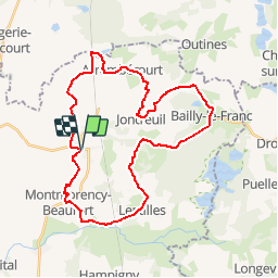

59 km | 64 km-effort

User


FREE GPS app for hiking
 SityTrail
IGN / Geographical institutes
SityTrail World
The world is yours!
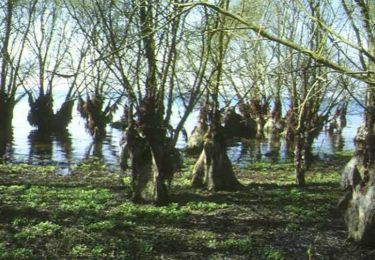
Trail Mountain bike of 33 km to be discovered at Grand Est, Aube, Chavanges. This trail is proposed by tracegps.
Espace VTT - FFC Lac du Der en Champagne Circuit officiel labellisé par la Fédération Française de Cyclisme. Cette promenade vous emmène…dans le Chavangeois à travers le bocage et les contreforts du plateau champenois pour atteindre des vues panoramiques à couper le souffle. Crédit photos ©Village de Chavanges - Gengoul


Mountain bike
Cycle
Via ferrata
Walking

Walking
Walking
Walking
Walking
Walking