![](/images/other/stat-length.png)
![Trail Mountain bike Louvemont - Espace VTT FFC Lac du Der en Champagne - Circuit n°06 - Le canal des Fabriques - Photo](https://media.geolcdn.com/t/1900/400/ext.pjpeg?maxdim=2&url=https%3A%2F%2Fservices.sitytrail.com%2FGeolivesWS%2FDownloadMedia.ashx%3FTrailID%3D102267%26Media%3D2728_1.jpg)
Espace VTT FFC Lac du Der en Champagne - Circuit n°06 - Le canal des Fabriques
tracegps
User
![Length](/images/other/stat-length.png)
Length
8.8 km
![Max alt](https://static1.geolcdn.com/siteimages/upload/files/1508320355ic_sort_altitude_max_24dp.png)
Max alt
186 m
![Uphill gradient](https://static1.geolcdn.com/siteimages/upload/files/1508320355ic_sort_den_pos_24dp.png)
Uphill gradient
78 m
![Km-Effort](/images/other/stat-length.png)
Km-Effort
9.9 km
![Min alt](https://static1.geolcdn.com/siteimages/upload/files/1508320355ic_sort_altitude_min_24dp.png)
Min alt
139 m
![Downhill gradient](https://static1.geolcdn.com/siteimages/upload/files/1508320355ic_sort_den_neg_24dp.png)
Downhill gradient
79 m
![Boucle](https://static1.geolcdn.com/siteimages/upload/files/16400158638029165_repeat_loop_refresh_sync_direction_icon.png)
Boucle
Yes
Creation date :
2014-12-10 00:00:00.0
Updated on :
2014-12-10 00:00:00.0
![Mountain bike](https://static1.geolcdn.com/sitytour/trail-icons/202.png)
40m
Difficulty : Medium
![Scan this QR Code to open this trail in the SityTrail application](https://capi.geolives.com/qq0zvz2zws4bq2lad0pu/sitytour/trails/102267/qr.png?size=200)
FREE GPS app for hiking
About
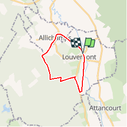
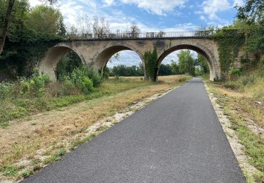
Trail Mountain bike of 8.8 km to be discovered at Grand Est, Haute-Marne, Louvemont. This trail is proposed by tracegps.
Description
Espace VTT - FFC Lac du Der en Champagne Circuit officiel labellisé par la Fédération Française de Cyclisme. Cette promenade vous offre un aperçu de l’aventure métallurgique de la Vallée de la Blaise.
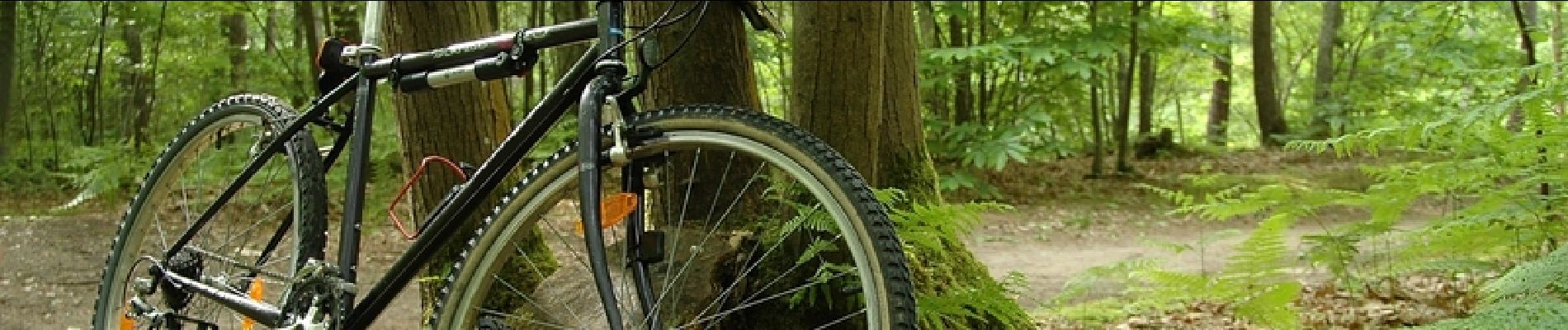
Positioning
Country:
France
Region :
Grand Est
Department/Province :
Haute-Marne
Municipality :
Louvemont
Location:
Unknown
Start:(Dec)
Start:(UTM)
641165 ; 5379551 (31U) N.
Comments
Trails nearby
![Trail Mountain bike Louvemont - LAC du DER ... le canal des Fabriques. - Photo](https://media.geolcdn.com/t/375/260/b6538103-d610-48f2-ba11-16ea1b3e6267.jpg&format=jpg&maxdim=2)
![Mountain bike Mountain bike](https://static1.geolcdn.com/sitytour/trail-icons/202.png)
LAC du DER ... le canal des Fabriques.
Mountain bike
Very easy
Louvemont,
Grand Est,
Haute-Marne,
France
![](/images/other/stat-length.png)
9.7 km | 10.9 km-effort
1h 27min
![](https://static1.geolcdn.com/siteimages/upload/files/16400158638029165_repeat_loop_refresh_sync_direction_icon.png)
Yes
![Trail Mountain bike Éclaron-Braucourt-Sainte-Livière - Lac du DER - CHANTECOQ ... par St-Marie- Nuisement. - Photo](https://media.geolcdn.com/t/375/260/0f27a926-3a1d-4ecb-8e04-b7fa88246190.jpg&format=jpg&maxdim=2)
![Mountain bike Mountain bike](https://static1.geolcdn.com/sitytour/trail-icons/202.png)
Lac du DER - CHANTECOQ ... par St-Marie- Nuisement.
Mountain bike
Very easy
Éclaron-Braucourt-Sainte-Livière,
Grand Est,
Haute-Marne,
France
![](/images/other/stat-length.png)
37 km | 40 km-effort
3h 13min
![](https://static1.geolcdn.com/siteimages/upload/files/16400158638029165_repeat_loop_refresh_sync_direction_icon.png)
Yes
![Trail Road bike Louvemont - 24 08 2020 WASSY - Photo](https://media.geolcdn.com/t/375/260/792bb28f-ea85-4049-9dd3-646f5ebb5ba7.jpg&format=jpg&maxdim=2)
![Road bike Road bike](https://static1.geolcdn.com/sitytour/trail-icons/201.png)
24 08 2020 WASSY
Road bike
Easy
Louvemont,
Grand Est,
Haute-Marne,
France
![](/images/other/stat-length.png)
37 km | 40 km-effort
2h 27min
![](https://static1.geolcdn.com/siteimages/upload/files/16400158638029165_repeat_loop_refresh_sync_direction_icon.png)
No
![Trail Walking Humbécourt - Humbécourt cimetière Nadine - Photo](https://media.geolcdn.com/t/375/260/ext.jpg?maxdim=2&url=https%3A%2F%2Fstatic1.geolcdn.com%2Fsiteimages%2Fupload%2Ffiles%2F1553511878bg_sport_marche.png)
![Walking Walking](https://static1.geolcdn.com/sitytour/trail-icons/101.png)
Humbécourt cimetière Nadine
Walking
Humbécourt,
Grand Est,
Haute-Marne,
France
![](/images/other/stat-length.png)
8.3 km | 9.2 km-effort
2h 25min
![](https://static1.geolcdn.com/siteimages/upload/files/16400158638029165_repeat_loop_refresh_sync_direction_icon.png)
Yes
![Trail Walking Éclaron-Braucourt-Sainte-Livière - Sources du Lac Nadine OKOK - Photo](https://media.geolcdn.com/t/375/260/ext.jpg?maxdim=2&url=https%3A%2F%2Fstatic1.geolcdn.com%2Fsiteimages%2Fupload%2Ffiles%2F1553511878bg_sport_marche.png)
![Walking Walking](https://static1.geolcdn.com/sitytour/trail-icons/101.png)
Sources du Lac Nadine OKOK
Walking
Éclaron-Braucourt-Sainte-Livière,
Grand Est,
Haute-Marne,
France
![](/images/other/stat-length.png)
8.3 km | 9.6 km-effort
2h 33min
![](https://static1.geolcdn.com/siteimages/upload/files/16400158638029165_repeat_loop_refresh_sync_direction_icon.png)
Yes
![Trail Walking Humbécourt - Humbécourt cimetière Nadine - Photo](https://media.geolcdn.com/t/375/260/ext.jpg?maxdim=2&url=https%3A%2F%2Fstatic1.geolcdn.com%2Fsiteimages%2Fupload%2Ffiles%2F1553511878bg_sport_marche.png)
![Walking Walking](https://static1.geolcdn.com/sitytour/trail-icons/101.png)
Humbécourt cimetière Nadine
Walking
Humbécourt,
Grand Est,
Haute-Marne,
France
![](/images/other/stat-length.png)
8.6 km | 9.7 km-effort
2h 38min
![](https://static1.geolcdn.com/siteimages/upload/files/16400158638029165_repeat_loop_refresh_sync_direction_icon.png)
Yes
![Trail Walking Attancourt - ASLH/Attancourt/vers Wassy - Photo](https://media.geolcdn.com/t/375/260/ext.jpg?maxdim=2&url=https%3A%2F%2Fstatic1.geolcdn.com%2Fsiteimages%2Fupload%2Ffiles%2F1553511878bg_sport_marche.png)
![Walking Walking](https://static1.geolcdn.com/sitytour/trail-icons/101.png)
ASLH/Attancourt/vers Wassy
Walking
Attancourt,
Grand Est,
Haute-Marne,
France
![](/images/other/stat-length.png)
10.2 km | 11 km-effort
3h 43min
![](https://static1.geolcdn.com/siteimages/upload/files/16400158638029165_repeat_loop_refresh_sync_direction_icon.png)
Yes
![Trail Walking Wassy - Pont Varin église - Photo](https://media.geolcdn.com/t/375/260/ext.jpg?maxdim=2&url=https%3A%2F%2Fstatic1.geolcdn.com%2Fsiteimages%2Fupload%2Ffiles%2F1553511878bg_sport_marche.png)
![Walking Walking](https://static1.geolcdn.com/sitytour/trail-icons/101.png)
![Trail Cycle Éclaron-Braucourt-Sainte-Livière - philibert Haute Marne1 - Photo](https://media.geolcdn.com/t/375/260/ext.jpg?maxdim=2&url=https%3A%2F%2Fstatic1.geolcdn.com%2Fsiteimages%2Fupload%2Ffiles%2F1524743154velo.jpg)
![Cycle Cycle](https://static1.geolcdn.com/sitytour/trail-icons/200.png)
philibert Haute Marne1
Cycle
Very easy
Éclaron-Braucourt-Sainte-Livière,
Grand Est,
Haute-Marne,
France
![](/images/other/stat-length.png)
41 km | 46 km-effort
7h 13min
![](https://static1.geolcdn.com/siteimages/upload/files/16400158638029165_repeat_loop_refresh_sync_direction_icon.png)
Yes