


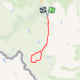

11.4 km | 17.5 km-effort

User


FREE GPS app for hiking
 SityTrail
IGN / Geographical institutes
SityTrail World
The world is yours!
Trail Walking of 25 km to be discovered at Occitania, Hautespyrenees, Cauterets. This trail is proposed by PatDev.
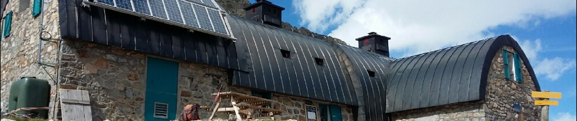
Randonnée longue et difficile surtout sur le chemin de Labas depuis le refuge de Baysselance (Corniche aérienne) et la longue descente du col (éboulis/névés)


Walking

Walking

Walking

Walking

Walking

Walking

Walking

Walking

Walking