Trail Mountain bike La Roche-sur-Grane - Grande Traversée des PréAlpes à VTT : La Roche sur Grâne - Crest - Photo

Grande Traversée des PréAlpes à VTT : La Roche sur Grâne - Crest

 tracegps
tracegps

User

© OpenStreetMap contributors
Length
Length
16 km
Max alt
Max alt
462 m
Uphill gradient
Uphill gradient
451 m
Km-Effort
Km-Effort  
22 km
Min alt
Min alt
185 m
Downhill gradient
Downhill gradient
552 m
Boucle
Boucle
No
Creation date :
2014-12-10 00:00:00.0
Updated on :
2014-12-10 00:00:00.0

(0 Reviews)

Mountain bike
Mountain bike
2h10
Difficulty : Difficult

Scan this QR Code to open this trail in the SityTrail application

FREE GPS app for hiking

Logo SityTrail SityTrail

IGN / Geographical institutes

Download SityTrail from the App Store Download SityTrail from Google Play

Logo SityTrail SityTrail World

The world is yours!

Download SityTrail from the App Store Download SityTrail from Google Play Download SityTrail on Huawei AppGallery

About

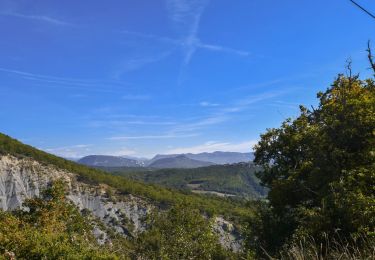
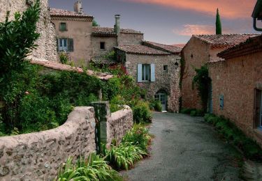
Trail Mountain bike of 16 km to be discovered at Auvergne-Rhône-Alpes, Drôme, La Roche-sur-Grane. This trail is proposed by tracegps.

Description

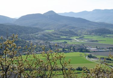
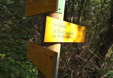
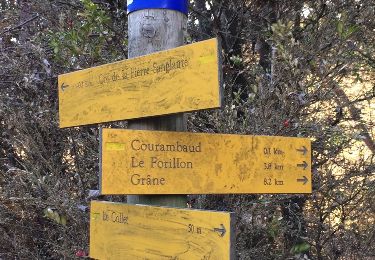
Grande Traversée des Préalpes, les Chemins du Soleil. Parcours officiel labellisé par la Fédération Française de Cyclisme. Parcours Valence – Gap - Sisteron – Tronçon n° 22 Niveau: moyen; très roulant dans l'ensemble, avec seulement une courte montée raide avant le château de Divajeu. Mesure de prudence: - 2km de descente rapide après la croix de Sylvestre. - traversée de route à grande circulation à Lambres-Divajeu. - descente technique après le point 10. Consultez toutes les informations sur les hébergements et les services associés sur la fiche du tronçon. Retrouvez cette traversée dans l’indispensable topo Guide Chamina Grande Traversée des Préalpes

Elevation profile

Photos

Positioning

Country:
France
Region :
Auvergne-Rhône-Alpes
Department/Province :
Drôme
Municipality :
La Roche-sur-Grane
Location:
Unknown
Start:(UTM)
653876 ; 4949351 (31T) N.

Trails nearby

Trail Walking Puy-Saint-Martin - La Montagne de Ste-Euphémie - Puy-St-Martin - Manas - Photo
Walking
Philindy26

Walking

Medium
Puy-Saint-Martin, Auvergne-Rhône-Alpes, Drôme, France
14.4 km | 22 km-effort
5h 5min
Yes
Trail sport La Roche-sur-Grane - La Roche Sur Grane Pierre sanglante  - Photo
sport
alinetpierre

sport

Very easy
La Roche-sur-Grane, Auvergne-Rhône-Alpes, Drôme, France
13 km | 17 km-effort
Unknown
Yes
Trail Walking Roynac - 2022-10-20_15h11m02_GPX-Baron-Chevriere-Roynac - Photo
Walking
chancha

Walking

Difficult
Roynac, Auvergne-Rhône-Alpes, Drôme, France
10.6 km | 15.7 km-effort
3h 34min
Yes
Trail Walking Autichamp - Autichamp 9Km - Photo
Walking
chancha

Walking

Difficult
(1)
Autichamp, Auvergne-Rhône-Alpes, Drôme, France
8.8 km | 13.2 km-effort
2h 59min
Yes
Trail Walking Grane - Grane jour 6 - Photo
Walking
Jackoyo

Walking

Very easy
Grane, Auvergne-Rhône-Alpes, Drôme, France
8.5 km | 12.4 km-effort
2h 17min
Yes
Trail Walking Autichamp - 2022-06-24_19h04m17_Autichamp 16km.gpx.xml - Photo
Walking
chancha

Walking

Very difficult
Autichamp, Auvergne-Rhône-Alpes, Drôme, France
16.3 km | 23 km-effort
5h 9min
Yes
Trail Walking La Roche-sur-Grane - La Pierre Sanglante  - Photo
Walking
Pacekall

Walking

Easy
La Roche-sur-Grane, Auvergne-Rhône-Alpes, Drôme, France
13.6 km | 17.8 km-effort
2h 57min
Yes
Trail Walking La Roche-sur-Grane - La Pierre Sanglante  - Photo
Walking
ajd26

Walking

Easy
La Roche-sur-Grane, Auvergne-Rhône-Alpes, Drôme, France
13.6 km | 17.8 km-effort
2h 57min
Yes
Trail Walking Grane - Malaire - Photo
Walking
sklada

Walking

Easy
Grane, Auvergne-Rhône-Alpes, Drôme, France
11.3 km | 15 km-effort
3h 51min
Yes


Close
My subscriptions