


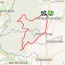

13 km | 18.5 km-effort


User


FREE GPS app for hiking
 SityTrail
IGN / Geographical institutes
SityTrail World
The world is yours!
Trail Mountain bike of 14.6 km to be discovered at Grand Est, Bas-Rhin, Dambach-la-Ville. This trail is proposed by tracegps.
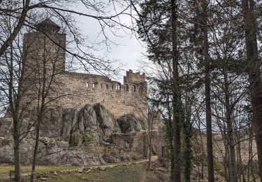
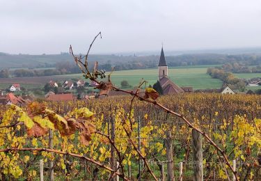
Balade proposée par « Alsace en randonnée.» A Dambach-la-Ville, prendre la direction Blienschwiller. Après la porte haute, suivre le chemin à gauche balisé disque blanc qui fait passer à la chapelle Saint-Sébastien. On poursuit pour monter au château de Bernstein d'où l'on a une belle vue sur la plaine d'Alsace. Repartir vers la droite en suivant le rectangle rouge jusqu'au carrefour Karsmarkt. Passer devant l'abri forestier pour suivre le losange jaune. Après une demi-heure de marche, emprunter le triangle bleu sur la gauche jusqu'au carrefour. Tourner à gauche. Le sentier balisé disque jaune conduit au Engelsfelsen en contournant à flanc le Schild. Au point coté 525, une multitude de sentiers se croisent. Emprunter le rectangle rouge sur la droite qui conduit jusqu'au château Ortenbourg. On peut aller au château le Ramstein (15 mn) en suivant le rectangle rouge. Devant le château Ortenbourg suivre le sentier qui pénètre dans la forêt marqué de la croix blanche. Après 30 mn de marche, prendre le sentier qui part sur la gauche (triangle rouge) et qui conduit à Dieffenthal. On arrive à Dambach-la-Ville par la porte Sud. Remarques ; le carrefour marqué Karsmarkt sur la cane devrait, d'après l'histoire, s'appeler "Kasmarkt" (marché aux fromages) car, au cours d'une épidémie de peste au XlVème siècle, les habitants de la vallée venaient déposer les fromages pendant la journée. Les habitants de Dambach venaient les récupérer durant la nuit pour éviter la contagion. Ceci justifie la présence de la croix à cet endroit. Depuis le château d'Ortenbourg, la vue s'étend sur la plaine d'Alsace et les vallées de Villé et de SainteMarie-aux-Mines. Balisage : la plupart des sentiers dans la montagne vosgienne sont tracés, entretenus et balisés bénévolement par les membres du Club Vosgien, d'une façon tout à fait remarquable. Les différents signes en couleur (rectangle, disque, triangle, croix, etc...) sont reproduits sur la carte.


Walking
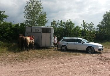
Equestrian

Walking

Walking
Walking
Horseback riding

Walking
Walking
Walking