Trail Mountain bike Chabreloche - Espace VTT FFC du Massif des Bois-Noirs - Circuit n° 21 - Le Roc du Guet - Photo

Espace VTT FFC du Massif des Bois-Noirs - Circuit n° 21 - Le Roc du Guet

 tracegps
tracegps

User

© OpenStreetMap contributors
Length
Length
18.8 km
Max alt
Max alt
914 m
Uphill gradient
Uphill gradient
623 m
Km-Effort
Km-Effort  
27 km
Min alt
Min alt
611 m
Downhill gradient
Downhill gradient
623 m
Boucle
Boucle
Yes
Creation date :
2014-12-10 00:00:00.0
Updated on :
2014-12-10 00:00:00.0

(0 Reviews)

Mountain bike
Mountain bike
2h00
Difficulty : Difficult

Scan this QR Code to open this trail in the SityTrail application

FREE GPS app for hiking

Logo SityTrail SityTrail

IGN / Geographical institutes

Download SityTrail from the App Store Download SityTrail from Google Play

Logo SityTrail SityTrail World

The world is yours!

Download SityTrail from the App Store Download SityTrail from Google Play Download SityTrail on Huawei AppGallery

About

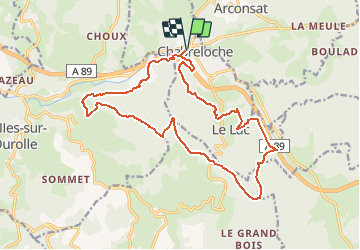
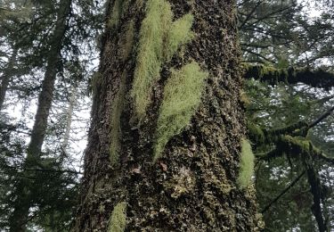
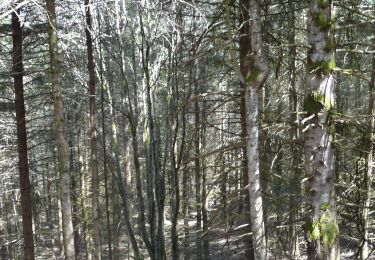
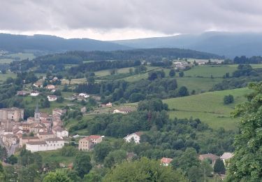
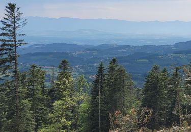
Trail Mountain bike of 18.8 km to be discovered at Auvergne-Rhône-Alpes, Puy-de-Dôme, Chabreloche. This trail is proposed by tracegps.

Description

Circuit labellisé par la Fédération Française de Cyclisme. Chabreloche est une petite cité de la montagne Thiernoise, située aux portes du Forez et de l’Auvergne qui a su garder son charme authentique fait de bonhomie et de bon vivre. Le Roc du Guet est un lieu éminent d’où l’on peut regarder (gueità) au loin à 912 m d’altitude.

Elevation profile

Photos

Positioning

Country:
France
Region :
Auvergne-Rhône-Alpes
Department/Province :
Puy-de-Dôme
Municipality :
Chabreloche
Location:
Unknown
Start:(UTM)
553912 ; 5080778 (31T) N.

Trails nearby

Trail On foot Arconsat - Montlune - Photo
On foot
GUIDE+

On foot

Medium
Arconsat, Auvergne-Rhône-Alpes, Puy-de-Dôme, France
13.5 km | 21 km-effort
4h 41min
Yes
Trail Walking Arconsat - Col de la Charme  - Photo
Walking
dudu42

Walking

Medium
Arconsat, Auvergne-Rhône-Alpes, Puy-de-Dôme, France
12.9 km | 16.2 km-effort
3h 36min
Yes
Trail Walking Chabreloche - Tracé actuel: 18 AVR 2019 08:39 - Photo
Walking
GilGry

Walking

Medium
Chabreloche, Auvergne-Rhône-Alpes, Puy-de-Dôme, France
22 km | 35 km-effort
7h 0min
Yes
Trail Walking Chausseterre - retour TOP 03 - Photo
Walking
aldaus

Walking

Medium
Chausseterre, Auvergne-Rhône-Alpes, Loire, France
34 km | 47 km-effort
7h 46min
No
Trail Walking Celles-sur-Durolle - Le Puy de Montoncel_T - Photo
Walking
force

Walking

Difficult
Celles-sur-Durolle, Auvergne-Rhône-Alpes, Puy-de-Dôme, France
12.2 km | 18.5 km-effort
3h 11min
Yes
Trail On foot Chabreloche - Le Roc du Guet - Photo
On foot
GUIDE+

On foot

Easy
Chabreloche, Auvergne-Rhône-Alpes, Puy-de-Dôme, France
10.5 km | 15.3 km-effort
3h 29min
No
Trail Walking Saint-Priest-la-Prugne - Col de la Charme - Photo
Walking
dudu42

Walking

Easy
Saint-Priest-la-Prugne, Auvergne-Rhône-Alpes, Loire, France
9.4 km | 12 km-effort
3h 5min
Yes
Trail Walking Saint-Priest-la-Prugne - Col de la Charme 2020 - Photo
Walking
dudu42

Walking

Easy
Saint-Priest-la-Prugne, Auvergne-Rhône-Alpes, Loire, France
9.8 km | 12.6 km-effort
3h 25min
Yes
Trail Walking Chabreloche - Chabreloche_Roc_Guet_1 - Photo
Walking
GUIDE
jagarnier

Walking

Medium
Chabreloche, Auvergne-Rhône-Alpes, Puy-de-Dôme, France
10.8 km | 15.6 km-effort
3h 16min
Yes


Close
My subscriptions