


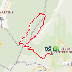

12.7 km | 23 km-effort


User GUIDE


FREE GPS app for hiking
 SityTrail
IGN / Geographical institutes
SityTrail World
The world is yours!
Trail Walking of 9.6 km to be discovered at Auvergne-Rhône-Alpes, Savoy, Entremont-le-Vieux. This trail is proposed by nadd73.
Il serait préférable de faire le circuit dans l'autre sens car la descente du pas de Fontanieu est raide avec pierriers feuilles, peu de balisage.
Ne pas faire par temps humide.
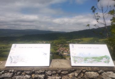
Sinon très belle vue sur la chartreuse et le Mont blanc

Walking

Walking

Walking

Walking

Road bike
Walking

Walking

Snowshoes
Trail