Trail Mountain bike Rousset - Espace VTT FFC de Serre-Ponçon - Durance - Circuit n°11 - La Faure - Photo

Espace VTT FFC de Serre-Ponçon - Durance - Circuit n°11 - La Faure

 tracegps
tracegps

User

© OpenStreetMap contributors
Length
Length
20 km
Max alt
Max alt
1232 m
Uphill gradient
Uphill gradient
740 m
Km-Effort
Km-Effort  
30 km
Min alt
Min alt
660 m
Downhill gradient
Downhill gradient
745 m
Boucle
Boucle
Yes
Creation date :
2014-12-10 00:00:00.0
Updated on :
2014-12-10 00:00:00.0

(0 Reviews)

Mountain bike
Mountain bike
2h00
Difficulty : Difficult

Scan this QR Code to open this trail in the SityTrail application

FREE GPS app for hiking

Logo SityTrail SityTrail

IGN / Geographical institutes

Download SityTrail from the App Store Download SityTrail from Google Play

Logo SityTrail SityTrail World

The world is yours!

Download SityTrail from the App Store Download SityTrail from Google Play Download SityTrail on Huawei AppGallery

About

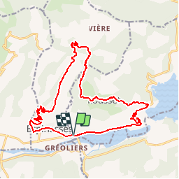
Trail Mountain bike of 20 km to be discovered at Provence-Alpes-Côte d'Azur, Hautes-Alpes, Rousset. This trail is proposed by tracegps.

Description

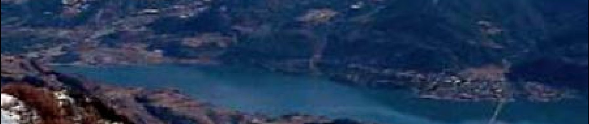
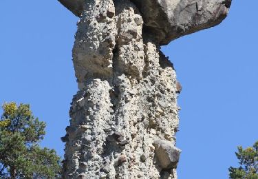
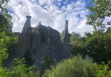
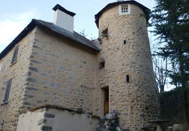
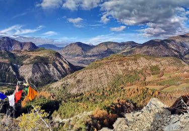
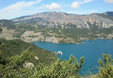
Espace VTT FFC de Serre-Ponçon - Durance Circuit labellisé par la Fédération Française de Cyclisme. Trois départs possibles depuis l’Office du Tourisme du Pays de Serre-Ponçon (Celliers de Rousset). La Poste d’Espinasses et le belvédère du barrage de Serre-Ponçon. Circuit sportif, avec une longue montée de 7km depuis Espinasses jusqu’au hameau de La Faure. Dénivelé de 550m pour atteindre le point le plus haut (1220m). Liaison par une montée de 4km au circuit n° 9 permettant d’admirer au passage l’ancien petit village de Vières. Superbes vues à la montée sur la Vallée de la Durance et le torrent de Trente Pas avec ses Demoiselles coiffées. A la descente le vieux village de Rousset et sa vue sur le lac, puis le barrage de Serre-Ponçon avec son belvédère.

Elevation profile

Photos

Positioning

Country:
France
Region :
Provence-Alpes-Côte d'Azur
Department/Province :
Hautes-Alpes
Municipality :
Rousset
Location:
Unknown
Start:(UTM)
279952 ; 4927300 (32T) N.

Trails nearby

Trail Walking Théus - R47   Les Demoiselles Coiffees - Photo
Walking
GUIDE+

Walking

Very easy
(2)
Théus, Provence-Alpes-Côte d'Azur, Hautes-Alpes, France
6.7 km | 13.4 km-effort
2h 31min
Yes
Trail Walking Théus - Les demoiselles coiffées  - Photo
Walking
Fabichette

Walking

Difficult
(1)
Théus, Provence-Alpes-Côte d'Azur, Hautes-Alpes, France
7.5 km | 14.2 km-effort
3h 13min
Yes
Trail Walking Ubaye-Serre-Ponçon - Circuit de l'Escoubaye 25 -12- 2014 - Photo
Walking
Dervalmarc

Walking

Easy
(1)
Ubaye-Serre-Ponçon, Provence-Alpes-Côte d'Azur, Alpes-de-Haute-Provence, France
6.9 km | 10.1 km-effort
2h 32min
Yes
Trail Walking Chorges - clôt c l'avais sur fein - Photo
Walking
Didier.kiehl

Walking

Very easy
(2)
Chorges, Provence-Alpes-Côte d'Azur, Hautes-Alpes, France
8 km | 12.6 km-effort
2h 24min
Yes
Trail Walking Rochebrune - Chapelle Saint-Sixte Via Rochebrune - Photo
Walking
PapouBertrand

Walking

Medium
(1)
Rochebrune, Provence-Alpes-Côte d'Azur, Hautes-Alpes, France
3.9 km | 7.4 km-effort
1h 52min
Yes
Trail Walking Ubaye-Serre-Ponçon - L'Escoubaye - Photo
Walking
FERAUD

Walking

Medium
(1)
Ubaye-Serre-Ponçon, Provence-Alpes-Côte d'Azur, Alpes-de-Haute-Provence, France
6 km | 9 km-effort
1h 22min
Yes
Trail Walking Ubaye-Serre-Ponçon - L'Escoubaye - Photo
Walking
saintherant

Walking

Easy
(1)
Ubaye-Serre-Ponçon, Provence-Alpes-Côte d'Azur, Alpes-de-Haute-Provence, France
4.5 km | 7.4 km-effort
2h 0min
Yes
Trail Walking Ubaye-Serre-Ponçon - Circuit de Costebelle - Photo
Walking
saintherant

Walking

Medium
(2)
Ubaye-Serre-Ponçon, Provence-Alpes-Côte d'Azur, Alpes-de-Haute-Provence, France
8.2 km | 12.8 km-effort
2h 30min
Yes
Trail Walking Chorges - Clôt Clavary 3.9.23 - Photo
Walking
GUIDE
fredetpascale

Walking

Easy
Chorges, Provence-Alpes-Côte d'Azur, Hautes-Alpes, France
7.1 km | 11.6 km-effort
2h 0min
Yes


Close
My subscriptions