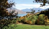
Trail Mountain bike Chorges - Espace VTT FFC de Serre-Ponçon - Durance - Circuit n°05 - Chorges - Photo

Espace VTT FFC de Serre-Ponçon - Durance - Circuit n°05 - Chorges

 tracegps
tracegps

User

© OpenStreetMap contributors
Length
Length
7.3 km
Max alt
Max alt
911 m
Uphill gradient
Uphill gradient
185 m
Km-Effort
Km-Effort  
9.5 km
Min alt
Min alt
786 m
Downhill gradient
Downhill gradient
117 m
Boucle
Boucle
No
Creation date :
2014-12-10 00:00:00.0
Updated on :
2014-12-10 00:00:00.0

(0 Reviews)

Mountain bike
Mountain bike
40m
Difficulty : Medium

Scan this QR Code to open this trail in the SityTrail application

FREE GPS app for hiking

Logo SityTrail SityTrail

IGN / Geographical institutes

Download SityTrail from the App Store Download SityTrail from Google Play

Logo SityTrail SityTrail World

The world is yours!

Download SityTrail from the App Store Download SityTrail from Google Play Download SityTrail on Huawei AppGallery

About

Trail Mountain bike of 7.3 km to be discovered at Provence-Alpes-Côte d'Azur, Hautes-Alpes, Chorges. This trail is proposed by tracegps.

Description

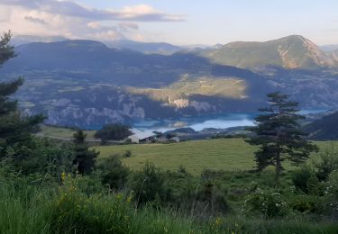
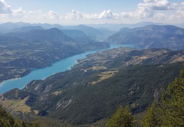
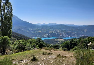
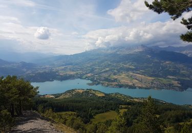
Espace VTT FFC de Serre-Ponçon - Durance Circuit labellisé par la Fédération Française de Cyclisme. Départ depuis l’embarcadère de la baie Saint Michel. Parcours familial sur route et piste roulante sans dénivelé important. Prudence dans la petite descente en lacets à mi-parcours. Retour à la baie Saint Michel par le circuit n°4. La cité Caturige de Chorges, ancien village fortifié, et son circuit historique, l’église Saint Victor classée du XII ème siècle, fontaine. Panorama sur les montagnes dominant Chorges : aiguilles de Chabrières (2.403m) et Le Piolit.

Elevation profile

Photos

Positioning

Country:
France
Region :
Provence-Alpes-Côte d'Azur
Department/Province :
Hautes-Alpes
Municipality :
Chorges
Location:
Unknown
Start:(Dec)
Start:(UTM)
287568 ; 4933664 (32T) N.

Trails nearby

Trail Walking Pontis - PONTIS , le dolmen  - Photo
Walking
GUIDE
RobinMicheline

Walking

Medium
(1)
Pontis, Provence-Alpes-Côte d'Azur, Alpes-de-Haute-Provence, France
12.9 km | 21 km-effort
3h 50min
Yes
Trail Walking Chorges - Chanteloube et lac de Serre Ponçon - Photo
Walking
gildascb

Walking

Very easy
(2)
Chorges, Provence-Alpes-Côte d'Azur, Hautes-Alpes, France
5.9 km | 8.2 km-effort
1h 47min
Yes
Trail Walking Chorges - clôt c l'avais sur fein - Photo
Walking
Didier.kiehl

Walking

Very easy
(2)
Chorges, Provence-Alpes-Côte d'Azur, Hautes-Alpes, France
8 km | 12.6 km-effort
2h 24min
Yes
Trail Walking Pontis - pic de Morgon par les ortals et les traverses  - Photo
Walking
GUIDE
orsel

Walking

Difficult
Pontis, Provence-Alpes-Côte d'Azur, Alpes-de-Haute-Provence, France
12.3 km | 26 km-effort
8h 49min
Yes
Trail Walking Pontis - Le Grand Morgon par la face nord 07/09/23 - Photo
Walking
GUIDE
R@ph

Walking

Difficult
Pontis, Provence-Alpes-Côte d'Azur, Alpes-de-Haute-Provence, France
7.8 km | 18.9 km-effort
4h 18min
Yes
Trail Walking Pontis - Morgon par les Traverses, retour par les Ortals - Photo
Walking
GUIDE
David25400

Walking

Very difficult
Pontis, Provence-Alpes-Côte d'Azur, Alpes-de-Haute-Provence, France
17.1 km | 33 km-effort
5h 49min
No
Trail Walking Pontis - Le Morgonnet - Photo
Walking
GUIDE
Specialized77

Walking

Medium
Pontis, Provence-Alpes-Côte d'Azur, Alpes-de-Haute-Provence, France
5.9 km | 10.6 km-effort
2h 46min
Yes
Trail Walking Pontis - Morgon par les Ortals - Photo
Walking
GUIDE
David25400

Walking

Difficult
Pontis, Provence-Alpes-Côte d'Azur, Alpes-de-Haute-Provence, France
15.6 km | 32 km-effort
6h 29min
Yes
Trail Walking Pontis - Pic du Morgon par Serre-Chiret - Photo
Walking
GUIDE
David25400

Walking

Difficult
Pontis, Provence-Alpes-Côte d'Azur, Alpes-de-Haute-Provence, France
14 km | 27 km-effort
4h 2min
Yes


Close
My subscriptions