Trail Mountain bike Gouffern en Auge - Espace VTT FFC du Pays d'Auge Ornais- Circuit n°1 - Aout 1944 - Photo

Espace VTT FFC du Pays d'Auge Ornais- Circuit n°1 - Aout 1944

 tracegps
tracegps

User

© OpenStreetMap contributors
Length
Length
16.9 km
Max alt
Max alt
261 m
Uphill gradient
Uphill gradient
232 m
Km-Effort
Km-Effort  
20 km
Min alt
Min alt
91 m
Downhill gradient
Downhill gradient
232 m
Boucle
Boucle
Yes
Creation date :
2014-12-10 00:00:00.0
Updated on :
2014-12-10 00:00:00.0

(0 Reviews)

Mountain bike
Mountain bike
1h45
Difficulty : Medium

Scan this QR Code to open this trail in the SityTrail application

FREE GPS app for hiking

Logo SityTrail SityTrail

IGN / Geographical institutes

Download SityTrail from the App Store Download SityTrail from Google Play

Logo SityTrail SityTrail World

The world is yours!

Download SityTrail from the App Store Download SityTrail from Google Play Download SityTrail on Huawei AppGallery

About

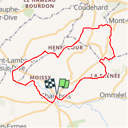
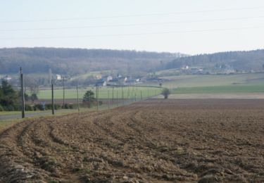
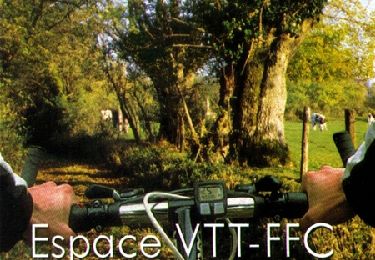
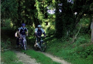
Trail Mountain bike of 16.9 km to be discovered at Normandy, Orne, Gouffern en Auge. This trail is proposed by tracegps.

Description

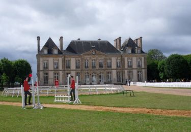
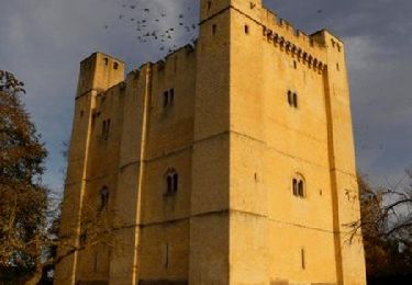
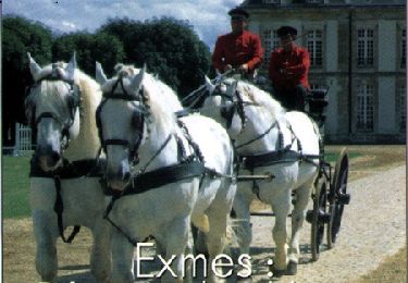
Espace VTT FFC du Pays d’Auge Ornais Circuit labellisé par la Fédération Française de Cyclisme. Chambois, son donjon, son exposition sur la fameuse "Poche de Chambois" d'Août 1944, ses églises et ses salons du savoir faire, de la peinture et sculpture.
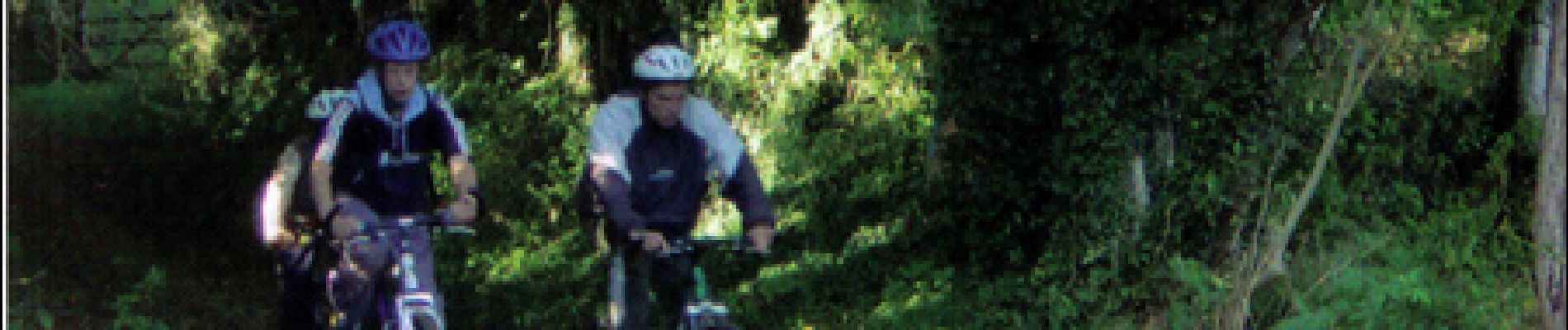
Elevation profile

Photos

Positioning

Country:
France
Region :
Normandy
Department/Province :
Orne
Municipality :
Gouffern en Auge
Location:
Chambois
Start:(UTM)
287546 ; 5409937 (31U) N.

Trails nearby

Trail Mountain bike Gouffern en Auge - Randonnée VTT - Le Bourg Saint Léonard - Photo
Mountain bike
tracegps

Mountain bike

Difficult
(1)
Gouffern en Auge, Normandy, Orne, France
43 km | 53 km-effort
2h 30min
Yes
Trail Equestrian Gouffern en Auge - Boucle du Bourg-St-Leonard  - Photo
Equestrian
tracegps

Equestrian

Difficult
Gouffern en Auge, Normandy, Orne, France
20 km | 23 km-effort
5h 0min
Yes
Trail Equestrian Gouffern en Auge - Août 1944 - Chambois - Photo
Equestrian
tracegps

Equestrian

Medium
Gouffern en Auge, Normandy, Orne, France
16.1 km | 19 km-effort
4h 0min
Yes
Trail Mountain bike Gouffern en Auge - Août 1944 - Chambois - Photo
Mountain bike
tracegps

Mountain bike

Medium
Gouffern en Auge, Normandy, Orne, France
16.1 km | 19 km-effort
1h 30min
Yes
Trail Walking Gouffern en Auge - Août 1944 - Chambois - Photo
Walking
tracegps

Walking

Difficult
Gouffern en Auge, Normandy, Orne, France
16.1 km | 19 km-effort
5h 0min
Yes
Trail Mountain bike Gouffern en Auge - Espace VTT FFC du Pays d'Auge Ornais - Circuit n°14 - Trans'Pays d'Auge - Photo
Mountain bike
tracegps

Mountain bike

Difficult
Gouffern en Auge, Normandy, Orne, France
20 km | 26 km-effort
1h 30min
No
Trail Mountain bike Gouffern en Auge - Espace VTT FFC du Pays d'Auge Ornais - Circuit n°12 - Exmes - Photo
Mountain bike
tracegps

Mountain bike

Difficult
Gouffern en Auge, Normandy, Orne, France
24 km | 28 km-effort
2h 0min
Yes
Trail Mountain bike Gouffern en Auge - Espace VTT FFC du Pays d'Auge Ornais - Circuit n°4 - Trun - Photo
Mountain bike
tracegps

Mountain bike

Difficult
Gouffern en Auge, Normandy, Orne, France
47 km | 53 km-effort
3h 30min
Yes
Trail Mountain bike Gouffern en Auge - Espace VTT FFC du Pays d'Auge Ornais- Circuit n°3 - Chambois - Fel - Photo
Mountain bike
tracegps

Mountain bike

Medium
Gouffern en Auge, Normandy, Orne, France
8 km | 9.1 km-effort
40min
Yes


Close
My subscriptions