


9.5 km | 13.3 km-effort


User


FREE GPS app for hiking
 SityTrail
IGN / Geographical institutes
SityTrail World
The world is yours!
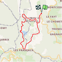
Trail Mountain bike of 14.8 km to be discovered at Auvergne-Rhône-Alpes, Puy-de-Dôme, Saint-Anthème. This trail is proposed by tracegps.
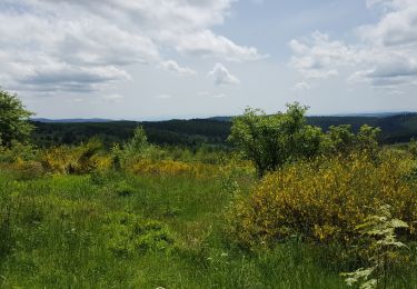
Espace VTT FFC de la Vallée de l’Ance Circuit labellisé par la Fédération Française de Cyclisme. Ce circuit assez facile dans son ensemble, vous fera découvrir le domaine des jasseries (La Fayolle, Grande Fayerie) et le barrage des Pradeaux. Il vous permettra d’admirer de magnifiques panoramas. Seule difficulté ; une montée technique sur un chemin très abîmé, peu après le col des Pradeaux.


Walking

Walking

On foot

On foot
On foot

Walking
On foot
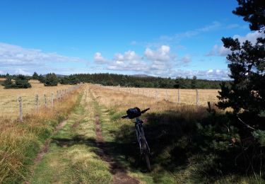
Mountain bike
Walking