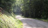

Espace VTT FFC Pyrénées Comminges - n° 23 Découverte des hameaux de la Vallée de l'Arbas

tracegps
User

Length
15.1 km

Max alt
475 m

Uphill gradient
310 m

Km-Effort
19.2 km

Min alt
356 m

Downhill gradient
309 m
Boucle
Yes
Creation date :
2014-12-10 00:00:00.0
Updated on :
2014-12-10 00:00:00.0
2h30
Difficulty : Easy

FREE GPS app for hiking
About
Trail Mountain bike of 15.1 km to be discovered at Occitania, Haute-Garonne, Arbas. This trail is proposed by tracegps.
Description
Circuit labellisé par la Fédération Française de Cyclisme. Ce circuit, sans difficultés techniques, propose une alternance de pistes et d epetites routes goudronnées.
Positioning
Country:
France
Region :
Occitania
Department/Province :
Haute-Garonne
Municipality :
Arbas
Location:
Unknown
Start:(Dec)
Start:(UTM)
329379 ; 4762476 (31T) N.
Comments
Trails nearby
2020-08-20 Arbas - cabane de roqué pic - de paloumère - sommet de cornudère.


Walking
Medium
Herran,
Occitania,
Haute-Garonne,
France

13.2 km | 23 km-effort
4h 14min
Yes
Arbas, chemin du facteur avec extension Penne blanque


Walking
Medium
Arbas,
Occitania,
Haute-Garonne,
France

13.8 km | 23 km-effort
4h 52min
Yes
Balade Coume Paloumere


Walking
Very difficult
Herran,
Occitania,
Haute-Garonne,
France

11.1 km | 19.5 km-effort
5h 6min
Yes
COL de LARRIEU avec Léo


Walking
Very easy
(1)
Estadens,
Occitania,
Haute-Garonne,
France

3.4 km | 5.2 km-effort
1h 10min
Yes
Circuit VTT n°32 Arbas


Mountain bike
Very difficult
Arbas,
Occitania,
Haute-Garonne,
France

27 km | 40 km-effort
3h 30min
Yes
Circuit VTT n°31 à Arbas


Mountain bike
Difficult
(1)
Arbas,
Occitania,
Haute-Garonne,
France

22 km | 32 km-effort
2h 30min
Yes
Espace VTT FFC Pyrénées Comminges - n° 34 Le Bois du Thouas


Mountain bike
Medium
Estadens,
Occitania,
Haute-Garonne,
France

9.7 km | 13.7 km-effort
1h 30min
Yes

Espace VTT FFC Pyrénées Comminges - n° 33 La croix de Guéret


Mountain bike
Very difficult
Herran,
Occitania,
Haute-Garonne,
France

12.2 km | 21 km-effort
1h 45min
Yes
Espace VTT FFC Pyrénées Comminges - n° 32 Le Tour du Haut Arbas


Mountain bike
Very difficult
(1)
Arbas,
Occitania,
Haute-Garonne,
France

27 km | 41 km-effort
3h 0min
Yes


 SityTrail


