![](/images/other/stat-length.png)
![Trail Running Gorbio - Trail de Gorbio 32km 2007 - Photo](https://media.geolcdn.com/t/1900/400/ext.pjpeg?maxdim=2&url=https%3A%2F%2Fservices.sitytrail.com%2FGeolivesWS%2FDownloadMedia.ashx%3FTrailID%3D101651%26Media%3D1861_2.jpg)
Trail de Gorbio 32km 2007
tracegps
User
![Length](/images/other/stat-length.png)
Length
27 km
![Max alt](https://static1.geolcdn.com/siteimages/upload/files/1508320355ic_sort_altitude_max_24dp.png)
Max alt
1231 m
![Uphill gradient](https://static1.geolcdn.com/siteimages/upload/files/1508320355ic_sort_den_pos_24dp.png)
Uphill gradient
1457 m
![Km-Effort](/images/other/stat-length.png)
Km-Effort
46 km
![Min alt](https://static1.geolcdn.com/siteimages/upload/files/1508320355ic_sort_altitude_min_24dp.png)
Min alt
361 m
![Downhill gradient](https://static1.geolcdn.com/siteimages/upload/files/1508320355ic_sort_den_neg_24dp.png)
Downhill gradient
1454 m
![Boucle](https://static1.geolcdn.com/siteimages/upload/files/16400158638029165_repeat_loop_refresh_sync_direction_icon.png)
Boucle
Yes
Creation date :
2014-12-10 00:00:00.0
Updated on :
2014-12-10 00:00:00.0
![Running](https://static1.geolcdn.com/sitytour/trail-icons/103.png)
3h45
Difficulty : Very difficult
![Scan this QR Code to open this trail in the SityTrail application](https://capi.geolives.com/qq0zvz2zws4bq2lad0pu/sitytour/trails/101651/qr.png?size=200)
FREE GPS app for hiking
About
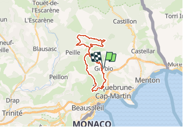
Trail Running of 27 km to be discovered at Provence-Alpes-Côte d'Azur, Maritime Alps, Gorbio. This trail is proposed by tracegps.
Description
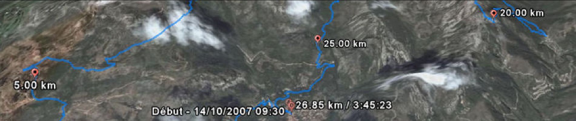
Parcours du Trail de Gorbio 32km qui s'est déroulé le 14 octobre 2007. Magnifique parcours avec des vues imprenables sur la côte Mentonnaise.
Positioning
Country:
France
Region :
Provence-Alpes-Côte d'Azur
Department/Province :
Maritime Alps
Municipality :
Gorbio
Location:
Unknown
Start:(Dec)
Start:(UTM)
374762 ; 4849362 (32T) N.
Comments
Trails nearby
![Trail Walking Castellar - Mont Carpano en boucle - Photo](https://media.geolcdn.com/t/375/260/ext.jpg?maxdim=2&url=https%3A%2F%2Fservices.sitytrail.com%2FGeolivesWS%2FDownloadMedia.ashx%3FTrailID%3D232983%26Media%3Dfix__20131116134859.jpg)
![Walking Walking](https://static1.geolcdn.com/sitytour/trail-icons/101.png)
Mont Carpano en boucle
Walking
Medium
(1)
Castellar,
Provence-Alpes-Côte d'Azur,
Maritime Alps,
France
![](/images/other/stat-length.png)
8.1 km | 14.4 km-effort
3h 18min
![](https://static1.geolcdn.com/siteimages/upload/files/16400158638029165_repeat_loop_refresh_sync_direction_icon.png)
Yes
![Trail Walking Peillon - Via Alpina - R161: Peillon > Monaco - Place du Palais - Photo](https://media.geolcdn.com/t/375/260/ext.jpg?maxdim=2&url=https%3A%2F%2Fservices.sitytrail.com%2FGeolivesWS%2FDownloadMedia.ashx%3FTrailID%3D109722%26Media%3D4434_1.jpg)
![Walking Walking](https://static1.geolcdn.com/sitytour/trail-icons/101.png)
Via Alpina - R161: Peillon > Monaco - Place du Palais
Walking
Medium
(2)
Peillon,
Provence-Alpes-Côte d'Azur,
Maritime Alps,
France
![](/images/other/stat-length.png)
10.3 km | 16.7 km-effort
2h 49min
![](https://static1.geolcdn.com/siteimages/upload/files/16400158638029165_repeat_loop_refresh_sync_direction_icon.png)
No
![Trail Walking Castellar - Castellar Gramondo Bocca Bassa Col St Bernard Monti réel - Photo](https://media.geolcdn.com/t/375/260/9ef1219a-4e40-4498-97fc-47b72eb8b3af.jpg&format=jpg&maxdim=2)
![Walking Walking](https://static1.geolcdn.com/sitytour/trail-icons/101.png)
Castellar Gramondo Bocca Bassa Col St Bernard Monti réel
Walking
Very difficult
Castellar,
Provence-Alpes-Côte d'Azur,
Maritime Alps,
France
![](/images/other/stat-length.png)
18.1 km | 36 km-effort
8h 17min
![](https://static1.geolcdn.com/siteimages/upload/files/16400158638029165_repeat_loop_refresh_sync_direction_icon.png)
Yes
![Trail On foot Peille - Cime de Baudon - Photo](https://media.geolcdn.com/t/375/260/9fe230af-c31e-48d2-a797-a81c449946d4.jpeg&format=jpg&maxdim=2)
![On foot On foot](https://static1.geolcdn.com/sitytour/trail-icons/100.png)
Cime de Baudon
On foot
Easy
Peille,
Provence-Alpes-Côte d'Azur,
Maritime Alps,
France
![](/images/other/stat-length.png)
7 km | 14.7 km-effort
3h 20min
![](https://static1.geolcdn.com/siteimages/upload/files/16400158638029165_repeat_loop_refresh_sync_direction_icon.png)
Yes
![Trail Walking Roquebrune-Cap-Martin - cape martin - Photo](https://media.geolcdn.com/t/375/260/ext.jpg?maxdim=2&url=https%3A%2F%2Fstatic1.geolcdn.com%2Fsiteimages%2Fupload%2Ffiles%2F1553511878bg_sport_marche.png)
![Walking Walking](https://static1.geolcdn.com/sitytour/trail-icons/101.png)
cape martin
Walking
Medium
(2)
Roquebrune-Cap-Martin,
Provence-Alpes-Côte d'Azur,
Maritime Alps,
France
![](/images/other/stat-length.png)
4.4 km | 5.9 km-effort
1h 57min
![](https://static1.geolcdn.com/siteimages/upload/files/16400158638029165_repeat_loop_refresh_sync_direction_icon.png)
Yes
![Trail Walking Gorbio - Gorbio-Circuit des Cabanelles 31-10-2016 - Photo](https://media.geolcdn.com/t/375/260/ext.jpg?maxdim=2&url=https%3A%2F%2Fstatic1.geolcdn.com%2Fsiteimages%2Fupload%2Ffiles%2F1553511878bg_sport_marche.png)
![Walking Walking](https://static1.geolcdn.com/sitytour/trail-icons/101.png)
Gorbio-Circuit des Cabanelles 31-10-2016
Walking
Medium
(1)
Gorbio,
Provence-Alpes-Côte d'Azur,
Maritime Alps,
France
![](/images/other/stat-length.png)
10.8 km | 21 km-effort
3h 51min
![](https://static1.geolcdn.com/siteimages/upload/files/16400158638029165_repeat_loop_refresh_sync_direction_icon.png)
Yes
![Trail Other activity La Turbie - fort de la Revere - Photo](https://media.geolcdn.com/t/375/260/ext.jpg?maxdim=2&url=https%3A%2F%2Fstatic1.geolcdn.com%2Fsiteimages%2Fupload%2Ffiles%2F1545311037marcheuse_200dpi.jpg)
![Other activity Other activity](https://static1.geolcdn.com/sitytour/trail-icons/900.png)
fort de la Revere
Other activity
Very easy
(1)
La Turbie,
Provence-Alpes-Côte d'Azur,
Maritime Alps,
France
![](/images/other/stat-length.png)
8.4 km | 12 km-effort
1h 37min
![](https://static1.geolcdn.com/siteimages/upload/files/16400158638029165_repeat_loop_refresh_sync_direction_icon.png)
Yes
![Trail Walking Roquebrune-Cap-Martin - Menton - Cap Martin - Photo](https://media.geolcdn.com/t/375/260/ext.jpg?maxdim=2&url=https%3A%2F%2Fservices.sitytrail.com%2FGeolivesWS%2FDownloadMedia.ashx%3FTrailID%3D435406%26Media%3Dfix__20150615113845.jpg)
![Walking Walking](https://static1.geolcdn.com/sitytour/trail-icons/101.png)
Menton - Cap Martin
Walking
Easy
Roquebrune-Cap-Martin,
Provence-Alpes-Côte d'Azur,
Maritime Alps,
France
![](/images/other/stat-length.png)
7.1 km | 9.1 km-effort
2h 15min
![](https://static1.geolcdn.com/siteimages/upload/files/16400158638029165_repeat_loop_refresh_sync_direction_icon.png)
Yes
![Trail Walking Peille - Cime de Baudon - Photo](https://media.geolcdn.com/t/375/260/ext.jpg?maxdim=2&url=https%3A%2F%2Fstatic1.geolcdn.com%2Fsiteimages%2Fupload%2Ffiles%2F1553511878bg_sport_marche.png)
![Walking Walking](https://static1.geolcdn.com/sitytour/trail-icons/101.png)
Cime de Baudon
Walking
Medium
(1)
Peille,
Provence-Alpes-Côte d'Azur,
Maritime Alps,
France
![](/images/other/stat-length.png)
7.8 km | 15.7 km-effort
4h 15min
![](https://static1.geolcdn.com/siteimages/upload/files/16400158638029165_repeat_loop_refresh_sync_direction_icon.png)
Yes