


10.6 km | 19.3 km-effort

User


FREE GPS app for hiking
 SityTrail
IGN / Geographical institutes
SityTrail World
The world is yours!
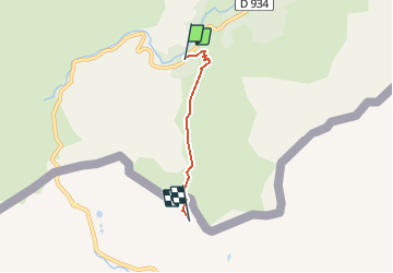
Trail Walking of 2.8 km to be discovered at New Aquitaine, Pyrénées-Atlantiques, Laruns. This trail is proposed by tracegps.
Après une ascension sans grande difficultée, la vallée qui mène au col de Peyrelue nous dévoile son décor magnifique. Attention, la frontière avec l'Espagne est franchie rapidement et rien ne la matérialise sur le terrain si ce n'est la balise du Chemin de St JAcques rédigée en espagnol indiquant les directions de Gabas et de port vieux de sallent. A découvrir absolument!


Walking

Walking

Walking

On foot
Walking

Walking

Walking

Walking
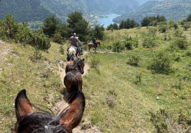
Horseback riding