


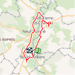

10.4 km | 13.1 km-effort

User


FREE GPS app for hiking
 SityTrail
IGN / Geographical institutes
SityTrail World
The world is yours!
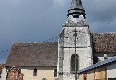
Trail Walking of 13.6 km to be discovered at Normandy, Eure, Bouchevilliers. This trail is proposed by Marie-Claire-mcp.
départ Parking, direction église puis point de vue.. Neufmarché puis Vardes, St Pierre Es champs et Mont Saint Hélène. Montel et Bouchevilliers


Walking

Walking
Walking
Walking
Walking
Walking

On foot
Walking
Walking