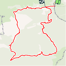
Trail Walking Saint-Pé-de-Bigorre - Soum des Toupiettes - Grottes de Bétharram - Photo

Soum des Toupiettes - Grottes de Bétharram

 tracegps
tracegps

User

© OpenStreetMap contributors
Length
Length
14.6 km
Max alt
Max alt
1314 m
Uphill gradient
Uphill gradient
1034 m
Km-Effort
Km-Effort  
28 km
Min alt
Min alt
395 m
Downhill gradient
Downhill gradient
1019 m
Boucle
Boucle
No
Creation date :
2014-12-10 00:00:00.0
Updated on :
2014-12-10 00:00:00.0

(0 Reviews)

Walking
Walking
4h15
Difficulty : Difficult

Scan this QR Code to open this trail in the SityTrail application

FREE GPS app for hiking

Logo SityTrail SityTrail

IGN / Geographical institutes

Download SityTrail from the App Store Download SityTrail from Google Play

Logo SityTrail SityTrail World

The world is yours!

Download SityTrail from the App Store Download SityTrail from Google Play Download SityTrail on Huawei AppGallery

About

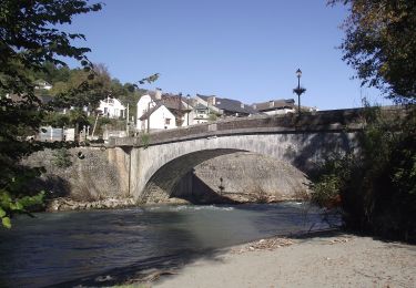
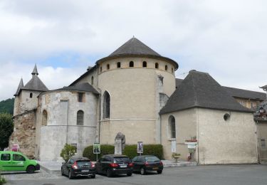
Trail Walking of 14.6 km to be discovered at Occitania, Hautespyrenees, Saint-Pé-de-Bigorre. This trail is proposed by tracegps.

Description

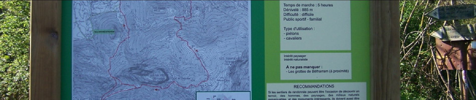
Départ des Grottes de Bétharram. Sentier balisé par la Communauté de Communes de la Vath Vielha sous le nom Boucle de l'Isarce.

Elevation profile

Photos

Positioning

Country:
France
Region :
Occitania
Department/Province :
Hautespyrenees
Municipality :
Saint-Pé-de-Bigorre
Location:
Unknown
Start:(UTM)
728041 ; 4775691 (30T) N.

Comments

Please log in to post a review or rate the element


À tester


Trails nearby

Trail On foot Saint-Pé-de-Bigorre - SAINT PE DE BIGORRE Le grand tour de saint pe
On foot
GUIDE
marmotte65

On foot

Easy
Saint-Pé-de-Bigorre, Occitania, Hautespyrenees, France
9.8 km | 13.6 km-effort
3h 5min
Yes
Trail On foot Saint-Pé-de-Bigorre - Le Plateau du Mousqué - Photo
On foot
GUIDE+

On foot

Easy
Saint-Pé-de-Bigorre, Occitania, Hautespyrenees, France
5.1 km | 7.8 km-effort
1h 45min
Yes
Trail On foot Saint-Pé-de-Bigorre - Lengous et Montagnou - Photo
On foot
GUIDE+

On foot

Easy
Saint-Pé-de-Bigorre, Occitania, Hautespyrenees, France
5.3 km | 7.4 km-effort
1h 40min
Yes
Trail On foot Saint-Pé-de-Bigorre - Les Coteaux de Saint-Pé - Photo
On foot
GUIDE+

On foot

Easy
Saint-Pé-de-Bigorre, Occitania, Hautespyrenees, France
9.2 km | 12.2 km-effort
2h 46min
Yes
Trail Walking Saint-Pé-de-Bigorre - SAINT PE de BIGORRE et ses côteaux G4  faite avec LPC
Walking
GUIDE
marmotte65

Walking

Medium
Saint-Pé-de-Bigorre, Occitania, Hautespyrenees, France
9 km | 12.5 km-effort
2h 40min
Yes
Trail Walking Saint-Pé-de-Bigorre - Les Soums Saint-Péens - Saint Pé de Bigorre - Photo
Walking
tracegps

Walking

Difficult
(1)
Saint-Pé-de-Bigorre, Occitania, Hautespyrenees, France
15.3 km | 31 km-effort
7h 0min
Yes
Trail Walking Lestelle-Bétharram - 2023 10 10 CHEMIN du PIÉMONT PYRÉNÉEN - 18ème étape : Lestelle-Bétharram - Asson - Bruges - Mifaget - Ste Colome - Arudy - Photo
Walking
LEGUE

Walking

Medium
Lestelle-Bétharram, New Aquitaine, Pyrénées-Atlantiques, France
28 km | 36 km-effort
6h 9min
No
Trail Walking Asson - ASSON Igon Touyas de Capsus
Walking
GUIDE
marmotte65

Walking

Difficult
Asson, New Aquitaine, Pyrénées-Atlantiques, France
13 km | 16.3 km-effort
4h 5min
Yes
Trail On foot Saint-Pé-de-Bigorre - Le sentier du Bénac - Photo
On foot
GUIDE+

On foot

Easy
Saint-Pé-de-Bigorre, Occitania, Hautespyrenees, France
8.1 km | 14.3 km-effort
3h 14min
Yes


Close
My subscriptions