![](/images/other/stat-length.png)
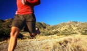
![Trail Running Urepel - Euskal Raid 2005 - 2 - Photo](https://media.geolcdn.com/t/1900/400/ext.pjpeg?maxdim=2&url=https%3A%2F%2Fservices.sitytrail.com%2FGeolivesWS%2FDownloadMedia.ashx%3FTrailID%3D101250%26Media%3D738_1.jpg)
Euskal Raid 2005 - 2
tracegps
User
![Length](/images/other/stat-length.png)
Length
38 km
![Max alt](https://static1.geolcdn.com/siteimages/upload/files/1508320355ic_sort_altitude_max_24dp.png)
Max alt
1296 m
![Uphill gradient](https://static1.geolcdn.com/siteimages/upload/files/1508320355ic_sort_den_pos_24dp.png)
Uphill gradient
2161 m
![Km-Effort](/images/other/stat-length.png)
Km-Effort
68 km
![Min alt](https://static1.geolcdn.com/siteimages/upload/files/1508320355ic_sort_altitude_min_24dp.png)
Min alt
151 m
![Downhill gradient](https://static1.geolcdn.com/siteimages/upload/files/1508320355ic_sort_den_neg_24dp.png)
Downhill gradient
2427 m
![Boucle](https://static1.geolcdn.com/siteimages/upload/files/16400158638029165_repeat_loop_refresh_sync_direction_icon.png)
Boucle
No
Creation date :
2014-12-10 00:00:00.0
Updated on :
2014-12-10 00:00:00.0
![Running](https://static1.geolcdn.com/sitytour/trail-icons/103.png)
8h00
Difficulty : Very difficult
![Scan this QR Code to open this trail in the SityTrail application](https://capi.geolives.com/qq0zvz2zws4bq2lad0pu/sitytour/trails/101250/qr.png?size=200)
FREE GPS app for hiking
About
Trail Running of 38 km to be discovered at New Aquitaine, Pyrénées-Atlantiques, Urepel. This trail is proposed by tracegps.
Description
Le Pays basque est un formidable terrain d’aventure offrant de larges possibilités de sports nature. C’est ce pays et la vallée de Baïgorry que vous invitent à découvrir les membres d’EUSKAL RAID ASSOCIATION avec cette deuxième étape. Grace aussi aux Ultra fondus !
Positioning
Country:
France
Region :
New Aquitaine
Department/Province :
Pyrénées-Atlantiques
Municipality :
Urepel
Location:
Unknown
Start:(Dec)
Start:(UTM)
628875 ; 4769884 (30T) N.
Comments
Trails nearby
![Trail Walking Erro - ARGINTZU - KINTOA BORDA DEPUIS URKIAGA - Photo](https://media.geolcdn.com/t/375/260/f32fccbe-17d6-4372-ae93-4e8154972100.jpg&format=jpg&maxdim=2)
![Walking Walking](https://static1.geolcdn.com/sitytour/trail-icons/101.png)
ARGINTZU - KINTOA BORDA DEPUIS URKIAGA
Walking
Easy
Erro,
Navarre,
Unknown,
Spain
![](/images/other/stat-length.png)
12.9 km | 21 km-effort
6h 39min
![](https://static1.geolcdn.com/siteimages/upload/files/16400158638029165_repeat_loop_refresh_sync_direction_icon.png)
Yes
![Trail On foot Urepel - Urepelbide zaharra / Antiguo Camino Urepel - Photo](https://media.geolcdn.com/t/375/260/7d38e3e5-c509-40d9-8bd5-3cb071032eed.jpeg&format=jpg&maxdim=2)
![On foot On foot](https://static1.geolcdn.com/sitytour/trail-icons/100.png)
Urepelbide zaharra / Antiguo Camino Urepel
On foot
Medium
Urepel,
New Aquitaine,
Pyrénées-Atlantiques,
France
![](/images/other/stat-length.png)
12.8 km | 22 km-effort
5h 2min
![](https://static1.geolcdn.com/siteimages/upload/files/16400158638029165_repeat_loop_refresh_sync_direction_icon.png)
No
![Trail Walking Urepel - urepel - Photo](https://media.geolcdn.com/t/375/260/34f4b20f-4218-4dc9-93c7-30b06ac568ca.jpg&format=jpg&maxdim=2)
![Walking Walking](https://static1.geolcdn.com/sitytour/trail-icons/101.png)
urepel
Walking
Medium
Urepel,
New Aquitaine,
Pyrénées-Atlantiques,
France
![](/images/other/stat-length.png)
14.4 km | 22 km-effort
6h 18min
![](https://static1.geolcdn.com/siteimages/upload/files/16400158638029165_repeat_loop_refresh_sync_direction_icon.png)
Yes
![Trail Walking Aldudes - Aldudes-Argibel - Photo](https://media.geolcdn.com/t/375/260/4f9773da-8c83-45eb-8f57-44f7bebf7df6.jpg&format=jpg&maxdim=2)
![Walking Walking](https://static1.geolcdn.com/sitytour/trail-icons/101.png)
Aldudes-Argibel
Walking
Medium
Aldudes,
New Aquitaine,
Pyrénées-Atlantiques,
France
![](/images/other/stat-length.png)
14 km | 25 km-effort
4h 24min
![](https://static1.geolcdn.com/siteimages/upload/files/16400158638029165_repeat_loop_refresh_sync_direction_icon.png)
Yes
![Trail Walking Urepel - Les aldudes urepel - Photo](https://media.geolcdn.com/t/375/260/bcaea539-9d72-42d9-b38f-2917d47505c5.jpg&format=jpg&maxdim=2)
![Walking Walking](https://static1.geolcdn.com/sitytour/trail-icons/101.png)
Les aldudes urepel
Walking
Difficult
Urepel,
New Aquitaine,
Pyrénées-Atlantiques,
France
![](/images/other/stat-length.png)
14.6 km | 22 km-effort
6h 8min
![](https://static1.geolcdn.com/siteimages/upload/files/16400158638029165_repeat_loop_refresh_sync_direction_icon.png)
Yes
![Trail Walking Aldudes - les Aldudes sentier des crêtes - Photo](https://media.geolcdn.com/t/375/260/38805aca-4424-480e-aee8-63b621fd698a.jpg&format=jpg&maxdim=2)
![Walking Walking](https://static1.geolcdn.com/sitytour/trail-icons/101.png)
les Aldudes sentier des crêtes
Walking
Very easy
Aldudes,
New Aquitaine,
Pyrénées-Atlantiques,
France
![](/images/other/stat-length.png)
3.9 km | 8.2 km-effort
1h 51min
![](https://static1.geolcdn.com/siteimages/upload/files/16400158638029165_repeat_loop_refresh_sync_direction_icon.png)
No
![Walking Walking](https://static1.geolcdn.com/sitytour/trail-icons/101.png)
Harrikulunka Aldudes ,roché bercé
Walking
Medium
Aldudes,
New Aquitaine,
Pyrénées-Atlantiques,
France
![](/images/other/stat-length.png)
14.3 km | 25 km-effort
5h 7min
![](https://static1.geolcdn.com/siteimages/upload/files/16400158638029165_repeat_loop_refresh_sync_direction_icon.png)
Yes
![Trail Mountain bike Urepel - Le Sentier des Contrebandiers en VTT - De Urepel à St Etienne de Baïgorry - Photo](https://media.geolcdn.com/t/375/260/ext.jpg?maxdim=2&url=https%3A%2F%2Fservices.sitytrail.com%2FGeolivesWS%2FDownloadMedia.ashx%3FTrailID%3D317579%26Media%3D16839_1.jpg)
![Mountain bike Mountain bike](https://static1.geolcdn.com/sitytour/trail-icons/202.png)
Le Sentier des Contrebandiers en VTT - De Urepel à St Etienne de Baïgorry
Mountain bike
Difficult
Urepel,
New Aquitaine,
Pyrénées-Atlantiques,
France
![](/images/other/stat-length.png)
34 km | 56 km-effort
6h 0min
![](https://static1.geolcdn.com/siteimages/upload/files/16400158638029165_repeat_loop_refresh_sync_direction_icon.png)
No
![Trail Equestrian Urepel - Sentier des Contrebandiers - de Urepel au col d'Elhorrieta au Pays Basque - Photo](https://media.geolcdn.com/t/375/260/ext.jpg?maxdim=2&url=https%3A%2F%2Fservices.sitytrail.com%2FGeolivesWS%2FDownloadMedia.ashx%3FTrailID%3D317110%26Media%3D16263_2.jpg)
![Equestrian Equestrian](https://static1.geolcdn.com/sitytour/trail-icons/300.png)
Sentier des Contrebandiers - de Urepel au col d'Elhorrieta au Pays Basque
Equestrian
Difficult
Urepel,
New Aquitaine,
Pyrénées-Atlantiques,
France
![](/images/other/stat-length.png)
24 km | 42 km-effort
5h 0min
![](https://static1.geolcdn.com/siteimages/upload/files/16400158638029165_repeat_loop_refresh_sync_direction_icon.png)
No