![](/images/other/stat-length.png)
![Trail Walking Uvernet-Fours - Autour de la Pierre Eclatée - Photo](https://media.geolcdn.com/t/1900/400/ext.pjpeg?maxdim=2&url=https%3A%2F%2Fservices.sitytrail.com%2FGeolivesWS%2FDownloadMedia.ashx%3FTrailID%3D101188%26Media%3D675_1.jpg)
Autour de la Pierre Eclatée
tracegps
User
![Length](/images/other/stat-length.png)
![Max alt](https://static1.geolcdn.com/siteimages/upload/files/1508320355ic_sort_altitude_max_24dp.png)
![Uphill gradient](https://static1.geolcdn.com/siteimages/upload/files/1508320355ic_sort_den_pos_24dp.png)
![Km-Effort](/images/other/stat-length.png)
![Min alt](https://static1.geolcdn.com/siteimages/upload/files/1508320355ic_sort_altitude_min_24dp.png)
![Downhill gradient](https://static1.geolcdn.com/siteimages/upload/files/1508320355ic_sort_den_neg_24dp.png)
![Boucle](https://static1.geolcdn.com/siteimages/upload/files/16400158638029165_repeat_loop_refresh_sync_direction_icon.png)
![Walking](https://static1.geolcdn.com/sitytour/trail-icons/101.png)
6h00
Difficulty : Very difficult
![Scan this QR Code to open this trail in the SityTrail application](https://capi.geolives.com/qq0zvz2zws4bq2lad0pu/sitytour/trails/101188/qr.png?size=200)
FREE GPS app for hiking
About
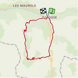
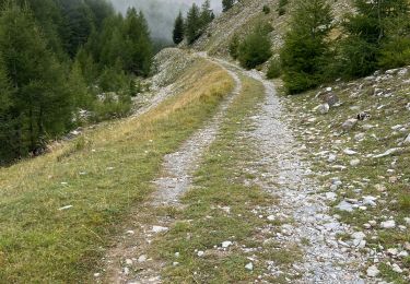
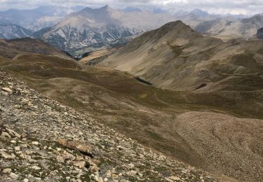
Trail Walking of 13.9 km to be discovered at Provence-Alpes-Côte d'Azur, Alpes-de-Haute-Provence, Uvernet-Fours. This trail is proposed by tracegps.
Description
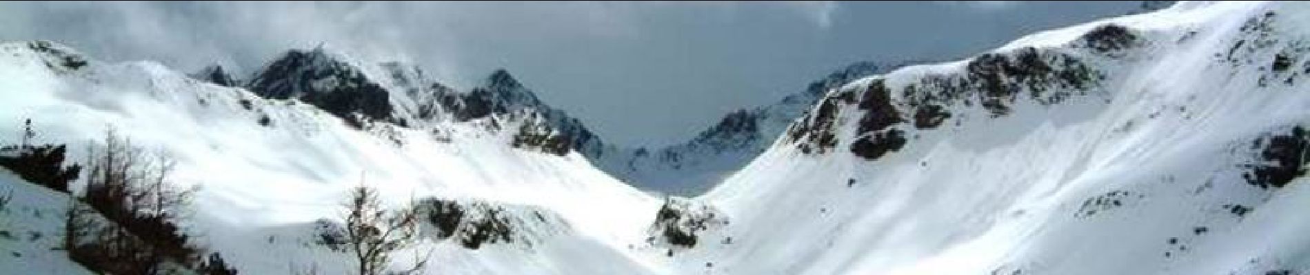
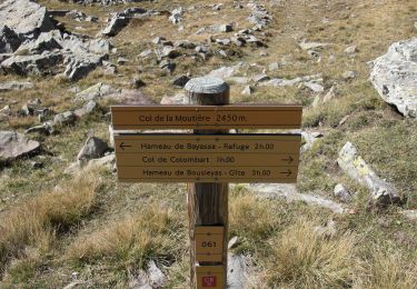
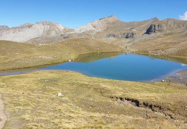
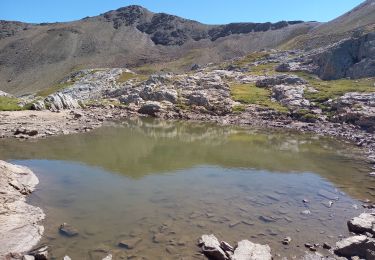
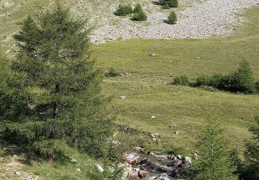
Une surprenante boucle, dans les vallées étroites du Mercantour. Ambiance sauvage garantie ! Certaines vallées du Mercantour, au plus fort de l’hiver, ont quelque chose de singulier, que l’on ne retrouve pas dans beaucoup d’autres parcs naturels : un mélange inédit de solitude, de rudesse, avec des bons morceaux de nature préservée, secrète et mystérieuse… La vallée des gorges du Bachelard ne fait pas exception à ce tableau. Le col de la Coyolle, comme quasiment tous les cols du Mercantour étant fermé, la route nous abandonne au hameau de Bayasse… Et là, dès les premiers pas, le silence s’abat sur nous. Et les rares traces que l’on croisent sont rarement celles d’homme. Laisser un peu aller votre imagination au grés des pas, dépaysement garanti. Plus qu’ailleurs, le Mercantour est une montagne qui s’apprécie les basses journées d’hiver… D'autres infos et photos sur le site de Montagne-Cool
Positioning
Comments
Trails nearby
![Trail Walking Uvernet-Fours - UVERNET. Bayasse, tour de la pierre éclatée o - Photo](https://media.geolcdn.com/t/375/260/585a8992-95bd-4974-8e25-bbc57e644b01.jpg&format=jpg&maxdim=2)
![Walking Walking](https://static1.geolcdn.com/sitytour/trail-icons/101.png)
Walking
![](/images/other/stat-length.png)
![](https://static1.geolcdn.com/siteimages/upload/files/16400158638029165_repeat_loop_refresh_sync_direction_icon.png)
![Walking Walking](https://static1.geolcdn.com/sitytour/trail-icons/101.png)
Walking
![](/images/other/stat-length.png)
![](https://static1.geolcdn.com/siteimages/upload/files/16400158638029165_repeat_loop_refresh_sync_direction_icon.png)
![Walking Walking](https://static1.geolcdn.com/sitytour/trail-icons/101.png)
Walking
![](/images/other/stat-length.png)
![](https://static1.geolcdn.com/siteimages/upload/files/16400158638029165_repeat_loop_refresh_sync_direction_icon.png)
![Trail On foot Uvernet-Fours - Pointe de Colombart - Photo](https://media.geolcdn.com/t/375/260/5fc579df-5419-4dca-9bed-ffaaf89250e9.jpeg&format=jpg&maxdim=2)
![On foot On foot](https://static1.geolcdn.com/sitytour/trail-icons/100.png)
On foot
![](/images/other/stat-length.png)
![](https://static1.geolcdn.com/siteimages/upload/files/16400158638029165_repeat_loop_refresh_sync_direction_icon.png)
![Trail Walking Uvernet-Fours - Le Cimet - Photo](https://media.geolcdn.com/t/375/260/4098429c-9fdf-41d6-86ee-b73867e6bff6.jpg&format=jpg&maxdim=2)
![Walking Walking](https://static1.geolcdn.com/sitytour/trail-icons/101.png)
Walking
![](/images/other/stat-length.png)
![](https://static1.geolcdn.com/siteimages/upload/files/16400158638029165_repeat_loop_refresh_sync_direction_icon.png)
![Trail Walking Jausiers - Toureis Restefond - Photo](https://media.geolcdn.com/t/375/260/20a0b540-9148-4e55-9ce1-b89ad38324dc.jpg&format=jpg&maxdim=2)
![Walking Walking](https://static1.geolcdn.com/sitytour/trail-icons/101.png)
Walking
![](/images/other/stat-length.png)
![](https://static1.geolcdn.com/siteimages/upload/files/16400158638029165_repeat_loop_refresh_sync_direction_icon.png)
![Trail Walking Jausiers - Le Chevalier 2886m 13.5.22 - Photo](https://media.geolcdn.com/t/375/260/c20c6b52-a1cc-4332-b67c-5306bb5ca764.jpg&format=jpg&maxdim=2)
![Walking Walking](https://static1.geolcdn.com/sitytour/trail-icons/101.png)
Walking
![](/images/other/stat-length.png)
![](https://static1.geolcdn.com/siteimages/upload/files/16400158638029165_repeat_loop_refresh_sync_direction_icon.png)
![Trail Walking Uvernet-Fours - Le Cimet - Photo](https://media.geolcdn.com/t/375/260/e4e25314-316a-4af8-9c46-765d0fa19a4e.jpg&format=jpg&maxdim=2)
![Walking Walking](https://static1.geolcdn.com/sitytour/trail-icons/101.png)
Walking
![](/images/other/stat-length.png)
![](https://static1.geolcdn.com/siteimages/upload/files/16400158638029165_repeat_loop_refresh_sync_direction_icon.png)
![Trail Walking Uvernet-Fours - Ventebrun depuis Pont de Julien - Photo](https://media.geolcdn.com/t/375/260/851cfbca-49f7-4dce-84ca-2e56fcb5741d.jpg&format=jpg&maxdim=2)
![Walking Walking](https://static1.geolcdn.com/sitytour/trail-icons/101.png)
Walking
![](/images/other/stat-length.png)
![](https://static1.geolcdn.com/siteimages/upload/files/16400158638029165_repeat_loop_refresh_sync_direction_icon.png)