Trail Mountain bike Osthouse - Les Berges de l'Ill - Photo

Les Berges de l'Ill

 tracegps
tracegps

User

© OpenStreetMap contributors
Length
Length
25 km
Max alt
Max alt
164 m
Uphill gradient
Uphill gradient
153 m
Km-Effort
Km-Effort  
27 km
Min alt
Min alt
147 m
Downhill gradient
Downhill gradient
154 m
Boucle
Boucle
Yes
Creation date :
2014-12-10 00:00:00.0
Updated on :
2014-12-10 00:00:00.0

(0 Reviews)

Mountain bike
Mountain bike
2h00
Difficulty : Difficult

Scan this QR Code to open this trail in the SityTrail application

FREE GPS app for hiking

Logo SityTrail SityTrail

IGN / Geographical institutes

Download SityTrail from the App Store Download SityTrail from Google Play

Logo SityTrail SityTrail World

The world is yours!

Download SityTrail from the App Store Download SityTrail from Google Play Download SityTrail on Huawei AppGallery

About

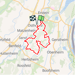
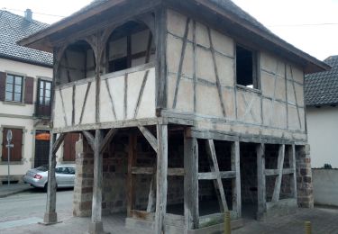
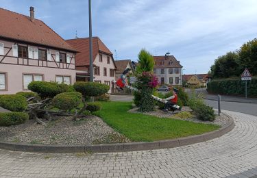
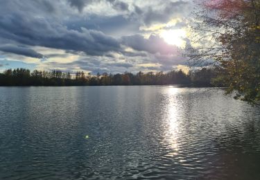
Trail Mountain bike of 25 km to be discovered at Grand Est, Bas-Rhin, Osthouse. This trail is proposed by tracegps.

Description

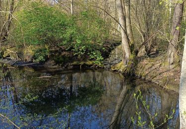
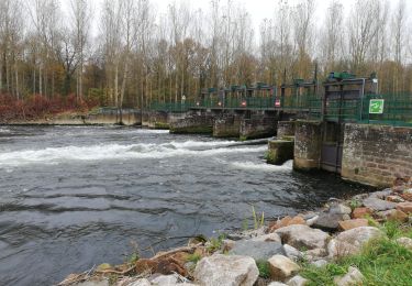
Contournez le terrain de foot par la gauche et rejoignez un chemin carrossable longeant un bra de l'Ill pour arriver aux 2 barrages de la journée. Traversez les et suivez ensuite un chemin balisé anneau rouge qui longe le Bronnwasser tantôt sur un bord, puis sur l'autre jusqu'à croiser la D131. Poursuivez en face toujours sur le sentier anneau rouge jusqu'à un pont sur l'Allmendgraben. Ensuite chemin carrossable sans difficultés jusqu'à la D924 que vous emprunterez sur environ 1km pour bifurquez à droite. Empruntez toujours le chemin devant vous, et vous atteindrez un chêne et un banc..... La suite est ICI
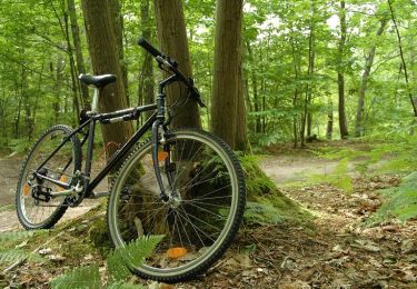
Elevation profile

Photos

Positioning

Country:
France
Region :
Grand Est
Department/Province :
Bas-Rhin
Municipality :
Osthouse
Location:
Unknown
Start:(UTM)
399949 ; 5362034 (32U) N.

Trails nearby

Trail Mountain bike Erstein - Entre Ill et Rhin Tortu - Photo
Mountain bike
tracegps

Mountain bike

Difficult
(1)
Erstein, Grand Est, Bas-Rhin, France
35 km | 38 km-effort
2h 30min
Yes
Trail Walking Erstein - polder sommerly Erstein  - Photo
Walking
apa

Walking

Easy
Erstein, Grand Est, Bas-Rhin, France
14.5 km | 15.7 km-effort
4h 3min
Yes
Trail Walking Nordhouse - 2023/04/23 L'Ill et l'écluse 81 par champs et forêt - Photo
Walking
Mich&Agnès

Walking

Very easy
Nordhouse, Grand Est, Bas-Rhin, France
10 km | 10.9 km-effort
1h 49min
Yes
Trail Walking Erstein - ail des ours source du Bronnenwasset - Photo
Walking
apa

Walking

Easy
Erstein, Grand Est, Bas-Rhin, France
12.5 km | 13.3 km-effort
4h 26min
Yes
Trail Electric bike Erstein - vieux Rhin - Photo
Electric bike
apa

Electric bike

Medium
Erstein, Grand Est, Bas-Rhin, France
67 km | 74 km-effort
3h 37min
Yes
Trail Walking Erstein - le long de l ill - Photo
Walking
apa

Walking

Medium
(1)
Erstein, Grand Est, Bas-Rhin, France
13.8 km | 14.9 km-effort
3h 33min
Yes
Trail Walking Benfeld - Chapelle Saint Materne - Photo
Walking
Claudele

Walking

Very easy
Benfeld, Grand Est, Bas-Rhin, France
11.1 km | 12.1 km-effort
4h 26min
Yes
Trail Walking Benfeld - Circuit de l'Ill et de la Lauter - Photo
Walking
tracegps

Walking

Medium
Benfeld, Grand Est, Bas-Rhin, France
14.6 km | 15.7 km-effort
3h 30min
Yes
Trail Mountain bike Nordhouse - Circuit entre les Ill - Photo
Mountain bike
tracegps

Mountain bike

Medium
Nordhouse, Grand Est, Bas-Rhin, France
14.4 km | 15.8 km-effort
1h 0min
Yes


Close
My subscriptions