


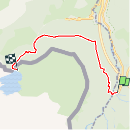

10.4 km | 19.6 km-effort

User


FREE GPS app for hiking
 SityTrail
IGN / Geographical institutes
SityTrail World
The world is yours!
Trail Walking of 5.2 km to be discovered at New Aquitaine, Pyrénées-Atlantiques, Urdos. This trail is proposed by tracegps.
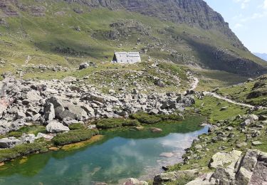
Balade d'été ou en raquettes, elle peut se faire en famille ! Proposé par Imag'In Pyrénées , retrouvez toutes les autres infos et photos ICI


On foot
On foot

On foot

Walking
Walking

Walking

Walking

Walking
Walking