![Trail Walking Mollepata - Trek Salkantay - Photo](https://media.geolcdn.com/t/1900/400/ext.pjpeg?maxdim=2&url=https%3A%2F%2Fstatic1.geolcdn.com%2Fsiteimages%2Fupload%2Ffiles%2F1553511878bg_sport_marche.png)
Trek Salkantay
sim1491
User
![Length](/images/other/stat-length.png)
Length
80 km
![Max alt](https://static1.geolcdn.com/siteimages/upload/files/1508320355ic_sort_altitude_max_24dp.png)
Max alt
4627 m
![Uphill gradient](https://static1.geolcdn.com/siteimages/upload/files/1508320355ic_sort_den_pos_24dp.png)
Uphill gradient
3910 m
![Km-Effort](/images/other/stat-length.png)
Km-Effort
134 km
![Min alt](https://static1.geolcdn.com/siteimages/upload/files/1508320355ic_sort_altitude_min_24dp.png)
Min alt
1766 m
![Downhill gradient](https://static1.geolcdn.com/siteimages/upload/files/1508320355ic_sort_den_neg_24dp.png)
Downhill gradient
4615 m
![Boucle](https://static1.geolcdn.com/siteimages/upload/files/16400158638029165_repeat_loop_refresh_sync_direction_icon.png)
Boucle
No
Creation date :
2019-01-15 13:38:16.691
Updated on :
2019-01-15 13:38:16.691
![Walking](https://static1.geolcdn.com/sitytour/trail-icons/101.png)
23h59
Difficulty : Difficult
![Scan this QR Code to open this trail in the SityTrail application](https://capi.geolives.com/qq0zvz2zws4bq2lad0pu/sitytour/trails/1010980/qr.png?size=200)
FREE GPS app for hiking
About
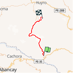
Trail Walking of 80 km to be discovered at Cusco, Province of Anta, Mollepata. This trail is proposed by sim1491.
Positioning
Country:
Peru
Region :
Cusco
Department/Province :
Province of Anta
Municipality :
Mollepata
Location:
Unknown
Start:(Dec)
Start:(UTM)
767626 ; 8505239 (18L) S.
Comments
Trails nearby