![](/images/other/stat-length.png)
![Trail Walking Arbéost - Ferrière - Photo](https://media.geolcdn.com/t/1900/400/ext.pjpeg?maxdim=2&url=https%3A%2F%2Fservices.sitytrail.com%2FGeolivesWS%2FDownloadMedia.ashx%3FTrailID%3D1008793%26Media%3Dfix__20180722171312.jpg)
Ferrière
pffrench
User
![Length](/images/other/stat-length.png)
Length
3.4 km
![Max alt](https://static1.geolcdn.com/siteimages/upload/files/1508320355ic_sort_altitude_max_24dp.png)
Max alt
700 m
![Uphill gradient](https://static1.geolcdn.com/siteimages/upload/files/1508320355ic_sort_den_pos_24dp.png)
Uphill gradient
170 m
![Km-Effort](/images/other/stat-length.png)
Km-Effort
5.7 km
![Min alt](https://static1.geolcdn.com/siteimages/upload/files/1508320355ic_sort_altitude_min_24dp.png)
Min alt
551 m
![Downhill gradient](https://static1.geolcdn.com/siteimages/upload/files/1508320355ic_sort_den_neg_24dp.png)
Downhill gradient
167 m
![Boucle](https://static1.geolcdn.com/siteimages/upload/files/16400158638029165_repeat_loop_refresh_sync_direction_icon.png)
Boucle
Yes
Creation date :
2019-01-15 13:25:48.395
Updated on :
2019-01-15 13:25:48.395
![Walking](https://static1.geolcdn.com/sitytour/trail-icons/101.png)
2h01
Difficulty : Very easy
![Scan this QR Code to open this trail in the SityTrail application](https://capi.geolives.com/qq0zvz2zws4bq2lad0pu/sitytour/trails/1008793/qr.png?size=200)
FREE GPS app for hiking
About
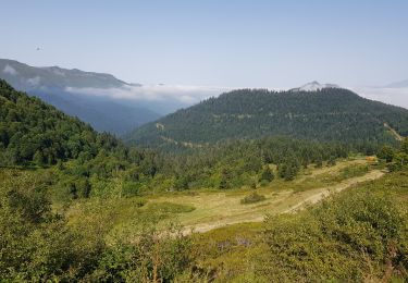
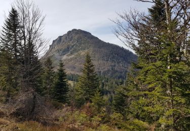
Trail Walking of 3.4 km to be discovered at Occitania, Hautespyrenees, Arbéost. This trail is proposed by pffrench.
Description
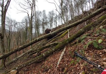
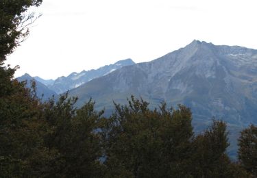
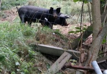
promenade en vallée d'Ossau à la limite du Val d'Azun-restes d'exploitations minières.
Positioning
Country:
France
Region :
Occitania
Department/Province :
Hautespyrenees
Municipality :
Arbéost
Location:
Unknown
Start:(Dec)
Start:(UTM)
722925 ; 4765546 (30T) N.
Comments
Trails nearby
![Trail On foot Arbéost - SityTrail - Arbeost le tour des quartiers d'Arbeost fait - Photo](https://media.geolcdn.com/t/375/260/ext.jpg?maxdim=2&url=https%3A%2F%2Fstatic1.geolcdn.com%2Fsiteimages%2Fupload%2Ffiles%2F1545311037marcheuse_200dpi.jpg)
![On foot On foot](https://static1.geolcdn.com/sitytour/trail-icons/100.png)
SityTrail - Arbeost le tour des quartiers d'Arbeost fait
On foot
Easy
(1)
Arbéost,
Occitania,
Hautespyrenees,
France
![](/images/other/stat-length.png)
6.7 km | 12.3 km-effort
Unknown
![](https://static1.geolcdn.com/siteimages/upload/files/16400158638029165_repeat_loop_refresh_sync_direction_icon.png)
Yes
![Trail Walking Arbéost - G3arbeost le tour fait 2022 - Photo](https://media.geolcdn.com/t/375/260/48356084-36bc-465f-b160-a49039e9ce27.jpg&format=jpg&maxdim=2)
![Walking Walking](https://static1.geolcdn.com/sitytour/trail-icons/101.png)
G3arbeost le tour fait 2022
Walking
Very difficult
Arbéost,
Occitania,
Hautespyrenees,
France
![](/images/other/stat-length.png)
7.1 km | 12.5 km-effort
4h 48min
![](https://static1.geolcdn.com/siteimages/upload/files/16400158638029165_repeat_loop_refresh_sync_direction_icon.png)
Yes
![Trail Walking Aucun - pic de Bazes - Photo](https://media.geolcdn.com/t/375/260/15d75ff9-b6a0-4d17-b33d-a021c2508c6c.jpg&format=jpg&maxdim=2)
![Walking Walking](https://static1.geolcdn.com/sitytour/trail-icons/101.png)
pic de Bazes
Walking
Medium
Aucun,
Occitania,
Hautespyrenees,
France
![](/images/other/stat-length.png)
7.2 km | 12.6 km-effort
5h 19min
![](https://static1.geolcdn.com/siteimages/upload/files/16400158638029165_repeat_loop_refresh_sync_direction_icon.png)
No
![Trail Walking Asson - Le Pic du Monbula - Arthez d'Asson - Photo](https://media.geolcdn.com/t/375/260/ext.jpg?maxdim=2&url=https%3A%2F%2Fservices.sitytrail.com%2FGeolivesWS%2FDownloadMedia.ashx%3FTrailID%3D317142%26Media%3D16291_6.jpg)
![Walking Walking](https://static1.geolcdn.com/sitytour/trail-icons/101.png)
Le Pic du Monbula - Arthez d'Asson
Walking
Difficult
Asson,
New Aquitaine,
Pyrénées-Atlantiques,
France
![](/images/other/stat-length.png)
11.3 km | 26 km-effort
6h 30min
![](https://static1.geolcdn.com/siteimages/upload/files/16400158638029165_repeat_loop_refresh_sync_direction_icon.png)
Yes
![Trail Walking Ferrières - FERRIERES la mine de Baburet 295 0542 - Photo](https://media.geolcdn.com/t/375/260/7e8af3ad-a6a0-485c-9d45-56b5e00c68a6.jpg&format=jpg&maxdim=2)
![Walking Walking](https://static1.geolcdn.com/sitytour/trail-icons/101.png)
FERRIERES la mine de Baburet 295 0542
Walking
Easy
Ferrières,
Occitania,
Hautespyrenees,
France
![](/images/other/stat-length.png)
2.8 km | 4.8 km-effort
1h 2min
![](https://static1.geolcdn.com/siteimages/upload/files/16400158638029165_repeat_loop_refresh_sync_direction_icon.png)
Yes
![Trail Walking Aucun - pic de Bazès - Photo](https://media.geolcdn.com/t/375/260/0333c2bf-fad6-4558-82dc-21364c50f60d.jpg&format=jpg&maxdim=2)
![Walking Walking](https://static1.geolcdn.com/sitytour/trail-icons/101.png)
pic de Bazès
Walking
Easy
Aucun,
Occitania,
Hautespyrenees,
France
![](/images/other/stat-length.png)
6.9 km | 13.2 km-effort
4h 27min
![](https://static1.geolcdn.com/siteimages/upload/files/16400158638029165_repeat_loop_refresh_sync_direction_icon.png)
Yes
![Trail Walking Aucun - pic de Bazès - Photo](https://media.geolcdn.com/t/375/260/64f29098-67c6-421c-a1a6-1ccb79ba050f.jpg&format=jpg&maxdim=2)
![Walking Walking](https://static1.geolcdn.com/sitytour/trail-icons/101.png)
pic de Bazès
Walking
Easy
Aucun,
Occitania,
Hautespyrenees,
France
![](/images/other/stat-length.png)
5 km | 10.1 km-effort
3h 30min
![](https://static1.geolcdn.com/siteimages/upload/files/16400158638029165_repeat_loop_refresh_sync_direction_icon.png)
Yes
![Trail On foot Arrens-Marsous - Soulor-Digole-OmprA--Aout-terrain-2016-MNT - Photo](https://media.geolcdn.com/t/375/260/ext.jpg?maxdim=2&url=https%3A%2F%2Fstatic1.geolcdn.com%2Fsiteimages%2Fupload%2Ffiles%2F1545311037marcheuse_200dpi.jpg)
![On foot On foot](https://static1.geolcdn.com/sitytour/trail-icons/100.png)
Soulor-Digole-OmprA--Aout-terrain-2016-MNT
On foot
Very easy
Arrens-Marsous,
Occitania,
Hautespyrenees,
France
![](/images/other/stat-length.png)
8.2 km | 13.9 km-effort
Unknown
![](https://static1.geolcdn.com/siteimages/upload/files/16400158638029165_repeat_loop_refresh_sync_direction_icon.png)
Yes
![Trail Walking Arrens-Marsous - ARRENS Turon d'ompre et cap d'aout - Photo](https://media.geolcdn.com/t/375/260/ext.jpg?maxdim=2&url=https%3A%2F%2Fstatic1.geolcdn.com%2Fsiteimages%2Fupload%2Ffiles%2F1553511878bg_sport_marche.png)
![Walking Walking](https://static1.geolcdn.com/sitytour/trail-icons/101.png)
ARRENS Turon d'ompre et cap d'aout
Walking
Very easy
Arrens-Marsous,
Occitania,
Hautespyrenees,
France
![](/images/other/stat-length.png)
8.8 km | 15 km-effort
3h 8min
![](https://static1.geolcdn.com/siteimages/upload/files/16400158638029165_repeat_loop_refresh_sync_direction_icon.png)
Yes