


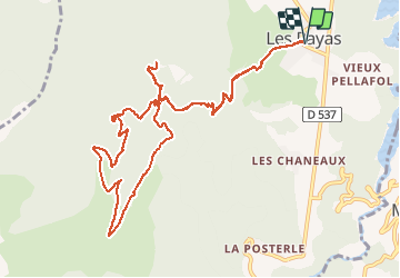

13.3 km | 19.9 km-effort


User


FREE GPS app for hiking
 SityTrail
IGN / Geographical institutes
SityTrail World
The world is yours!
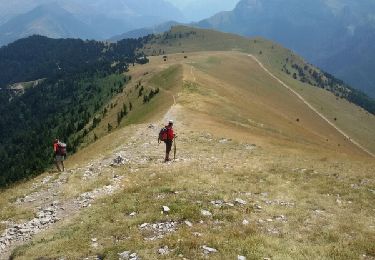
Trail Walking of 13.6 km to be discovered at Auvergne-Rhône-Alpes, Isère, Pellafol. This trail is proposed by rigol05.
sortie du 19/07/2018Modification, du col de la Samblue remonter par la piste jusqu'au col des Faïsses. Le chemin emprunté n'est plus praticable.
Walking

Walking

Walking
On foot
Walking
Walking
Walking

Walking
On foot