Trail Running Grenade - Grenade Merville - Photo
 tracegps
tracegps

User

© OpenStreetMap contributors
Length
Length
16.2 km
Max alt
Max alt
163 m
Uphill gradient
Uphill gradient
112 m
Km-Effort
Km-Effort  
17.7 km
Min alt
Min alt
107 m
Downhill gradient
Downhill gradient
113 m
Boucle
Boucle
Yes
Creation date :
2014-12-10 00:00:00.0
Updated on :
2014-12-10 00:00:00.0

(0 Reviews)

Running
Running
1h30
Difficulty : Difficult

Scan this QR Code to open this trail in the SityTrail application

FREE GPS app for hiking

Logo SityTrail SityTrail

IGN / Geographical institutes

Download SityTrail from the App Store Download SityTrail from Google Play

Logo SityTrail SityTrail World

The world is yours!

Download SityTrail from the App Store Download SityTrail from Google Play Download SityTrail on Huawei AppGallery

About

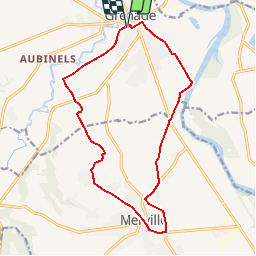
Trail Running of 16.2 km to be discovered at Occitania, Haute-Garonne, Grenade. This trail is proposed by tracegps.

Description

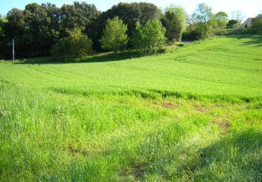
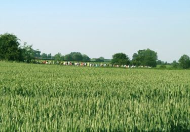
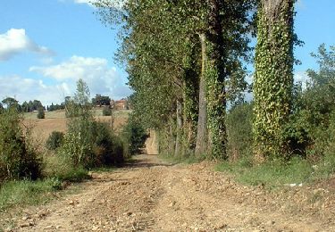
Descendre de Grenade sur Garonne à Merville par les champs et remonter le long de Garonne, un excellent entrainement sur sol plat.

Elevation profile

Photos

Positioning

Country:
France
Region :
Occitania
Department/Province :
Haute-Garonne
Municipality :
Grenade
Location:
Unknown
Start:(UTM)
362553 ; 4847676 (31T) N.

Trails nearby

Trail Cycle Grenade - Circuit des pigeonniers en Save & Garonne - Grenade - Photo
Cycle
tracegps

Cycle

Difficult
(1)
Grenade, Occitania, Haute-Garonne, France
98 km | 109 km-effort
6h 0min
Yes
Trail Running Grenade - Pont du Diable à Grenade - Photo
Running
tracegps

Running

Easy
Grenade, Occitania, Haute-Garonne, France
6.5 km | 7 km-effort
40min
Yes
Trail Walking Grenade - Pont du Diable à Grenade - Photo
Walking
tracegps

Walking

Easy
Grenade, Occitania, Haute-Garonne, France
6.5 km | 7 km-effort
1h 10min
Yes
Trail Running Grenade - Boucle des Caguères à Grenade - Photo
Running
tracegps

Running

Medium
Grenade, Occitania, Haute-Garonne, France
11 km | 11.9 km-effort
1h 0min
Yes
Trail Walking Grenade - Boucle des Caguères à Grenade - Photo
Walking
tracegps

Walking

Easy
Grenade, Occitania, Haute-Garonne, France
11 km | 11.9 km-effort
2h 0min
Yes
Trail Running Larra - Larra Thil, tranquille  !! - Photo
Running
tracegps

Running

Difficult
Larra, Occitania, Haute-Garonne, France
17.5 km | 19.5 km-effort
1h 10min
Yes
Trail Mountain bike Larra - Larra Thil, tranquille  !! - Photo
Mountain bike
tracegps

Mountain bike

Difficult
Larra, Occitania, Haute-Garonne, France
17.5 km | 19.5 km-effort
1h 45min
Yes
Trail Walking Larra - Larra Thil, tranquille  !! - Photo
Walking
tracegps

Walking

Difficult
Larra, Occitania, Haute-Garonne, France
17.5 km | 19.5 km-effort
5h 15min
Yes
Trail Walking Ondes - Boucle de Ondes - Photo
Walking
Fafou64

Walking

Easy
(1)
Ondes, Occitania, Haute-Garonne, France
10.2 km | 10.9 km-effort
2h 27min
Yes


Close
My subscriptions