


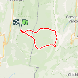


24 km | 33 km-effort


User


FREE GPS app for hiking
 SityTrail
IGN / Geographical institutes
SityTrail World
The world is yours!
Trail Walking of 21 km to be discovered at Auvergne-Rhône-Alpes, Drôme, Saint-Agnan-en-Vercors. This trail is proposed by choubaka77.
Superbe rando. Attention 6h sans les pauses. Une ascension physique mais sans difficulté majeure, attention, une descente rapide dans un première temps puis un long chemin très roulant pour le retour.


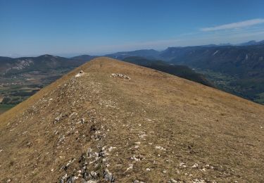
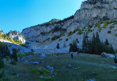
23 photos in total. Please click on a photo to see them all in the gallery.

Walking

Walking

Walking

Walking

Snowshoes

Walking
Walking

Snowshoes
Walking