


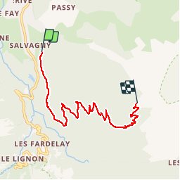

19.8 km | 37 km-effort

User


FREE GPS app for hiking
 SityTrail
IGN / Geographical institutes
SityTrail World
The world is yours!
Trail Walking of 6.8 km to be discovered at Auvergne-Rhône-Alpes, Upper Savoy, Sixt-Fer-à-Cheval. This trail is proposed by petole.
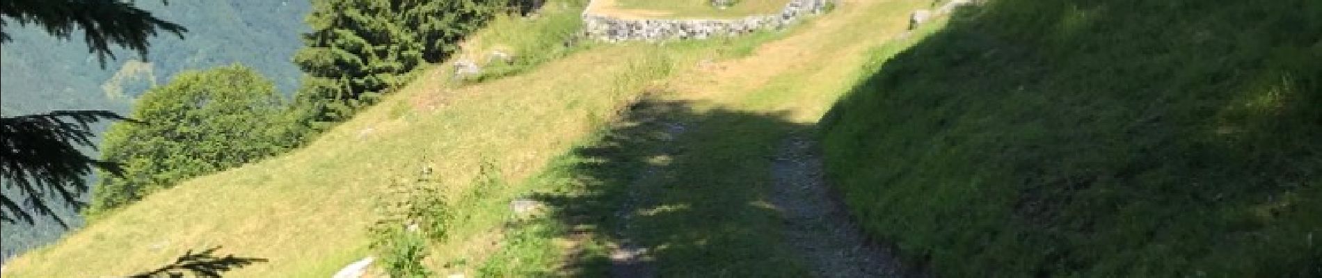
Montée par un chemin à " jeep " protégé par la foret ( soleil) sur la majeure partie du parcours. Progression sans aucun risque, plus sûr que par la feulatière.


Walking

Walking

Walking

Walking

Walking

Walking

Walking

Walking

Walking